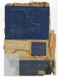
The 1896 Olmsted, Olmsted, and Eliot report commissioned by Charleston for the board of park commissioners. The report was created after the group's second visit to Charleston. This is the first report of many as the Parks Commissioners worked in tandem with the Olmstead group up through the twentieth century. The report outlines advice for the advancement of downtown Charleston's parks, general aesthetics, and public roadways. The projects outlined in the report are: Battery Park, Waterfront park, Ashely Ave, Chicora Parkway, and Chicora Park.
A pamphlet containing the Rules and Regulations of the Board of Adjustment Under the Zoning Ordinance of the City of Charleston; the 1921 Act of the General Assembly of South Carolina Providing for a Zoning Ordinance; and the 1931 Zoning Ordinance of the City of Charleston.
The 1880-1930 Year Book Index for the City of Charleston is an alphabetical list of subject and name entries pointing to the individual City of Charleston Year Books published between 1880 and 1930. The bound volume includes two separate indexes. The first is a published 1880 to 1901 index compiled by George H. Holmes of the Charleston Bar Association and printed locally by Lucas-Richardson Lithograph and Printing Company. The 1900 to 1930 index was compiled by Joseph C. Barbot, Clerk of Council. The Barbot index was never published and appears in typewritten manuscript form with handwritten corrections and editions.
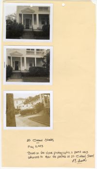
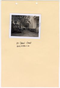
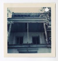
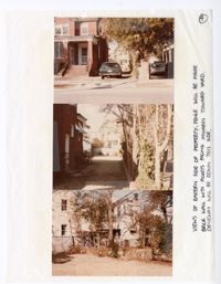
Three black and white photographs of No. 20 Colonial Street: Top (front facade/east elevation); Middle (front facade/east elevation); Bottom (front yard and sidewalk in front of structure). The photographs are stapled to a beige sheet of paper with two holes punched through the top. The paper is labeled "20 Colonial Street." There is a handwritten note on the paper explaining the purpose of the photographs. Their goal was to repair the porches at No. 20 Colonial Street. The note is signed by a "Smith." There is a white border surrounding all three photographs. The structure at No. 20 Colonial Street has a covered porch spanning the entirety of the exterior of the first story front facade/east elevation. There is a pediment held above the entryway of the porch by two Doric free standing columns. The first story is elevated with stairs leading up to the porch. There is a front yard covered in grass and an urban garden bordering the structure. There is a paved walkway to the entry stairs and a sidewalk running parallel to the street in front of the structure.
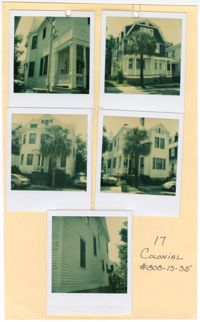
Five colored photographs of No. 17 Colonial Street and neighboring structures: Top left (north elevation of No. 17 Colonial Street); Top right (front facade/west elevation of the neighboring structure at No. 19 Colonial Street); Middle left (front facade/west elevation of the neighboring structure at No. 15 Colonial Street); Middle right (front facade/west elevation of No. 17 Colonial Street); Bottom (south elevation of No. 17 Colonial Street). The photographs are taped to a beige sheet of paper with two holes punched through the top. The paper is labeled "17 Colonial #808-13-35." There is a white border surrounding all five photographs. The structure at No. 17 Colonial Street is a two-and-a-half story structure with white horizontal exterior paneling. The neighboring structure at No. 15 Colonial Street is also a two-and-a-half story structure with white horizontal exterior paneling. Where the front facade is flat on No. 17 Colonial Street, there is a bay window at No. 15 Colonial Street. The neighboring structure at No. 19 Colonial Street is a three story Shingle style structure with a gambrel roof and dormer windows. The exterior siding consists of blue shingles on the third and second stories. The first story has white horizontal exterior paneling and a covered porch spanning the entire first story exterior.
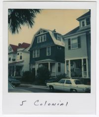
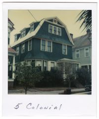
Colored photograph of the structure at No. 5 Colonial Street. The photograph has a white border with the label "5 Colonial" handwritten on the bottom half of the white border. The photograph was taken from across the street. Vehicles are visible parked on both sides of the street. The structure at No. 5 Colonial Street is a three-story Shingle style structure with a gambrel roof and dormer windows. The exterior siding consists of blue shingles on the third and second stories. The first story has white exterior paneling. There is a bay window on the left of the front facade/west elevation and a covered porch to the right. There is foliage obstructing the view of the first story. The neighboring structures to each side of No. 5 Colonial are visible in the photograph.
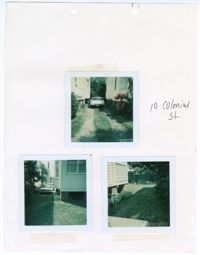
Three colored photographs of No. 10 Colonial Street: Top (parked vehicle in driveway); Bottom left (corner of west elevation and driveway); Bottom right (corner of south elevation and back yard). The three photographs are taped to a beige sheet of paper with two holes in the top. The paper is labeled as " 10 Colonial St." There is a white border surrounding all three photographs. The top photograph shows the north elevation of No. 10 Colonial Street and the south elevation of neighboring structure. The driveway is paved under where the tires of the vehicle sit. The center and sides of the driveway consist of grass. The bottom left photograph shows the back corner of the structure with a projecting bay window on the north elevation. The yard is covered in grass and lined with foliage along the border of the property in both of the bottom photographs.
Black and white photograph of No. 20 Colonial Street. The photograph is stapled to a beige sheet of paper with two holes punched through the top. The paper is labeled "20 Colonial Street BAR #835-11-21." There is a white border surrounding the photograph. The photograph shows a gravel path in between No. 20 Colonial Street and the neighboring structure to the right. The corner of the front facade/east elevation of No. 20 Colonial Street is visible as well as the corner of the front facade/east elevation and south elevation of the neighboring structure. There is foliage obstructing the view of the exterior of the first floor of No. 20 Colonial Street.
Colored photograph of the structure at No. 5 Colonial Street. The photograph has a white border with the label "5 Colonial" handwritten on the bottom half of the white border. The structure at No. 5 Colonial Street is a three-story Shingle style structure with a gambrel roof and dormer windows. The exterior siding consists of blue shingles on the third and second stories. The first story has white horizontal exterior paneling. There is a bay window on the left of the front facade/west elevation and a covered porch to the right. There is foliage obstructing the view of the first story. The neighboring structures to each side of No. 5 Colonial are visible in the photograph.
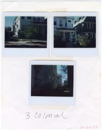
Three colored photographs of No. 3 Colonial Street: Top left (corner of front façade/west elevation and north elevation); Top right (front façade/west elevation and the southeastern corner of No. 5 Colonial Street); Bottom (side elevation). The photographs are taped to a white sheet of paper. The paper is labeled "3 Colonial" and "10-24-79." The exterior consists of white horizontal paneling. There is a bay window on the second story of the northeastern corner of the structure. Below the window on the first story is a covered porch with four free standing columns. Stairs lead onto the porch of the elevated first story. The front yard is covered in grass and shrubs. A sidewalk runs through the edge of the front yard. The neighboring structure located at No. 5 Colonial Street is visible in the top right photograph.
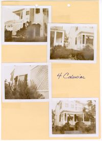
Four black and white photographs of No. 4 Colonial Street: Top left (side elevation); Top right (corner of front façade/east elevation and south elevation and neighboring structure); Bottom left (side elevation); Bottom right (corner of front façade/east elevation and south elevation). Each photograph is surrounded by a white border. The photographs are taped to a beige sheet of paper with two holes punched through the top. The paper is labeled as "4 Colonial." The two story structure has a porch spanning the majority of the exterior of the first story on the front facade/east elevation. The structure is slightly elevated with stairs leading up onto the first story front porch. There is foliage bordering the exterior of the structure on all sides.
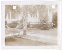
Black and white photograph of No. 4 Colonial Street. There is a white border surrounding the photograph with two holes punched through the top. The photograph shows the corner of the east elevation and the north elevation of the structure, as well as the neighboring structure to the left. The structure is elevated from the ground with a porch on the first story. The front yard is covered with grass and an urban garden bordering the structure. The sidewalk cuts through the edge of the front yard. There is a palm tree obstructing the view of the structure. There is a car parking in the bottom left corner of the photograph.
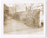
Black and white photograph of a wall located at No. 4 Colonial Street. There is a white border surrounding the photograph with two holes punched through the top. The photograph shows the retaining wall facing the north elevation of the structure at No. 4 Colonial Street. The wall separates No. 4 Colonial Street and No. 2 1/2 Colonial Street. The window of No. 2 1/2 Colonial Street can be seen behind the retaining wall in the photograph. There is grass covering the side yard with plants and trees planted along the retaining wall. A sidewalk is visible in the bottom of the photograph.
Black and white photograph of the front façade and east elevation of No. 138 Bull Street. The two-and-a-half-story structure has a sloped roof and three dormer windows on the half-story. The exterior has horizontal side paneling. The front door is centered on the front facade located on the north elevation of the structure. There is a thick wall projecting from the northwestern corner of the building. The photograph shows two cars parked in front of the north elevation. There is a white border around the photograph with a single hole punched through the top. There is a black mark above the hole punch.
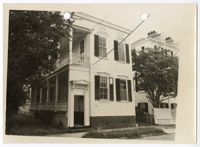
Black and white photograph of the front façade and east elevation of No. 132 Bull Street. The structure is a two-story Charleston Single style structure with a two-story piazza on the left. The structure has an elevated foundation. The structure has a missing shutter on the top left window and a damaged shutter on the bottom left window. There is a beige border around the photograph with two holes punched through the top of the photograph. There are diagonal black marks coming from the top right side of the photograph and extend towards the bottom left corner. "Palmer Property" is written on the back of the photograph.
Black and white photograph of the southwestern corner of No. 138 Bull Street. The photograph shows the north and east elevations of the two-and-a-half story structure. The sloped roof has three dormer windows. The exterior has horizontal side paneling. The front door is centered on the front facade located on the north elevation of the structure. There is a white border around the photograph with a hole punched in the top left corner.
Black and white photograph of the southwestern corner of No. 134 Bull Street. The photograph shows the north and east elevations of the Charleston Single style structure. There is a white border around the photograph. There is discoloration in the top left corner and along the right side of the photograph. The photograph shows trees and bushes in front of the piazza and bay window of the structure. There is a car in the bottom right corner of the photograph.
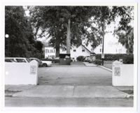
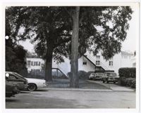
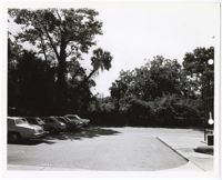
Black and white photograph of a parking lot in Charleston, South Carolina. There is a white border around the photograph with two holes punched through the left of the photograph. There a multiple vehicles shown in the photograph, located in either the parking lot, driveway, or yard of the structure in the background. There is a dumpster just beyond the parking lot in the center of the photograph. The parking lot is partially concealed by a white retaining wall and posts that act as an entryway. There are signs on the posts indicating the purpose of the lot.
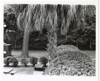
Black and white photograph of a grass area located in Charleston, South Carolina. There is a white border around the photograph with two holes punched through the left of the photograph. The photograph shows different types of trees and bushes in a grass area with a sidewalk cutting horizontally through the middle. There is a picnic table and trash can in the bottom left of the photograph.
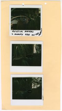
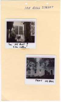
Three colored polaroid photographs of existing meters assumed to be located at No. 105 Bull Street: Top (existing meter); Middle (mark for new meter); Bottom (mark for new meter). The three photographs are attached to a beige paper with two holes punched through the top. There is writing in black ink on the top photograph indicating the existing meter. There are black marks on the middle and bottom photographs indicating the placement of the new meters. The paper is not labeled. The close up photographs each show large amounts of vegetation blocking the structure from view, limiting ability to confirm the address of the photographs.
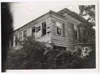
Black and white photograph of the upper section of the southwestern corner of No. 134 Bull Street. There is a white border around the photograph. There are two holes punched through the top of the photograph. The photograph shows the north and east elevations of the second floor of the two-story Charleston Single style structure. The second floor of the piazza is enclosed. The first floor is not visible due to vegetation. The structure is in disrepair with broken and missing shutters, decaying exterior paint, and large amounts of overgrowth in the landscape.
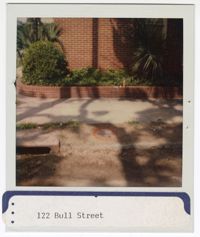
Colored polaroid photograph of brick exterior and sidewalk of No. 122 Bull Street. There is a white border around the photograph. There is a sticker placed on the bottom of the photograph which labels it as "122 Bull Street." There is a brick retaining wall with vegetation inside that backs up to the brick wall and lines the sidewalk.
Black and white photograph and drawing of a parking lot in Charleston, South Carolina. There is a white border around the photograph with two holes punched through the left side of the photograph. There are six cars shown in the photograph: three parked in the parking lot and three parked in the driveway of the building in the background. The center of the photograph has been drawn in or over an existing element of the photograph. The drawing is hidden but can be seen through the marks located in the grass, trees, and on the building in the background.
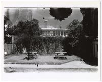
Black and white photograph of an outdoor seating area in Charleston, South Carolina. There is a white border around the photograph with two holes punched through the left of the photograph. The photograph shows two stone picnic tables in the center of a grass area. There is a sidewalk intersecting the grass area. Behind the tables is a stone wall covered in foliage. The grass area is bordered by three structures to the left, right, and back.
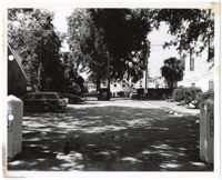
Black and white photograph of a parking lot in Charleston, South Carolina. There is a white border around the photograph with two holes punched through the left side of the photograph. The photograph shows three cars parked in the lot closest to the viewer. There is a second parking lot in the background of the image. The parking lot is bordered by three structures to the left, right, and back. There are two posts with signage on them acting as the gateway to the parking lot. There are trees and foliage throughout the photograph.
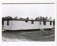
Black and white photograph of a portable structure located in Charleston, South Carolina. There is a white border around the photograph with two holes punched through the left of the photograph. The portable structure is in the center of the photograph. It has white vertically paneling and three steps leading up to it. The structure sits in the center of an open space with trees in the background.
Black and white photograph of a parking lot in Charleston, South Carolina. There is a white border around the photograph with two holes punched through the right side of the photograph. The photograph shows five cars parked to the left of the parking lot. There is a sidewalk shown at the bottom and on the right side of the photograph. There is a metal structure to the right. There are trees and foliage in the background of the photograph.
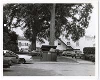
Black and white photograph of a parking lot in Charleston, South Carolina. There is a white border around the photograph with two holes punched through the left of the photograph. There are ten vehicles shown in the photograph, located in either the parking lot, driveway, and yard of the structure in the background. There is a dumpster in the center of the photograph.
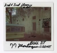
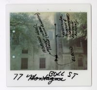
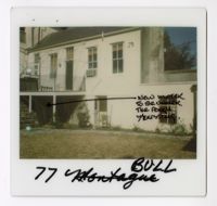
Colored polaroid photograph shows the south elevation of No. 77 Bull Street. There are hand-drawn black marks on the sidewalk shown in the photograph. The marks show a rectangle with a dot and line extending from the bottom left corner of the rectangle. There is an arrow drawn that is pointing at the pipe on the exterior of the building. The arrow is labeled as "Existing conduit and meter to be removed." The photograph is labeled at the top as "2nd & 3rd floor" with an arrow and dot drawn beneath. The photograph was originally labeled as "77 Montague Front" but was crossed out and renamed "77 Bull St." There is a yellow Ford Bronco parked in front of the south elevation.
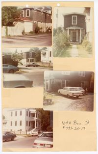
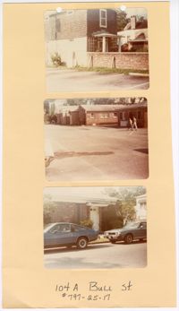
Five colored photographs of No. 104A Bull Street, the two-story outbuilding of No. 104 Bull Street: Top left (south elevation); Top right (front façade/north elevation); Middle left (north and east elevations from a distance); Middle right (west elevation); Bottom left (north and east elevations of No. 104 Bull Street). The five photographs are taped to a beige paper with two holes punched through the top. The paper is labeled "104A Bull St. #797-25-17." The outbuilding is a two-story structure. The exterior of the outbuilding consists of dark shingles and white ornamentation. No. 104 Bull Street is a Neoclassical style of architecture.
Colored polaroid photograph shows the south elevation of No. 77 Bull Street. There are hand-drawn black marks show a circle attached to a vertical line ending with a rectangle. There is an arrow pointing at the rectangle. The arrow is labeled as "Elbow." There is another arrow pointing to the rectangle with the label "Proposed new-meter under porch (south elevation)." There is an arrow pointing to the vertical line labeled as "Additional conduit of weatherhead adjacent existing." The photograph was originally labeled at "77 Montague" but was crossed out and renamed "77 Bull St." There are trees in front of the south elevation at the top of the photograph.
Two colored polaroid photographs of No. 105 Bull Street: Top (north elevation); Bottom (front façade/south elevation). The two photographs are attached to a beige paper with two holes punched through the top. The paper is labeled "105 Bull Street." The front facade of the structure indicates that No. 105 Bull Street is a blue row house. There are handwritten descriptions on each polaroid photograph. The top photograph has an arrow drawn within the photograph pointing upwards with a handwritten note indicating the new location for two meters. The handwritten label on the top photograph labels the photograph as “Rear 105 Bull.” The handwritten label on the bottom photograph labels the photograph as “Front 105 Bull.”
Three colored photographs of No. 104A Bull Street and its neighboring buildings to the west: Top (north and east elevations of No. 104A Bull Street); Middle (series of buildings located to the west of No. 104A Bull Street); (façade of building located to the west of No. 104A Bull Street). The three photographs are attached to a beige paper with two holes punched through the top. The paper is labeled "104A Bull St. #797-25-17." The outbuilding known as No. 104A Bull Street is a two-story structure. The exterior of the outbuilding consists of dark shingles and white ornamentation. The structures to the west of No. 104A Bull Street are single story brick structures.
Colored polaroid photograph shows the outbuilding of No. 77 Bull Street. There is a handmade black line that extends horizontally across the middle of the image and ends with a star. The hand-drawn star is located underneath the porch area shown in the photograph. The marks are labeled as "New meter to be under the porch/existing." The photograph was originally labeled as "77 Montague" but was crossed out and renamed "77 Bull."
Two colored photographs of the side elevation of No. 101 Bull Street; Left (side elevation with black marks drawn around equipment); Right (side elevation). The two photographs are attached to a beige paper with two holes punched through the top. The paper is labeled as "101 Bull Street SR84-106." The photographs show the side elevation containing both a brick and panel exterior. The section of white horizontal paneling is separated from the brick by a white piazza. The photograph on the left has a handmade drawing that was made around the outdoor housing equipment.
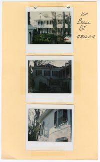
Three colored polaroid photographs of No. 100 Bull Street: Top (front facade/north elevation); Middle (building elevation); Bottom (close up of windows on building elevation). The three photographs are taped to a beige paper with holes punched through the top. The paper is labeled "100 Bull St. #8012-10-18." The top photograph shows the two-and-a-half-story structure with porches spanning the entire first and second floors of the facade. The middle and bottom photographs show the blue exterior and blue shutters of the structure.
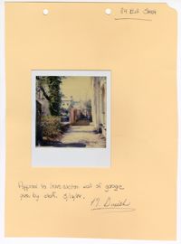
Colored polaroid photograph of a wall at No. 84 Bull Street. The photograph is attached to a beige paper with two holes punched through the top. The paper is labeled as "84 Bull Street." There is a note on the bottom that reads "Approval to leave eastern wall of garage given by staff. 3/16/84." The note is then signed by "D. Smith."
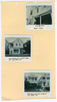
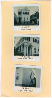
Three colored polaroid photographs of No. 62 Bull Street and its neighboring structures: Top (rear view of No. 62 Bull Street); Middle (facade of No. 60 Bull Street); Bottom (facade of No. 64 Bull Street). The photographs are attached to a beige paper with two holes punched through the top. There are handwritten labels for each photograph that have been attached beneath each polaroid identifying the photograph. The top photograph shows a rear view No. 62 Bull Street. In this photograph, the porch is visible. The middle photograph shows the north elevation of No. 60 Bull Street. The structure at No. 60 Bull Street is a first floor storefront with a closed space and porch on the second floor. The bottom photograph shows the facade of a structure with porches spanning the entirety of the first and second floors.
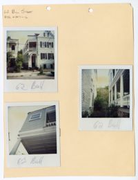
Three colored polaroid photographs of No. 62 Bull Street: Top left (front facade/north elevation facing Bull Street); Right (piazza on east elevation and the west elevation of the neighboring building); Bottom left (white coffered ceiling of the piazza and west elevation). The photographs are stapled to a beige paper with two holes punched through the top. The paper is labeled as "62 Bull Street BAR #847-11-6." The structure is a two-and-a-half-story raised Charleston Single style structure with a two-story piazza. The structure has a pitched gable roof with dormer windows. The entryway into the piazza is covered by a pediment and columns on the sides. The horizontal exterior paneling is blue.
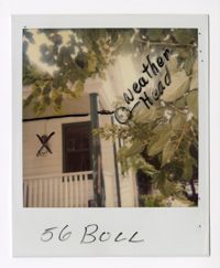
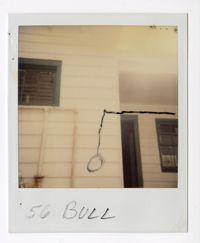
Colored polaroid photograph of the southwestern corner of No. 56 Bull Street. The photograph shows the exterior with white horizontal paneling and green columns and framed openings. There are handmade black marks on the photograph. The marks line the exterior wall where the wall intersects with the ceiling of the piazza. There is an "X" over the outdoor regulator and a circle drawn just outside the house with the label "Weather Head." There is a tree in the top right corner of the photograph, blocking some of the house from view.
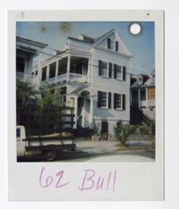
Colored polaroid photograph of No. 62 Bull Street. There is a hole punched through the top right corner of the photograph. The structure is a two-and-a-half-story raised Charleston Single style structure with a two-story piazza. The structure has a pitched gable roof with dormer windows. The entryway into the piazza is covered by a pediment and columns on the sides. The horizontal exterior paneling is blue. There is a truck parked on the left blocking the view of the first floor piazza.
Colored polaroid photograph of No. 58 Bull Street. The photograph shows a close up of the back of the structure with a porch on the first story and black metal stairs leading to the second story. Thick black marks and thin blue marks have been made on the photograph. The hand-drawn black marks show a circle above the windows and a line leading down to a rectangle with two dots in the center. The hand-drawn blue marks show lines circling and crossing out the black marks. There are also blue marks around the first floor window on the left.
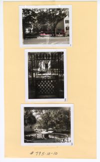
Three black and white photographs of No. 43 Bull Street: Top (open area to the right of the structure); Middle (front gate from the sidewalk); Bottom (metal work in front yard). The three photographs are attached to a beige sheet of paper with two holes punched through the top of the paper and the top photograph. There is a white border around each of the photographs. The photographs each have a number on the bottom right corner of their border, labeling them from top to bottom as "1," "2," and "3." There is a handwritten note that identifies the board as "#795-10-10."
Three colored polaroid photographs of No. 62 Bull Street: Top (front facade/north elevation facing Bull Street); Middle (corner of north and east elevations); Bottom (corner of south and west elevations). The photographs are attached to a beige paper with two holes punched through the top. There are handwritten labels for each photograph that have been attached beneath each polaroid identifying the photograph.
Colored polaroid photograph of No. 58 Bull Street. The photograph shows a close up of the back of the structure with a porch and clothing drying outside. The word "Exisiting" was handwritten and an arrow was drawn on the photograph in black ink. The arrow is pointing at an object on the wall. There are four small holes on the top of the photograph.
Black and white photograph of a parking lot in Charleston, South Carolina. There is a white border around the photograph with two holes punched through the left side of the photograph. The photograph shows four cars in the parking lot. There are structures on both the left and right side of the photograph. There are trees and foliage behind the parking lot in the center of the photograph.
Six colored photographs of the outbuilding at No. 48 Bull Street: Top left (north section); Top middle (middle section); Top right (south section); Bottom left (side elevation of north section); Bottom middle (middle section); Bottom right (middle and south section). The six photographs are attached to a white paper. There is a white border surrounding all six photographs. The paper is labeled "views of rear bldg. 48 Bull St." The outbuilding consists of horizontal exterior clapboard paneling and a red tin roof. There are large window openings on the second story and large garage doors on the first story.
Two colored photographs of No. 32 Bull Street: Top (front facade/north elevation facing Bull Street); Bottom (west elevation facing Pitt Street). The two photographs are taped to a beige paper with two holes punched through the top. The paper is labeled "App. No. 825-12-14" and “32 Bull Street.” The structure is a two-and-a-half-story Queen Anne style structure. The photograph shows a red gable roof with a turret visible on the southeastern corner of the structure. There is a porch on the corner of the first floor of the north and west elevations. The exterior consists of white horizontal paneling. There is a black hand drawn arrow on the bottom image pointing to the side of the turret. The marking is labeled as “Behind turret.” The photograph also shows a tree in front of the porch on the southeastern corner of the structure.
Three colored photographs of No. 32 Bull Street: Top (front facade with vehicle parked in front of the building); Bottom left (southeastern corner of building with vehicle parked in front); Bottom right (elevation with vehicle parked to the left). The three photographs are stapled to a beige paper with two holes punched through the top. The holes partially remove the label, however, the label of the folder can still be read as "32 Bull Street 8211-29-8." The structure is a two-and-a-half-story structure. The photograph shows a red gable roof and an exterior consisting of white horizontal paneling. There are hand-drawn black marks on the top photograph. These marks include a circle near the roof and an arrow above the photograph pointing downwards towards it. The arrow is labeled as "location."
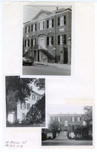
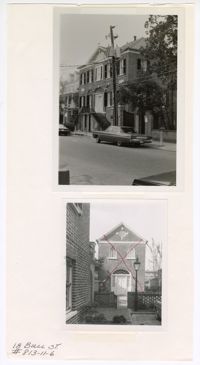
Three black and white photographs of No. 18 Bull Street: Top (front façade facing south on Bull Street); Middle (side elevation); Bottom (rear south elevation). The three photographs are taped to a beige colored paper. The photographs are overlaid on top of each other. There is a white border around each of the photographs. The paper is labeled "18 Bull St. #813-11-6." The structure is a three-story Adamesque style structure made of brick construction. The structure has a pitched roof with an elevated Palladian entryway and centered front and back door. The middle and bottom photographs show the side and back of the structure with trees in front of the structure and a yard.
Colored polaroid photograph of east elevation of No. 56 Bull Street. The photograph shows the exterior with white horizontal paneling and green framing around the openings of the structure, mainly windows and doors. The area of the structure on the right is setback. The area to the left has pipes running horizontally and vertically on the exterior. There are black markings of a horizontal line coming from the right side of the photograph which then runs vertically in the center of the photograph and is ended with a circle.
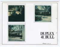
Three colored photographs of No. 41 Bull Street: Top Left (elevation); Top Right (front facade/south elevation facing Bull Street); Bottom Left (front facade/south elevation facing Bull Street). The three photographs are taped to a thick white board with two holes punched through the right of the board. There is a thin black line adjacent to the edges of the board. The board is labeled as "Duplex 41 Bull #801-10-2." The structure is one-story brick construction. The top left photograph shows the white exterior of the duplex with a tree and shade. The top right photograph shows a tree and car in front of the structure. The bottom left photograph shows two trees in front of the structure.
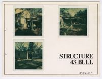
Three colored photographs of the rear of No. 43 Bull Street: Top left (outbuilding and cement block structure); Top right (cement block structure); Bottom left (cement block structure). The three photographs are attached to a white board with a thin black line lining the edges. There are two holes punched in the border on the left. There is a white border surrounding all three photographs. The board is labeled as "Structure 43 Bull." There is a handwritten note that identifies the board as "#801-10-1." The cement block structure is detached from the main structure.
Colored photograph of the second story balcony on the south elevation of No. 43 Bull Street. The photograph has a white border and a hole in the top right corner. The close up photograph shows the second story balcony in disrepair. The railing and ornamentation are missing on this section of the balcony. Sections of the ceiling are missing. There are cracks on the walls.
Colored photograph of the second story balcony on the south elevation of No. 43 Bull Street. The photograph has a white border and a hole punched through the top right corner. The close up photograph shows the second story balcony in disrepair. The railing and ornamentation are missing on the rounded section of the balcony.
Two black and white photographs of the main building and outbuilding of No. 18 Bull Street: Top (front façade); Bottom (detached outbuilding to the right of the front façade). The two photographs are taped to a white sheet of paper labeled on the bottom left corner as "18 Bull St. #813-11-6." The top photograph shows the three-story front facade of the Adamesque style main structure. The main structure has a pitched roof with an elevated Palladian entryway and centered front door. The bottom photograph shows the two-story outbuilding with a pitched roof and a Palladian entryway matching the one found on the facade of the main house. Both structures are of brick construction. The bottom photograph also has a hand drawn red “X” over the entire structure. The top photograph shows cars, electric poles, and trees in front of the building's three-story facade with its neighboring building, No. 20 Bull Street, to the back right.
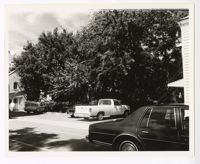
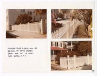
Two colored photographs of the front facade/north elevation of No. 70 Bull Street: Left (left side of north elevation); Right (right side of north elevation). The photographs are taped to a beige sheet of paper with two holes punched through the right side of the paper. The two photographs are taped together at the top of the paper to create a complete image of the facade. The structure is a two-story brick construction. There are two driveways on each side of the structure, both with a singular vehicle parked on them. There are measurements of a proposed fence below the photographs on the paper. There is a description of the fence and a drawing of the proposed post. There is a sideways circled "2" above the drawing of the proposed post. All marks are handmade in black ink.
Three colored photographs of No. 70 Bull Street: Top (left side of the front facade/north elevation); Middle (east elevation and side yard); Bottom (yard and corner of neighboring structure). The three photographs are taped to a beige sheet of paper with two holes punched through the top. The structure is a two-and-a-half-story brick construction. There is a driveway on the left side of the structure with a vehicle parked on it. The property has a front yard, side yard, and back yard. There is a description written vertically on the paper to the right of the photographs. There is a circled "3" in the top right corner. All marks are handmade in black ink.
Three colored photographs of No. 70 Bull Street: Top (right side of the front facade/north elevation); Middle (west elevation and side yard); Bottom (yard and neighboring structure). The three photographs are taped to a beige sheet of paper with two holes punched through the top. The exterior of the structure is complied of brick. There is a driveway on the right side of the structure with a vehicle parked on it. The property has a side yard and back yard. There is a description written vertically on the paper to the right of the photographs. There is a circled "4" in the top right corner. All marks are handmade in black ink.
Three colored photographs of No. 24 Montagu Street used as an example of the proposed fence and gate for No. 70 Bull Street: Top left (front of fence facing south on Montagu Street); Top right (back of fence facing south on Montagu Street); Bottom right (front of fence and opened gate facing south on Montagu Street). The three photographs are attached to a beige sheet of paper with two holes punched through the right side of the paper. The fence is a white picket fence with white posts intersecting the fence. There is a description and explanation in the bottom left corner. There is a circled "5" in the bottom right corner. All marks are handmade in black ink.
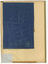
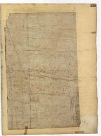
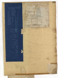
Page 259 of the City Engineer's Plat Book with three plats. Plat 1 shows lots located between Hester Street and Piedmont Street. Plat 1 also shows Alberta Street, Poplar Street, and a stretch of marsh land. Plat 2 shows lots located between Tradd Street, Ashley Street, and Murray Boulevard. Plat 2 also shows South Bay Street. Plat 3 shows a city block between Hester Street and Piedmont Avenue, and between Poplar Street and Alberta Avenue.
Page 256 of the City Engineer's Plat Book with four plats. Plat 1 shows land located between Elliot Street and Boundary Street, near Mill Street, Bee Street, President Street, and Doughty Street. It also shows several streams, a mill pond, and a large stretch of marsh land. Plat 2 shows a lot on Brigade Street. The third plat shows a lot and building located on the corner of Grove Street and Russell Street. The fourth plat shows lots located near the intersection of Grove Street and Tracy Street.
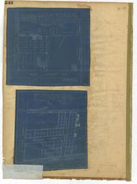
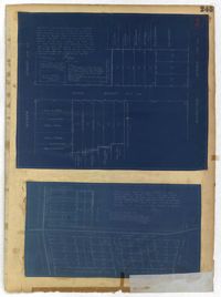
Page 248 of the City Engineer's Plat Book with two plats. Plat 1 shows lots and structures located between Wescott Court and President Street, north of Bee Street. Plat 2 shows lots on and near Huger Street, King Street, Congress Street, and Benson Street.
Page 252 of the City Engineer's Plat Book with two plats. Plat 1 shows lots on and near Lenwood Street, between South Bay Street and Boulevard Drive. Plat 2 shows lots located on and near the intersection of Huger Street and Rutledge Avenue.
Page 251 of the City Engineer's Plat Book with two plats. Plat 1 shows Meeting Street, Williman Street, and Romney Street. Plat 2 shows lots located on and near America Street, Lee Street, Cooper Street, and Drake Street.
Page 257 of the City Engineer's Plat Book with two plats. Plat 1 shows lots located between St. Margaret Street and Grove Street. Plat 2 shows lots located along Marsh Street and Concord Street, near where they intersect with Laurens Street.
Page 255 of the City Engineer's Plat Book with two plats. Plat 1 features lots located between St. Margaret Street and Grove Street, and between Tenth Street and Eleventh Street. Plat 2 features lots and structures located on the intersection of Aiken Street and Hampden Court.
Page 250 of the City Engineer's Plat Book with one plat. The plat shows lots between Romney Street and Williman Street, and east of Meeting Street. The plat also shows Isabella Street.
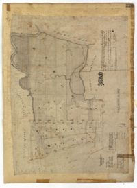
Page 254 of the City Engineer's Plat Book with one plat. A "Plat of Wagner Terrace," showing numerous lots and Hampton Park. Streets shown include Dunneman Street, Grove Street, and Rutledge Avenue.
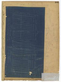
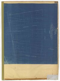
Page 243 of the City Engineer's Plat Book with three plats. Plat 1 features lots along Cumberland Street, near where it intersects with State Street. The second plat features "City Lands West of President Street and South of Congress Street." It also labels reading "Old Folks Holme," "Grave Yard Old Folks Home," "City Board of Public School Commissioners," and "Colored Industrial School." Plat 3 shows lots located west of Meeting Street, and also shows Cooper Street, Lee Street, Sheppard Street, and Sumter Street.
Page 244 of the City Engineer's Plat Book with three plats. Plat 1 shows lots and structures located along Maple Street, near where it intersects with Meeting Street. Plat 2 features a lot located on the east side of Tenth Street, between St. Margaret Street and Grove Street. Plat 3 shows land located near the intersection of State Street and Cumberland Street.
Page 246 of the City Engineer's Plat Book with one plat. The plat shows lots located between Rutledge Avenue and the Ashley River. Groups of lots are labelled with red letters. The plat also shows Darlington Avenue, Ashley Avenue, Piedmont Avenue, Hester Street, Clemson Street, Maple Street, Peachtree Street, Poplar Street, Pendleton Street, and Sans Souci Street.
Page 247 of the City Engineer's Plat Book with one plat. The plat shows lots located from the west side of Ashley Avenue to King Street, between Mount Pleasant and Sans Souci Street. The plat also shows Darlington Street, Rutledge Avenue, Magnolia Street, Tracy Street, and Laurel Avenue.
Page 240 of the City Engineer's Plat Book with one plat. The plat shows "The Property of Riverside Park Inc. and Peerless Securities Co." The streets shown include Rutledge Avenue, Sans Souci Street, Hester Street, and Ashley Avenue.
Page 245 of the City Engineer's Plat Book with two plats. Plat 1 shows lots located on and near Seyle Street, between Huger Street and Moultrie Street. Plat 2 shows lots on and near Grove Street, between Rutledge Avenue and King Street. Plat 2 also shows Tracy Street.
Page 242 of the City Engineer's Plat Book with one plat. The plat shows lots located on and near King Street, between Cypress Street and Romney Street. It also features a stretch of railroad track.
Page 241 of the City Engineer's Plat Book with one plat. The plat shows lots on and near King Street, Baxter Street, and Lenox Street. It also shows the end of Sans Souci Street.
Page 235 of the City Engineer's Plat Book with four plats. Plat 1 features a proposed right-of-way through Chicora Park, and shows a state road, Clements Avenue, Pine Avenue, and a label reading "U. S. Navy Yard." Plat 2 shows land located near the intersection of Grove Street and Rutledge Avenue, with one plot labeled "Trustees of the Endowment Fund of the Charleston Library Society." Plat 3 shows lots, structures, and marshland located on and near the Ashley River, north of Congress Street. the fourth plat is a pencil-sketched map showing land located near the intersection of Rutledge Avenue and Grove Street.
Page 237 of the City Engineer's Plat Book with three plats. Plat 1 shows "property situated on the west side of Rutledge Avenue," most of which is situated between Grove Street and Moultrie Street. Plat 1 also marks a "Brick Dwelling" and a stretch of marsh land. Plat 2 features land labeled "Trustees of the Endowment Fund of the Charleston Library Society," located between Rutledge Avenue and the Ashley River. Plat 3 shows land located on Huger Street, between King Street and Meeting Street.
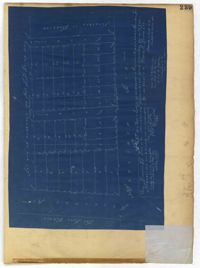
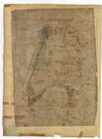
Page 229 of the City Engineer's Plat Book with two plats. Plat 1 features lots located on Queen Street, near its intersections with Mazyck Street, Friend Street, King Street, and Meeting Street. Plat 2 features lots located between Sans Souci Street and Simons Street, and between Rutledge Avenue and King Street.
Page 236 of the City Engineer's Plat Book with one plat. The plat features lots located between Romney Street and Cypress Street, and between King Street and a stretch of railroad tracks. Writing in red reads "See Page #242."
Page 230 of the City Engineer's Plat Book with one plat. The Plat features lots located between Chinquapin Street and President Street, and between Bee Street and Spring Street. It also shows several structures, Pine Street, and Chesnut Street. One lot is labelled "Vegetable Garden."
Page 232 of the City Engineer's Plat Book with one plat. The plat shows lots and structures between East Bay Street and the Cooper River, and between Society Street and Vernon Street. The plat also shows Washington Street, Marsh Street, Concord Street, Vernon Street, and Wharf Street.
Page 233 of the City Engineer's Plat Book with one plat. The plat features a stretch of marshland located east of Bay Street. The plat also shows America Street, Cooper Street, Blake Street, several creeks, and land labelled "Magazine."
Page 234 of the City Engineer's Plat Book with one plat. The plat shows lots and structures located on Mill Street, President Street, Lucas Street, and Sixth Street. It also shows a lot labelled "U. S. Arsenal."
Page 231 of the City Engineer's Plat Book with one plat. The plat features lots belonging to "The Cannonsboro Whf & Mill Co." It shows Bee Street, Doughty Street, President Street, Lucas Street, and Mill Street.
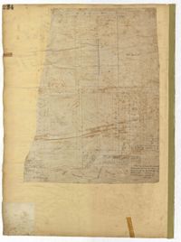
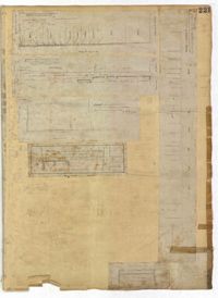
Page 221 of the City Engineer's Plat Book with six plats. Plat 1 shows lots along Payne Street, between Mount Street and Fishburne Street. Plat 2 shows lots along Lucas Street, near its intersections with Doughty Street and Mill Street, including a lot labelled "City Hospital." Plat 3 shows lots located along Kirkland Lane, between Wentworth Street and Beaufain Street. Plat 4 shows lots located near the intersection of Gadsden Street and Beaufain Street. Plat 5 shows lots located along Lightwood Alley, between Meeting Street and Church Street. Plat 6 shows a lot and building located on Cannon Street, Between Coming Street and a label reading "Church."
Page 223 of the City Engineer's Plat Book with five plats. Plat 1 shows lots and structures along Poinsett Street, near where it intersects with King Street. Plat 2 shows lots located on Sans Souci Street, near where it intersects with King Street. Plat 3 shows lots located on Line Street, including a lot labelled "City Stables." Plat 4 shows lots along King Street, near where it intersects with Moultrie Street. Plat 5 shows lots and structures located near the intersection of King Street and Romney Street.
Page 227 of the City Engineer's Plat Book with two plats. Plat 1 shows lots and structures located on Grove Street, between King Street and Russell Street. Plat 2 features a "Plot of Ground Surrounding Charleston Colored Industrial School." Plat 2 also shows Fishburne Street, Mount Street, Congress Street, and President Street.
Page 222 of the City Engineer's Plat Book with two plats. Plat 1 shows lots and structures located along East Bay Street, between Hasell Street and an unlabeled street. Plat 1 also shows Pritchard Street, Pinckney Street, Guignard Street, and Market Street. Plat 2 shows lots and structures located between Church Street and land owned by the Dry Dock Company. Plat 2 also shows Hayne Street, Anson Street, Guignard Street, and East Bay Street.
Page 228 of the City Engineer's Plat Book with two plats. Plat 1 shows the ground elevation near Mount Pleasant Street, between the Ashley River Marsh and the Cooper River Marsh. It also shows where Mount Pleasant Street intersects with Meeting Street and King Street. Plat 2 shows lots and structures located on and near Magazine Street, between Franklin Street and Smith Street.
Page 224 of the City Engineer's Plat Book with one plat. The plat features lots and structures belonging to a refining company. It also shows several streams, a right-of-way for a rail line, America Street, Hanover Street, Centre Street, and Meeting Street.
Page 220 of the City Engineer's Plat Book with one plat. The plat shows lots extending from the Ashley River, past Lucas Street. The plat also shows Doughty Street, Calhoun Street, President Street, U. S. Arsenal Square, and several structures.
Page 226 of the City Engineer's Plat Book with one plat. It shows lots located between Rutledge Avenue and King Street, and between Race Street and Sheppard Street.
Page 225 of the City Engineer's Plat Book with one plat. The plat shows lots and marsh located east of King Street and north of Line Street. It also shows Meeting Street.
Page 215 of the City Engineer's Plat Book with two plats. Plat 1 shows land located between Calhoun Street and Bull Street, and between Lynch Street and Rutledge Street. Plat 2, located inside a folding insert, shows land along Moultrie Street. Plat 2 also includes Hanover Street, Hill Street, Huger Street, Nassau Street, Meeting Street, Hampton Street, King Street, a lot labeled "Chas. Gas Light Co.," labels for high land, labels for marsh land, and a structure located on Hampton Street.
Page 212 of the City Engineer's Plat Book with three plats. Plat 1 shows lots located between Broad Street, Tradd Street, and Savage Street. Plat 2 shows lots and structures located near the intersection of Tradd Street and Chisolm Street, including wharves, a storehouse, a rice mill, an engine house, and a saw mill. Plat 3 shows lots, structures, and geographic features located between New Street and the Ashley River. Plat 3 also includes Tradd Street, Savage Street, Rutledge Street, Lynch Street, and a large stretch of marshland.