City Engineers's Plat Book, 1671-1951, Page 215
Close Viewer
- Title:
- City Engineers's Plat Book, 1671-1951, Page 215
- Date:
- 1921
- Description:
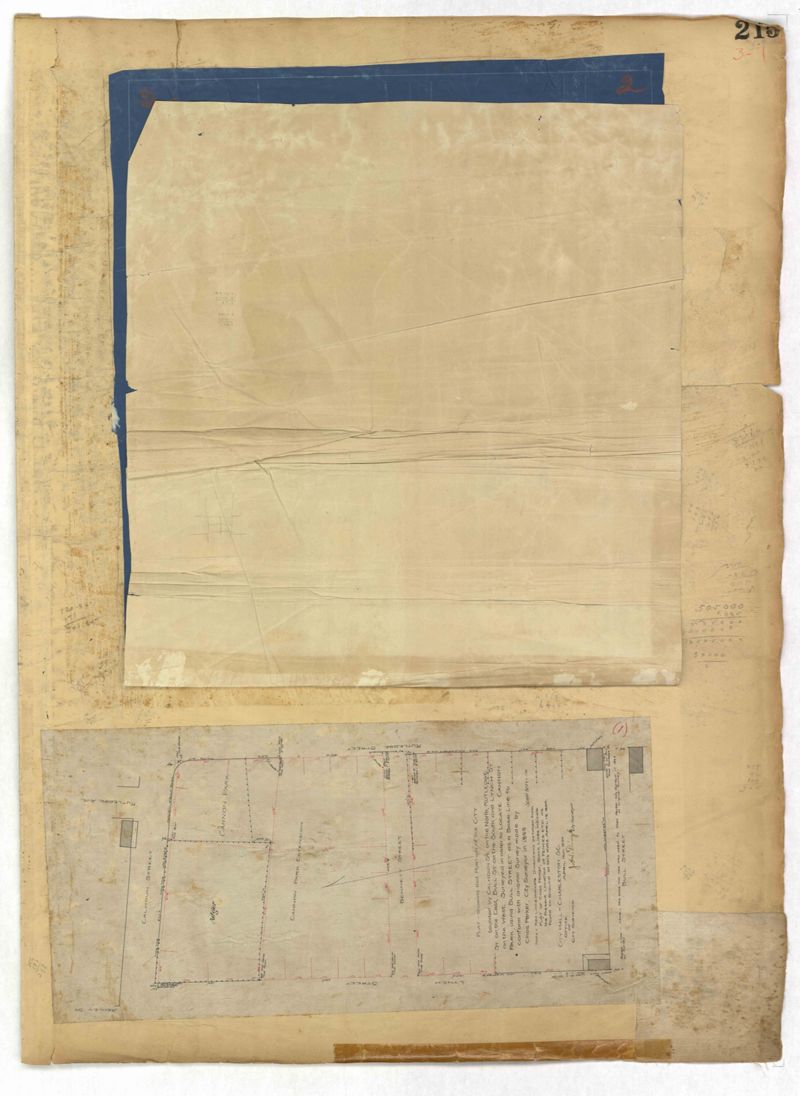
- Page 215 of the City Engineer's Plat Book with two plats. Plat 1 shows land located between Calhoun Street and Bull Street, and between Lynch Street and Rutledge Street. Plat 2, located inside a folding insert, shows land along Moultrie Street. Plat 2 also includes Hanover Street, Hill Street, Huger Street, Nassau Street, Meeting Street, Hampton Street, King Street, a lot labeled "Chas. Gas Light Co.," labels for high land, labels for marsh land, and a structure located on Hampton Street.
- Collection Title:
- City Engineers's Plat Book, 1671-1951
- Contributing Institution:
- The Charleston Archive at CCPL and City of Charleston
- Media Type:
- Maps
- Personal or Corporate Subject:
- Dingle, J. H. (James Hervey), 1869-1938
Howe, Gedney M. - Topical Subject:
- Cadastral maps and Surveys
- Geographic Subject:
- Charleston (S.C.)
- S.C. County:
- Charleston County (S.C.)
- Language:
- English
- Date Digital:
- 2023
- Digitization Specifications:
- 300 dpi, 24-bit depth, color, i2S SupraScan Quartz A0. Archival masters are tiffs.
- Format:
- image/jpeg
- Copyright Status Statement:
- Copyright status undetermined.
- Access Information:
- This City of Charleston has placed this collection on permanent loan with the Charleston County Public Library. For more information and reuse requirements contact The Charleston Archive at Charleston County Public Library, 68 Calhoun Street, Charleston, SC 29411.
- Admin ID:
- 296848
Permalink