City Engineers's Plat Book, 1671-1951, Page 222
Close Viewer
- Title:
- City Engineers's Plat Book, 1671-1951, Page 222
- Date:
- 1862
- Description:
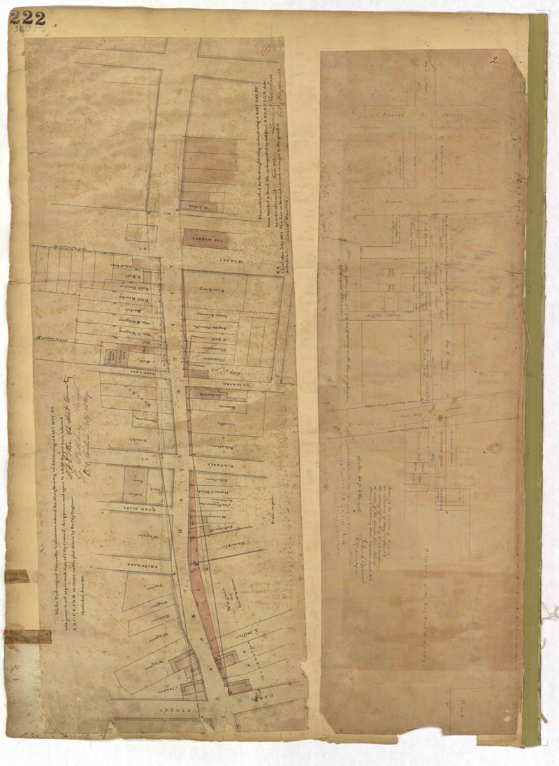
- Page 222 of the City Engineer's Plat Book with two plats. Plat 1 shows lots and structures located along East Bay Street, between Hasell Street and an unlabeled street. Plat 1 also shows Pritchard Street, Pinckney Street, Guignard Street, and Market Street. Plat 2 shows lots and structures located between Church Street and land owned by the Dry Dock Company. Plat 2 also shows Hayne Street, Anson Street, Guignard Street, and East Bay Street.
- Collection Title:
- City Engineers's Plat Book, 1671-1951
- Contributing Institution:
- The Charleston Archive at CCPL and City of Charleston
- Media Type:
- Maps
- Personal or Corporate Subject:
- Branch, John L.
- Topical Subject:
- Cadastral maps and Surveys
- Geographic Subject:
- Charleston (S.C.)
- S.C. County:
- Charleston County (S.C.)
- Language:
- English
- Date Digital:
- 2023
- Digitization Specifications:
- 300 dpi, 24-bit depth, color, i2S SupraScan Quartz A0. Archival masters are tiffs.
- Format:
- image/jpeg
- Copyright Status Statement:
- Public domain.
- Access Information:
- This City of Charleston has placed this collection on permanent loan with the Charleston County Public Library. For more information and reuse requirements contact The Charleston Archive at Charleston County Public Library, 68 Calhoun Street, Charleston, SC 29411.
- Admin ID:
- 296855
Permalink