City Engineers's Plat Book, 1671-1951, Page 248
Close Viewer
- Title:
- City Engineers's Plat Book, 1671-1951, Page 248
- Date:
- 1919
- Description:
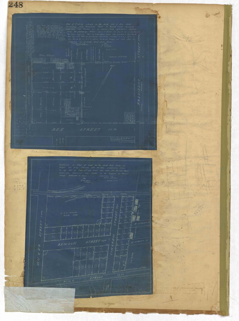
- Page 248 of the City Engineer's Plat Book with two plats. Plat 1 shows lots and structures located between Wescott Court and President Street, north of Bee Street. Plat 2 shows lots on and near Huger Street, King Street, Congress Street, and Benson Street.
- Collection Title:
- City Engineers's Plat Book, 1671-1951
- Contributing Institution:
- The Charleston Archive at CCPL and City of Charleston
- Media Type:
- Maps
- Personal or Corporate Subject:
- Howe, Gedney M.
- Topical Subject:
- Cadastral maps and Surveys
- Geographic Subject:
- Charleston (S.C.)
- S.C. County:
- Charleston County (S.C.)
- Language:
- English
- Date Digital:
- 2023
- Digitization Specifications:
- 300 dpi, 24-bit depth, color, i2S SupraScan Quartz A0. Archival masters are tiffs.
- Format:
- image/jpeg
- Copyright Status Statement:
- Copyright status undetermined.
- Access Information:
- This City of Charleston has placed this collection on permanent loan with the Charleston County Public Library. For more information and reuse requirements contact The Charleston Archive at Charleston County Public Library, 68 Calhoun Street, Charleston, SC 29411.
- Admin ID:
- 296880
Permalink