Page 28 of the City Engineer's Plat Book with three plats. Plat 1 shows lots located near Calhoun Street, Bull Street, South Street, Ashley Street, Rutledge Street Lynch Street, and Bennett Street. Plat 1 also shows lots labelled "The Mall," and Lots Belonging to Sundry Persons. Plat 2 shows lots and buildings located near the intersection of Calhoun Street and Lucas Street, including lots labelled "Mansion Lot" and "Left for a Public Square." Plat 3 shows lots and buildings located near Bee Street, between Ashley Street and Rutledge Street.
Page 34 of the City Engineer's Plat Book with four plats. Plat 1 shows lots located on South Bay Street. Plat 2 shows land located between Beaufain Street and Queen Street, near Smith Street, Wilson Street, and Franklin Street. Plat 3 shows lots located near Beaufain Street's intersections with Pitt Street and Wilson Street. Plat 4 features a lot and its buildings located on Meeting Street.
Page 27 of the City Engineer's Plat Book with five plats. Plat 1 shows lots located on Broad Street, between the intersections with East Bay Street and State Street. Plat 2 shows lots on Chapel Street. Plat 3 shows lots near Savage Street and Tradd Street. Plat 4 shows lots on Savage Street. Plat 5 shows lots near the intersection of Broad Street and East Bay Street.
Page 38 of the City Engineer's Plat Book with two plats. Plat 1 shows lots located near Calhoun Street, some buildings, "Lots Belonging to Sundry Persons," and "The Mall." Plat 1 also shows Bennett Street, Ashley Street, Rutledge Street, Gadsden Street, and Lynch Street. Plat 2 features a lot on Smith Street.
Page 37 of the City Engineer's Plat Book with three plats. Plat 1 shows lots located on Herriot Street. Plat 2 shows lots located on the block between Rutledge Street and Smith Street, and Morris Street and Radcliffe Street. Plat 3 shows lots and buildings located on King Street, with a stretch labelled "Unitarian Church Land."
Page 25 of the City Engineer's Plat Book with two plats. Plat 1 shows lots and buildings near Guignard Street, located between East Bay Street and "Rapers Ally." Plat 2 shows lots located near Cumming Street, between Shepherd Street and Line Street.
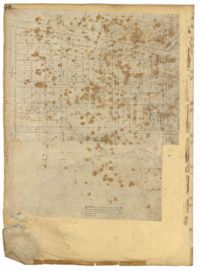
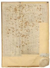
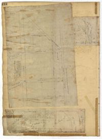
Page 215 of the City Engineer's Plat Book with two plats. Plat 1 shows land located between Calhoun Street and Bull Street, and between Lynch Street and Rutledge Street. Plat 2, located inside a folding insert, shows land along Moultrie Street. Plat 2 also includes Hanover Street, Hill Street, Huger Street, Nassau Street, Meeting Street, Hampton Street, King Street, a lot labeled "Chas. Gas Light Co.," labels for high land, labels for marsh land, and a structure located on Hampton Street.
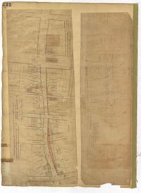
Page 212 of the City Engineer's Plat Book with three plats. Plat 1 shows lots located between Broad Street, Tradd Street, and Savage Street. Plat 2 shows lots and structures located near the intersection of Tradd Street and Chisolm Street, including wharves, a storehouse, a rice mill, an engine house, and a saw mill. Plat 3 shows lots, structures, and geographic features located between New Street and the Ashley River. Plat 3 also includes Tradd Street, Savage Street, Rutledge Street, Lynch Street, and a large stretch of marshland.
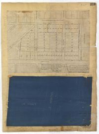
Page 213 of the City Engineer's Plat Book with two plats. Plat 1 features lots located between Savage Street and Chisolm Street, and between Tradd Street and Broad Street. Plat 1 also shows New Street, Rutledge Avenue, Lynch Street, Trapmann Street, and a lot labelled "Chisolm Mill Property." Plat 2 shows Calhoun Street's intersections with Lynch Street and Ashley Street.
Page 222 of the City Engineer's Plat Book with two plats. Plat 1 shows lots and structures located along East Bay Street, between Hasell Street and an unlabeled street. Plat 1 also shows Pritchard Street, Pinckney Street, Guignard Street, and Market Street. Plat 2 shows lots and structures located between Church Street and land owned by the Dry Dock Company. Plat 2 also shows Hayne Street, Anson Street, Guignard Street, and East Bay Street.