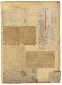
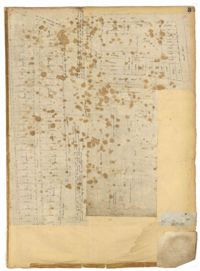
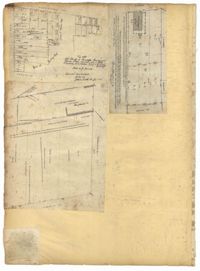
Page 243 of the City Engineer's Plat Book with three plats. Plat 1 features lots along Cumberland Street, near where it intersects with State Street. The second plat features "City Lands West of President Street and South of Congress Street." It also labels reading "Old Folks Holme," "Grave Yard Old Folks Home," "City Board of Public School Commissioners," and "Colored Industrial School." Plat 3 shows lots located west of Meeting Street, and also shows Cooper Street, Lee Street, Sheppard Street, and Sumter Street.
Page 244 of the City Engineer's Plat Book with three plats. Plat 1 shows lots and structures located along Maple Street, near where it intersects with Meeting Street. Plat 2 features a lot located on the east side of Tenth Street, between St. Margaret Street and Grove Street. Plat 3 shows land located near the intersection of State Street and Cumberland Street.
Page 246 of the City Engineer's Plat Book with one plat. The plat shows lots located between Rutledge Avenue and the Ashley River. Groups of lots are labelled with red letters. The plat also shows Darlington Avenue, Ashley Avenue, Piedmont Avenue, Hester Street, Clemson Street, Maple Street, Peachtree Street, Poplar Street, Pendleton Street, and Sans Souci Street.
Page 251 of the City Engineer's Plat Book with two plats. Plat 1 shows Meeting Street, Williman Street, and Romney Street. Plat 2 shows lots located on and near America Street, Lee Street, Cooper Street, and Drake Street.
Page 257 of the City Engineer's Plat Book with two plats. Plat 1 shows lots located between St. Margaret Street and Grove Street. Plat 2 shows lots located along Marsh Street and Concord Street, near where they intersect with Laurens Street.
Page 255 of the City Engineer's Plat Book with two plats. Plat 1 features lots located between St. Margaret Street and Grove Street, and between Tenth Street and Eleventh Street. Plat 2 features lots and structures located on the intersection of Aiken Street and Hampden Court.
Page 250 of the City Engineer's Plat Book with one plat. The plat shows lots between Romney Street and Williman Street, and east of Meeting Street. The plat also shows Isabella Street.
Page 254 of the City Engineer's Plat Book with one plat. A "Plat of Wagner Terrace," showing numerous lots and Hampton Park. Streets shown include Dunneman Street, Grove Street, and Rutledge Avenue.
Page 176 of the City Engineer's Plat Book with three plats. Plat 1 shows lots located between Meeting Street and land owned by the South Carolina Railroad Company. Plat 2 shows lots located near the intersection of King Street and Line Street. Plat 3 features a proposed road from Clements Ferry Road to Chicora Park. It also shows a stretch of pine woods and a stretch of land labelled as "Bottom."
Page 173 of the City Engineer's Plat Book with five plats. Plat 1 shows lots and structures located near the intersection of Meeting Street and Brigade Street. Plat 2 shows lots located between Meeting Street and Lee Street, and includes a lot labeled "German Cemetery." Plat 3 shows lots located between Cunnington Avenue and Wiliman Street, and between Meeting Street and Lee Street, and shows a lot labeled "4th Brigade." Plat 4 shows lots located near Brigade Street. Plat 5 features lots located in the Village of Hampstead, between Bay Street and Town Creek.
Page 170 of the City Engineer's Plat Book with four plats. Plat 1 shows lots located between King Street and Meeting Street, and between Romney Street and Grove Street. Plat 2 shows lots located between King Street and Meeting Street, and between Brigade Street and Mount Pleasant Street. Plat 4 shows lots located on Butler Street, near its intersection with Russell Street. Plat 5 features a lot labelled "Reservoir," located between Hanover Street and America Street.
Page 172 of the City Engineer's Plat Book with three plats. Plat 1 features a stretch of land located between Nassau Street and "Town Creek," and between Mary Street and Cooper Street. Plat 2 shows lots located near Division Street, Cleland Street, Union Street, and "Town Creek." Plat 3 shows lots located between President Street and Norman Street, near where it intersects with Spring Street.
Page 171 of the City Engineer's Plat Book with three plats. Plat 1 shows lots located on and near the intersection of Meeting Street and Mt. Pleasant Street. Plat 2 shows lots located along King Street, near its intersection with Mt. Pleasant Street. Plat 3 shows the intersection of Calhoun Street and Smith Street.
Page 174 of the City Engineer's Plat Book with two plats. Plat 1 shows lots and structures located between King Street and Meeting Street. Plat 2 features a lot located on Nassau Street, near where it intersects with Stewart Street.
Page 181 of the City Engineer's Plat Book with one plat. The plat features a survey of Mount Pleasant Farm, focusing on "High land" and "Marsh." The plat also shows the city boundary, several structures, marsh leading to the Ashley River, Hester Street, Sans Souci Street, and Mount Pleasant Road.
Page 179 of the City Engineer's Plat Book with two plats. Plat 1 shows lots located on and near Hinloch Court and Meeting Street. Plat 2 shows lots located between Moultrie Street and Price Street.
Page 180 of the City Engineer's Plat Book with one plat. The plat shows lots located on and near Brigade Street, Lee Street, the City Boundary, and the "N.E.R.R. Right of Way."
Page 100 of the City Engineer's Plat Book with four plats. Plat 1 features lots located near the intersection of Broad Street and Friend Street. Plat 2 shows lots and structures on Meeting Street. Plat 3 shows land located near the intersection of Drake Street and Cool Blow Street, including a stretch of the North Eastern Rail Road, a creek leading to the Cooper River, and some marshland. Plat 4 is affixed to the page so it folds in and out, and shows lots located near a stream, Pine Street, Alleyway Street, Norman Street, and Ashton Street.
Page 105 of the City Engineer's Plat Book with seven plats. Plat 1 shows several lots located on Chalmers Street. Plat 2 shows lots located near the intersection of East Bay Street and Market Street, and several structures, including docs and wharves. Plat 3 features lots and structures located on Chalmers Street. Plat 4 features a lot located on the intersection of Church Street and Waters Street, and shows several structures. Plat 5 shows a lot and several structures located on Waters Street. Plat 6 features a lot and buildings located on Broad Street. Plat 7 features the profiles of streets where tidal drains will be built. The profiles include Calhoun Street, Mazyck Street, Logan Street, Tradd Street, Coming Street, Chesnut Street, Spring Street, and Meeting Street.
Page 102 of the City Engineer's Plat Book with five plats. Plat 1 shows lots along a stretch of Rutledge Avenue from Grove Street to Sans Souci Street. Plat 2 features a projected extension of Rutledge Avenue from Mt. Pleasant Road to Heriot Street, and also shows a lot labelled "S.C. Agricultural Society." Plat 3 shows a projected extension Rutledge Avenue, extending from Sans Souci Street to Mt. Pleasant Road. Plat 4 shows a projected expansion of Rutledge Avenue through Heriot Street, and also shows a plot labelled "Agricultural Society." Plat 5 shows a projected extension of Rutledge Avenue from Grove Street to Simons Street, and also shows King Street.
Page 99 of the City Engineer's Plat Book with four plats. Plat 1 shows land located near Meeting Street, between Williams Street and Semmes Street. Plat 1 also shows Nassau Street, Romney Street, some marshland, and New Market Creek. Plat 2 shows a lot with two structures located on Laurel Street. Plat 3 features lots located between Congress Street and Gadsden Street, near Pinckney Street. Plat 4 features lots located along Mount Street, between President Street and Payne Street.
Page 97 of the City Engineer's Plat Book with three plats. Plat 1 shows a stretch of land extending from Cunnington Street to Columbus Street, with a projected rout for America Street. Plat 1 also shows Hampstead Mall, Meeting Street, several creeks, some city lands, and a stretch of King Street. Plat 2 shows land from near Line Street to Hudson Street, between King Street and Meeting Street. Plat 2 also features structures, including several freight depots. Plat 3 shows a lot labelled "Lands of Fourth Brigade," between Brigade Street and William Street.
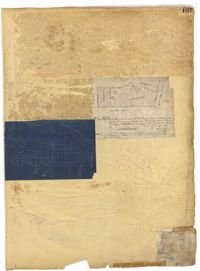
Page 107 of the City Engineer's Plat Book with two plats, labelled 3 and 4. Plat 3 features a lot and buildings located on the intersection or Tradd Street and East Bay Street. Plat 4 shows lots located near Gibbes Street, Tradd Street, New Street, and Savage Street. Plat 4 also shows three lines, labelled "Edge of high land," "Low water by Parker," and "Edge of Channel by Purcell and Parker."
Page 101 of the City Engineer's Plat Book with two plats. Plat 1 shows lots located between Washington Street and Wharf Street, and between Calhoun Street and Laurens Street. Plat 2 shows lots located near the intersection of Rutledge Avenue and Line Street, with several buildings labelled.
Page 112 of the City Engineer's Plat Book with five plats. Plat 1 shows lots and structures located on the north side of Tradd Street. Plat 2 shows lots located on the east side of Savage Street. Plat 3 shows lots located on King Street. Plat 4 shows lots located between Broad Street and Tradd Street, and between Lynch Street and the Ashley River. Plat 5 shows lots and structures located near the intersection of King Street and Broad Street.
Page 111 of the City Engineer's Plat Book with one plat. This plat shows lots located near the intersection of East Bay Street and Broad Street. It also shows a building labelled "EXCHANGE," and Gillon Street.
Page 24 of the City Engineer's Plat Book with three plats. Plat 1 shows lots located near King Street, Meeting Street, Wolf Street, March Lane, and Reid Street, including a portion of land labelled "Old fish pond low & broken land" and large label reading "Part of Hampstead." Plat 2 shows lots and features near the Charleston Harbor on the Cooper River, Boundary Street, Charlotte Street, Washington Street, and East Bay Street, and notes the "High Water Mark at Common Tides." Plat 3 shows lots located Meeting Street, Elizabeth Street, Ann Street, John Street, "Chapple Street," Alexander Street, and Washington Street, including a lot labelled "Tobacco Inspection."
Page 26 of the City Engineer's Plat Book with two plats. Plat 1 is a plan for a public square located near the intersection of Pinkney Street and Boundary Street, and shows a creek. Plat 2 features a lot located on the Ashley River channel and "Commings Creek," located near the intersections of Pinckney Street and Boundary Street, and Bull Street and Rutledge Street. Plat 2 also labels a pond, an island, and "Cannon's Point." Plat 3 shows lots located between Boundary Street and Bull Street, near the intersections with Barre Street, Gadsden Street, Lynch Street, Rutledge Street, Pitt Street, and "Comming Street."
Page 29 of the City Engineer's Plat Book with three plats. Plat 1 shows lots and structures located near Calhoun Street, Rutledge Street, Lynch Street, Gadsden Street, Lucas Street, and Bennett Street, including a lot labelled "Public Square," a creek, and a building labelled "Saw Mill." Plat 2 shows land located near the intersection of West Bay Street and a body of water labelled "Mill Pond." Plat 3 shows land located near the Ashley River channel and a road labelled "Causeway Leading to Rice Mill."
Page 28 of the City Engineer's Plat Book with three plats. Plat 1 shows lots located near Calhoun Street, Bull Street, South Street, Ashley Street, Rutledge Street Lynch Street, and Bennett Street. Plat 1 also shows lots labelled "The Mall," and Lots Belonging to Sundry Persons. Plat 2 shows lots and buildings located near the intersection of Calhoun Street and Lucas Street, including lots labelled "Mansion Lot" and "Left for a Public Square." Plat 3 shows lots and buildings located near Bee Street, between Ashley Street and Rutledge Street.
Page 34 of the City Engineer's Plat Book with four plats. Plat 1 shows lots located on South Bay Street. Plat 2 shows land located between Beaufain Street and Queen Street, near Smith Street, Wilson Street, and Franklin Street. Plat 3 shows lots located near Beaufain Street's intersections with Pitt Street and Wilson Street. Plat 4 features a lot and its buildings located on Meeting Street.
Page 27 of the City Engineer's Plat Book with five plats. Plat 1 shows lots located on Broad Street, between the intersections with East Bay Street and State Street. Plat 2 shows lots on Chapel Street. Plat 3 shows lots near Savage Street and Tradd Street. Plat 4 shows lots on Savage Street. Plat 5 shows lots near the intersection of Broad Street and East Bay Street.
Page 38 of the City Engineer's Plat Book with two plats. Plat 1 shows lots located near Calhoun Street, some buildings, "Lots Belonging to Sundry Persons," and "The Mall." Plat 1 also shows Bennett Street, Ashley Street, Rutledge Street, Gadsden Street, and Lynch Street. Plat 2 features a lot on Smith Street.
Page 37 of the City Engineer's Plat Book with three plats. Plat 1 shows lots located on Herriot Street. Plat 2 shows lots located on the block between Rutledge Street and Smith Street, and Morris Street and Radcliffe Street. Plat 3 shows lots and buildings located on King Street, with a stretch labelled "Unitarian Church Land."
Page 25 of the City Engineer's Plat Book with two plats. Plat 1 shows lots and buildings near Guignard Street, located between East Bay Street and "Rapers Ally." Plat 2 shows lots located near Cumming Street, between Shepherd Street and Line Street.
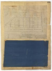
Page 215 of the City Engineer's Plat Book with two plats. Plat 1 shows land located between Calhoun Street and Bull Street, and between Lynch Street and Rutledge Street. Plat 2, located inside a folding insert, shows land along Moultrie Street. Plat 2 also includes Hanover Street, Hill Street, Huger Street, Nassau Street, Meeting Street, Hampton Street, King Street, a lot labeled "Chas. Gas Light Co.," labels for high land, labels for marsh land, and a structure located on Hampton Street.
Page 212 of the City Engineer's Plat Book with three plats. Plat 1 shows lots located between Broad Street, Tradd Street, and Savage Street. Plat 2 shows lots and structures located near the intersection of Tradd Street and Chisolm Street, including wharves, a storehouse, a rice mill, an engine house, and a saw mill. Plat 3 shows lots, structures, and geographic features located between New Street and the Ashley River. Plat 3 also includes Tradd Street, Savage Street, Rutledge Street, Lynch Street, and a large stretch of marshland.
Page 213 of the City Engineer's Plat Book with two plats. Plat 1 features lots located between Savage Street and Chisolm Street, and between Tradd Street and Broad Street. Plat 1 also shows New Street, Rutledge Avenue, Lynch Street, Trapmann Street, and a lot labelled "Chisolm Mill Property." Plat 2 shows Calhoun Street's intersections with Lynch Street and Ashley Street.
Page 222 of the City Engineer's Plat Book with two plats. Plat 1 shows lots and structures located along East Bay Street, between Hasell Street and an unlabeled street. Plat 1 also shows Pritchard Street, Pinckney Street, Guignard Street, and Market Street. Plat 2 shows lots and structures located between Church Street and land owned by the Dry Dock Company. Plat 2 also shows Hayne Street, Anson Street, Guignard Street, and East Bay Street.
Page 228 of the City Engineer's Plat Book with two plats. Plat 1 shows the ground elevation near Mount Pleasant Street, between the Ashley River Marsh and the Cooper River Marsh. It also shows where Mount Pleasant Street intersects with Meeting Street and King Street. Plat 2 shows lots and structures located on and near Magazine Street, between Franklin Street and Smith Street.
Page 224 of the City Engineer's Plat Book with one plat. The plat features lots and structures belonging to a refining company. It also shows several streams, a right-of-way for a rail line, America Street, Hanover Street, Centre Street, and Meeting Street.
Page 220 of the City Engineer's Plat Book with one plat. The plat shows lots extending from the Ashley River, past Lucas Street. The plat also shows Doughty Street, Calhoun Street, President Street, U. S. Arsenal Square, and several structures.
Page 226 of the City Engineer's Plat Book with one plat. It shows lots located between Rutledge Avenue and King Street, and between Race Street and Sheppard Street.
Page 225 of the City Engineer's Plat Book with one plat. The plat shows lots and marsh located east of King Street and north of Line Street. It also shows Meeting Street.
Page 145 of the City Engineer's Plat Book with seven plats. Plat 1 shows lots located on Chapel Street, near where they intersect with Alexander Street. Plat 2 shows lots and structures located on South Street, near where it intersects with another street. Plat 3 shows lots located along Anson Street, near where it intersects with Calhoun Street. Plat 4 features lots located on the "Eastern end of Wraggs" Street. Plat 4 shows lots and structures located between Concord Street and Wharf Street, near where they intersect with Inspection Street. Plat 5 features a strip of land belonging to the Charleston Gas Light Company, located near Concord Street. It also shows a "Train-way" and a building labelled "Gas Works." Plat 7 shows lots and structures located between Line Street and Sheppard Street.
Page 141 of the City Engineer's Plat Book with four plats. Plat 1 features a lot and structures located between Lynch Steet and the Ashley River, near Broad Street. It also shows Comings Creek, a pond, and a lot labelled "Clark & Steinmeyer." Plat 2 shows lots and structures located near the intersection of College Street and Calhoun Street. Plat 3 shows a lot and structures in "the City of Charleston in Ward No. 9." Plat 4 shows lots on and near Society Street, between Meeting Street and King Street.
Page 144 of the City Engineer's Plat Book with five plats. Plat 1 shows lots on and near the Cooper River channel, near Boundary Street, Charlotte Street, Washington Street, and Alexander Street. Plat 1 also shows a creek and a stretch of marshland. Plat 2 shows lots located near the intersection of South Street and America Street. Plat 3 features structures located on the intersection of South Street and America Street. Plat 4 shows lots and structures located at the intersection of President Street and Cannon's Court. Plat 5 shows lots located between Drake Street, America Street, and Alexander Street.
Page 154 of the City Engineer's Plat Book with three plats. Plat 1 shows lots and structures located between Radcliffe Street and Warren Street, near where they intersect with Coming Street. Plat 2 shows lots and structures located between Thomas Street and Smith Street. Plat 3 shows lots and structures located near the intersection of St. Philips Street and Vanderhorst Street. Plat 3 also includes labels reading "Kitchen building," and "Lot of the Irish Volunteers."
Page 151 of the City Engineer's Plat Book with two plats. Plat 1 shows lots and structures located on and near Anson Street. Plat 2 shows lots and structures located between Coming Street and the Ashley River Channel, and between Elliott Street and Mill Creek. The plat also shows 50 acres of marsh, several bodies of water, Boundary Street, Pinckney Street, Cannon Street, and President Street.