Search
Search Results
Date:
1945
Description:
A report entitled "History and Objectives of the Civic Services Committee Campaign for Funds" (Sept. 25-29, 1945).
Date:
1945
Description:
A report entitled "Planning in Charleston" (June 28, 1945).
Date:
1945
Description:
Background materials related to the Civic Service Committee's preservation and urban planning efforts in Charleston.
Date:
1945
Description:
Background materials related to the Civic Service Committee's preservation and urban planning efforts in Charleston.
Date:
1945
Description:
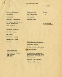
List of the "Planning Groups" including Chamber of Commerce, Ports Authority, Civic Services Committee, and Retail Merchants.
Date:
1945
Description:
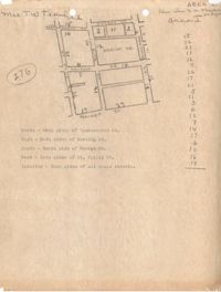
Map of Area 1 bounded by George Street, St. Philip Street, Vanderhorst Street, Hutson Street, and Meeting Street assigned to Mrs. T W. Thornhill.
Date:
1945
Description:
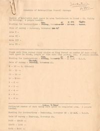
Metropolitan Council Survey schedule (mostly blank but with handwritten corrections).
Date:
1945
Description:
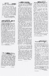
Six articles regarding war memorials in Charleston, SC, including a letter to the editor from Susan P. Frost.
Date:
1945
Description:
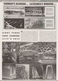
Clipping "Eight Years Have Changed City's Face."; illustrates progress made in New York City under Mayor La Guardia's leadership.
Date:
1945
Description:
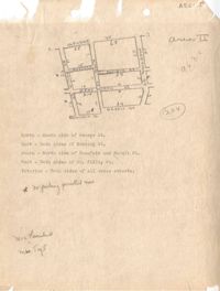
Map of Area 2 bounded by George Street, Meeting Street, Philip Street, Beaufain Street, and Hasell Street assigned to Mrs. Thornhill and Mrs. Taft.
Date:
1945
Description:
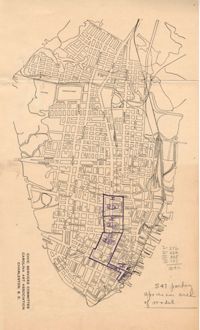
Map of Area 3 bounded by Beaufain Street, Hasell Street, Meeting Street, Broad Street, Legare Street, and Archdale Street assigned to Ferdinanda Waring.
Date:
1945
Description:
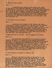
Document with sample letters to Board members, Civic Services Committee members, people who are members of neither organization, each regarding the outcome of the City Council meeting at which off-street parking plan was presented and the resolution passed
Date:
1945
Date:
1945
Description:
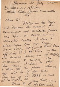
Letter to Robert N.S. Whitelaw from Mrs. E. R. Holcombe regarding parking in Charleston (1945).
Date:
1945
Description:
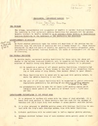
Statement attached to George W. Simon's letter, entitled "Charleston: Off-Street Parking" by the Civic Services Committee.
Date:
1945
Description:
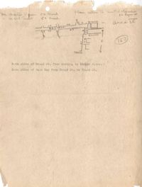
Map of Area 4 bounded by Broad Street, East Bay Street, and Tradd Street assigned to Mr. Martin Powers and Maier Triest.
Date:
1945
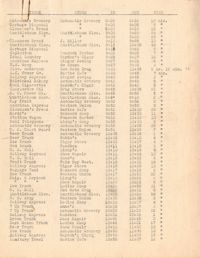
Description:
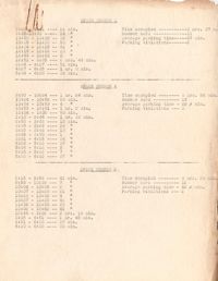
Parking survey of trucks, showing name on truck, name of store, time-in, time-out, and total time parked.
Date:
1945
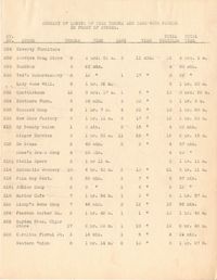
Description:
Summary of length of time trucks and cars were parked in front of stores.
Date:
1945
Description:
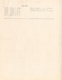
Parking survey Summary Report; location not indicated.
Date:
1945
Description:
Map of the Charleston peninsula with one area marked to indicate number of parking spaces.
Date:
1945
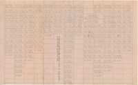
Description:
Parking survey chart with details of how long cars were parked; location not indicated.
Date:
1945
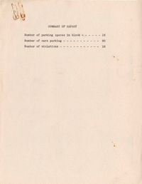
Description:
A parking violations tally sheet (presumably of area shown on attached map) with the corresponding map of the Charleston peninsula; survey area marked.
Date:
1945
Description:
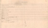
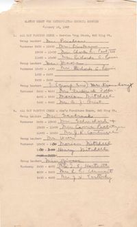
Master sheet for the Metropolitan Council parking survey, listing parking check location, group leaders, shifts and workers (Jan. 16,1945).
Date:
1945
Description:
Metropolitan Council traffic survey report for parking spaces 1-13 and a bus stop; location not indicated.
Date:
1945
Description:
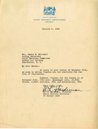
Letter to the Civic Services Committee from W. L. Hardeman regarding Charleston county figures for passenger cars, trucks, trailers, and motorcycles.
Date:
1945
Description:
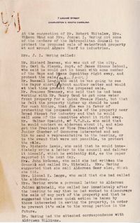
Notes regarding the efforts of Metropolitan Council members to protest the proposed sale of waterfront property at South Adgers Wharf to industries.
Date:
1945
Description:
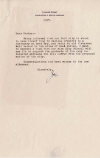
Transcript copy of letter from Joseph I. Waring to Porter Williams [City of Charleston Alderman] expressing opposition to the proposed selling of waterfront property at South Adgers Wharf and East Bay Street to a shrimpery.