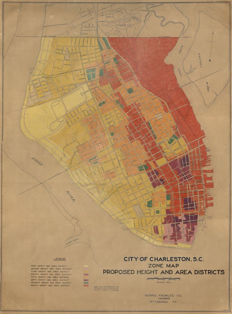
City of Charleston, SC, Zoning Data Map: Proposed Height and Area Districts
Close Viewer
Title:
City of Charleston, SC, Zoning Data Map: Proposed Height and Area Districts
Date:
1931
Creator (Corporate):
City of Charleston and Morris Knowles, Inc.
Description:
Hand-colored, linen map showing proposed height and area districts for the city of Charleston. Map shows eight height and area districts from Murray Boulevard to the northern limits of the city at Mount Pleasant Road. Map measures 42" by 60".