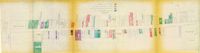
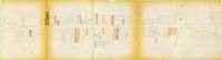
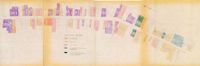
One of four maps of King Street building footprints, hand-colored to designate status. This map illustrates the historical significance of buildings on King Street from Calhoun Street to Columbus Street.
One of four maps of King Street building footprints, hand-colored to designate status. This map illustrates area conditions of buildings on King Street from Calhoun Street to Columbus Street.
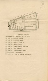
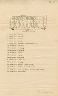
One of four maps of King Street building footprints, hand-colored to designate status. This map illustrates proposed reuses of buildings on King Street from Calhoun Street to Queen Street.
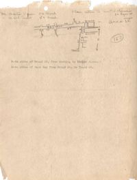
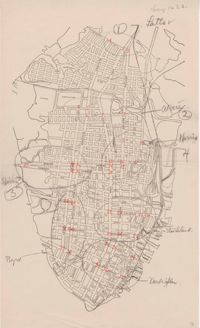
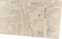
Map of Area 3 bounded by Beaufain Street, Hasell Street, Meeting Street, Broad Street, Legare Street, and Archdale Street assigned to Ferdinanda Waring.
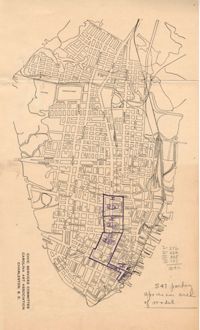
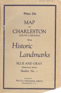
Map of the Charleston peninsula featuring points of interest. Cover title: Map of Charleston, South Carolina with historic landmarks. Blue and gray historical series, booklet no. 1. Published by Wil-Tuc Advertising Agency. Map measures 21” x 6.25” folded to create 13 pages measuring 6.25” x 3.5.
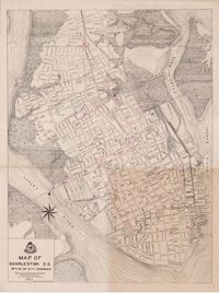
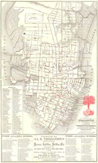
Map of the Charleston peninsula. Revised in 1879; published by Walker, Evans & Cogswell. Features locations of fire alarm boxes and public buildings, with indexes to each. Presented by A.R. Thomlinson, manufacturer of harness, saddles, bridles, etc., located at 137 Meeting Street. Measures 21.875" x 13.625"