Map of Charleston, South Carolina
Close Viewer
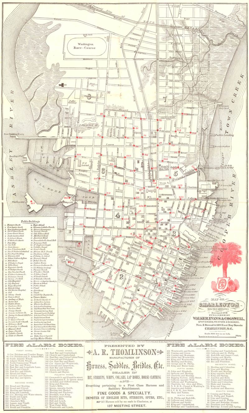
- Title:
- Map of Charleston, South Carolina
- Date:
- 1879
- Creator (Corporate):
- Walker, Evans & Cogswell
- Description:
- Map of the Charleston peninsula. Revised in 1879; published by Walker, Evans & Cogswell. Features locations of fire alarm boxes and public buildings, with indexes to each. Presented by A.R. Thomlinson, manufacturer of harness, saddles, bridles, etc., located at 137 Meeting Street. Measures 21.875" x 13.625"
- Collection Title:
- Historic Charleston Foundation's Map Collection
- Contributing Institution:
- Historic Charleston Foundation
- Media Type:
- Maps
- Geographic Subject:
- Charleston (S.C.)--Maps and Charleston (S.C.)--Maps, Tourist
- S.C. County:
- Charleston County (S.C.)
- Shelving Locator:
- 2005.002.001; TouristMaps_01.jpg
- Date Digital:
- 2010-07
- Digitization Specifications:
- 300 ppi, 24-bit depth color, HP Scanjet 4890. Archival Masters are tiffs.
- Internet Media Type:
- image/jpeg
- Copyright Status Statement:
- Digital image copyright 2010, Historic Charleston Foundation. All rights reserved. For more information contact Margaretta Childs Archives at HCF, P.O. Box 1120, Charleston, SC 29402.
- Admin ID:
- 35750
Permalink