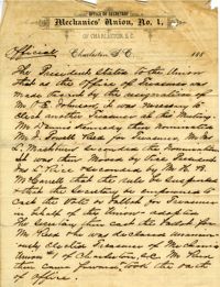
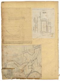
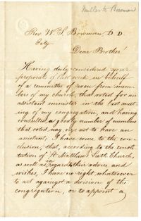
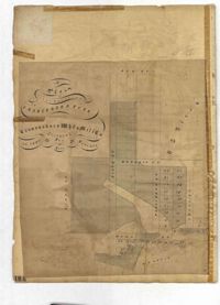
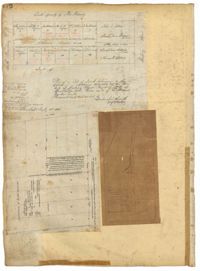
Excerpts from minutes of "the regular monthly meeting held in their hall July 4, 1887" concern the election of J. Powell Reid as treasurer of the Mechanics' Union No. 1. The Mechnic's Union No. 1 was a trade union organized in Charelston in 1869.
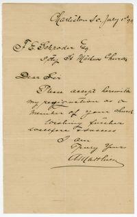
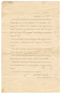
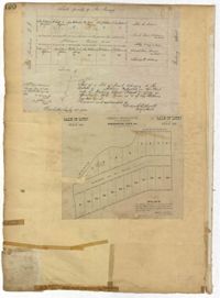
Summons sent to Samuel Hart Sr. from Nathaniel Levin, secretary and treasurer of KKBE Board of Trustees, requesting Hart's presence at a meeting for the sale of synagogue seats.
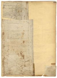
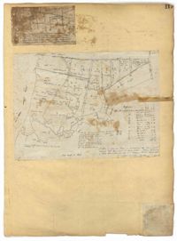
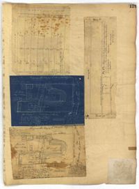
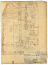
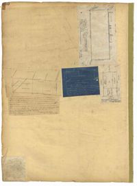
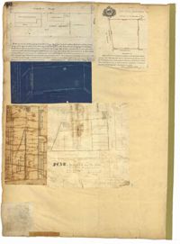
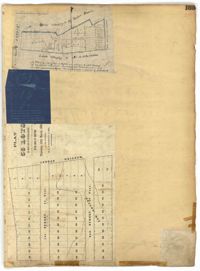
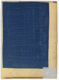
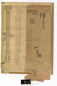
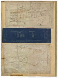
Page 100 of the City Engineer's Plat Book with four plats. Plat 1 features lots located near the intersection of Broad Street and Friend Street. Plat 2 shows lots and structures on Meeting Street. Plat 3 shows land located near the intersection of Drake Street and Cool Blow Street, including a stretch of the North Eastern Rail Road, a creek leading to the Cooper River, and some marshland. Plat 4 is affixed to the page so it folds in and out, and shows lots located near a stream, Pine Street, Alleyway Street, Norman Street, and Ashton Street.
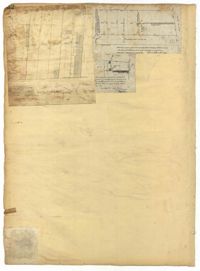
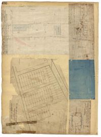
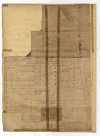
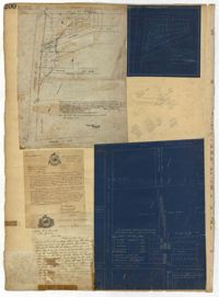
Page 102 of the City Engineer's Plat Book with five plats. Plat 1 shows lots along a stretch of Rutledge Avenue from Grove Street to Sans Souci Street. Plat 2 features a projected extension of Rutledge Avenue from Mt. Pleasant Road to Heriot Street, and also shows a lot labelled "S.C. Agricultural Society." Plat 3 shows a projected extension Rutledge Avenue, extending from Sans Souci Street to Mt. Pleasant Road. Plat 4 shows a projected expansion of Rutledge Avenue through Heriot Street, and also shows a plot labelled "Agricultural Society." Plat 5 shows a projected extension of Rutledge Avenue from Grove Street to Simons Street, and also shows King Street.
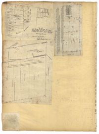
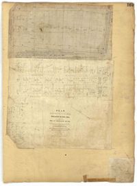
Page 103 of the City Engineer's Plat Book with three plats. Plat 1 shows lots located between President Street and Norman Street, near where they intersect with Spring Street. Plat 2 shows lots and some buildings along Bogard Street, between Laurel Street and Percy Street. Plat 3 shows a lot and several buildings located on Percy Street.
Page 105 of the City Engineer's Plat Book with seven plats. Plat 1 shows several lots located on Chalmers Street. Plat 2 shows lots located near the intersection of East Bay Street and Market Street, and several structures, including docs and wharves. Plat 3 features lots and structures located on Chalmers Street. Plat 4 features a lot located on the intersection of Church Street and Waters Street, and shows several structures. Plat 5 shows a lot and several structures located on Waters Street. Plat 6 features a lot and buildings located on Broad Street. Plat 7 features the profiles of streets where tidal drains will be built. The profiles include Calhoun Street, Mazyck Street, Logan Street, Tradd Street, Coming Street, Chesnut Street, Spring Street, and Meeting Street.
Page 106 of the City Engineer's Plat Book with ten plats. Plat 1 features a lot and its buildings located near the intersection of King Street and Tradd Street. Plat 2 features a lot and buildings located between Church Street and Water Street, near where the latter intersects with East Bay Street. Plat 3 shows lots located near the intersection of King Street and Grove Street. Plat 4 features a plat and building located on Church Street. Plat 5 features a lot located on the intersection of East Bay Street and Elliott Street. Plat 6 shows a lot located between two streets leading to wharves. Plat 7 shows lots, wharves, and docks located near the intersection of Market Street and East Bay Street. Plat 8 features a wharf and lot located near the intersection of Legare Street and South Bay Street. Plat 9 shows lots located on and near the intersection of Broad Street and East Bay Street. Plat 10 shows lots and some structures located on East Bay Street.
Page 108 of the City Engineer's Plat Book with five plats. Plat 1 features lots and some structures located near South Bay Street's intersections with Meeting Street and Church Street. It also shows a lot labelled "Battery Garden." Plat 2 shows lots located near East Bay Street. Plat 3 features White Point Garden, also known as Battery Park, located south of South Battery Street, near the Church Street and Meeting Street. Plat 4 shows a lot located near the intersection of Meeting Street and Broad Street. Plat 5 shows land located between Broad Road and the Ashley River, and includes labels marking salt marshes, cleared lands, a fish pond.
Page 109 of the City Engineer's Plat Book with six plats. Plat 1 shows lots located near the intersection of Exchange Street and Champney Street. Plat 2 shows lots and some buildings located on Church Street. Plat 3 shows lots located along Elliott Street, between East Bay and Church Street. Plat 4 shows lots and structures located near the corner of Church Street and Atlantic Street. Plat 5 shows lots and structures located near the corner of Church Street and Atlantic Street. Plat 6 shows lots and structures located near the intersection of East Bay Street and Guignard Street.
Page 110 of the City Engineer's Plat Book with three plats. Plat 1 shows lots located near the corner of Champney Street and Exchange Street, including labels for brick buildings, a label reading "EAST SHORE TERMINAL." Plat 2 shows lots and structures located near South Bay Street, between Church Street and Meeting Street. Plat 3 shows lots and some structures located near the intersection of Bogard Street and Percy Street.
Page 112 of the City Engineer's Plat Book with five plats. Plat 1 shows lots and structures located on the north side of Tradd Street. Plat 2 shows lots located on the east side of Savage Street. Plat 3 shows lots located on King Street. Plat 4 shows lots located between Broad Street and Tradd Street, and between Lynch Street and the Ashley River. Plat 5 shows lots and structures located near the intersection of King Street and Broad Street.
Page 113 of the City Engineer's Plat Book with two plats. Plat 1 features "Shoal and Channel lots" located south of Tradd Street. Plat 1 also shows Gibbes Street, Council Street, two labels reading "ASHLEY RIVER EMBANKMENT," a line marking the edge of high land, a line marking the low water, and a line marking the edge of the channel. Plat 2 shows lots along New Street.
Page 114 of the City Engineer's Plat Book with elven plats. Plat 1 features lots located at the corner of King Street and Queen Street. Plat 2 shows a strip of land on the west side of King Street. Plat 3 shows lots along King Street. Plat 4 shows lots located near the intersection of Savage Street and Tradd Street. Plat 5 shows lots located on King Street. Plat 6 shows lots located near the intersection of King Street and Queen Street. Plat 7 shows lots located on King Street. Plat 8 shows a lot located on King Street. Plat 9 shows lots located near the intersection of South Bay Street and Legare Street. Plat 10 shows a lot on King Street. Plat 11 shows lots located near the intersection of Council Street and Gibbes Street.
Page 115 of the City Engineer's Plat Book with four plats. Plat 1 shows land located near Broad Street, Short Street, Franklin Street, and Queen Street. Plat 2 shows lots and structures located on King Street. Plat 3 shows lots and structures located on Franklin Street. Plat 4 shows lots and structures located on Queen Street.
Page 116 of the City Engineer's Plat Book with three plats. Plat 1 shows lots and structures located near the intersection of Meeting Street and Ladson's Court. Plat 2 features a proposed extension of Ladson's Court. Plat 3 shows lots located south of Tradd Street. Plat 3 also shows Gibbes Street, Council Street, a line marking the low water, and a line marking the edge of the channel.
Page 117 of the City Engineer's Plat Book with two plats. Plat 1 shows lots located near the Cooper River. Plat 2 shows marshlands, bodies of water, and lots located near the Ashley River.
Page 119 of the City Engineer's Plat Book with five plats. Plat 1 shows land located between East Bay Street and the Cooper River. Plat 1 also shows Trott Street, Hasell Street, Concord Street, and Pinckney Street. Plat 2 features Bennett's Rice and Lumber Mills, near East Bay Street. Plat 3 features a plot on East Bay Street. Plat 4 features lots and structures located near Church Street and Market Street, and shows a lot labelled "Gas Company." Plat 5 shows lots located near the intersection of East Bay Street and Lodge Alley.
Page 121 of the City Engineer's Plat Book with six plats. Plat 1 shows lots located near the intersection of Washington Street and Society Street. Plat 2 shows lots located on East Bay Street. Plat 3 shows lots and structures located near the intersection of Wall Street and Minority Street. Plat 4 shows lots located between Concord Street and Wharf Street. Plat 5 shows lots and buildings on Cumberland Street. Plat 6 shows lots and structures located on and near Broad Street.
Page 122 of the City Engineer's Plat Book with three plats. Plat 1 shows lots and structures on Meeting Street. Plat 2 shows lots and structures located near the intersection of Anson Street and Laurens Street. Plat 3 shows lots located between Moultrie Street and Huger Street, near Rutledge Avenue.
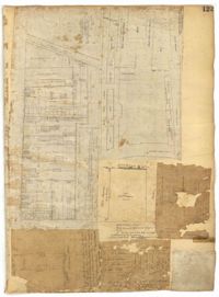
Page 123 of the City Engineer's Plat Book with six plats. Plat 1 shows lots and structures located on and near Calhoun Street, between Anson Street and Meeting Street. Plat 2 shows lots and structures located between East Bay Street and Cooper River. Plat 3 shows lots and buildings located near Meeting Street. Plat 4 shows lots near a road, and has a large hole in the middle. Plat 5 shows lots and buildings located on Beaufain Street. Plat 5 shows lots located near an intersection, and has several holes in the paper.
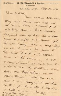
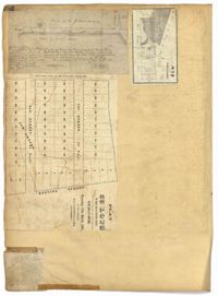
Alex writes about the children and encloses a flyer from R.M. Marshall (Broad St. brokers) encouraging investors to build homes for rent at Sheffield, Alabama
Page 125 of the City Engineer's Plat Book with seven plats. Plat 1 shows several measurements for a structure. Plat 2 shows the line of division between St. Mary's Church Yard and the "Property of Mrs. Anna D. Fleming." Plat 3 shows two wharves. Plat 4 shows lots and structures near wharf street. Plat 5 shows lots near the intersection of Washington Street and Laurens Street. Plat 6 shows lots between Rose Lane and Market Street, near where they intersect with East Bay Street. Plat 7 shows lots between Congress Street and Race Street, near Rutledge Street.
Page 128 of the City Engineer's Plat Book with one plat. The plat shows a city block between Meeting Street and Church Street, and between Cumberland Street and Market Street. A label reads "Champion Cotton Press Co. Lots," and another reads "Tudor Ice House."
Page 129 of the City Engineer's Plat Book with four plats. Plat 1 shows lots between Hayne Street and Market Street, near where they intersect with Meeting Street. Plat 2 features a lot and structures located along Meeting Street, between Hayne Street and Market Street. Plat 3 features a lot located on the "Charleston Harbour on Cooper River." Plat 3 also shows a wharf and other structures. Plat 4 shows the same area as Plat 3.
Page 131 of the City Engineer's Plat Book with three plats. Plat 1 shows lots and structures located on George Street. Plat 2 features a lot on Rutledge Street. Plat 3 shows lots located on King Street, near its intersection with Clifford Alley.
Page 133 of the City Engineer's Plat Book with one plat. The plat features Colonial Lake, located between Broad Street and Beaufain Street, and between Rutledge Street and Lynch Street.
Page 134 of the City Engineer's Plat Book with eleven plats. Plat 1 shows lots and structures located on Lynch Street. Plat 2 shows a lot located on Wentworth Street, with a building labelled "Charleston Engine House." Plat 3 shows lots located near the intersection of Calhoun Street and Ogier Street. Plat 4 shows lots located on Ogier Street. Plat 5 shows lots located on Ogier Street, near its intersection with Calhoun Street. Plat 6 shows lots located along Clifford Alley, near where it intersects with Archdale Street. Plat 7 shows lots located near the intersection of Calhoun Street and Ogier Street. Plat 8 shows lots located near the intersection of Vanderhorst Street and Ogier Street. Plat 9 shows lots located near the intersection of Calhoun Street and Ogier Street. Plat 10 shows lots located on and near Boundary Street, near where it intersects with St. Philips Street. Plat 11 features a lot owned by "The Unitarian Church," located on the intersection of Archdale Street and Clifford Alley.
Page 135 of the City Engineer's Plat Book with seven plats. Plat 1 shows lots on a city block located between Bennett Street and Calhoun Street, and between Rutledge Street and Lynch Street. Plat 2 shows a lot labelled "Cannon's Mall," located on the intersection of Calhoun Street and Rutledge Street. Plat 3 shows lots located on Meeting Street. Plat 4 shows the same lot as Plat 2. Plat 5 shows a lot located on King Street. Plat 6 shows lots and structures located on King Street, including a graveyard, a Meeting House, and a kitchen.
Page 136 of the City Engineer's Plat Book with seven plats. Plat 1 shows lots and structures located on and near the intersection of Liberty Street and St. Philips Street. Plat 2 shows lots located on Archdale Street, near Bennett's Mill Pond. Plat 3 shows lots and structures located on and near the intersection of Rutledge Street and Montague Street. Plat 4 shows lots and structures located on Archdale Street, including a building labelled "Hope Engine House." Plat 5 shows a lot located along Clifford Alley, near a lot labelled "Unitarian Church." Plat 6 shows lots located along King Street. Plat 7 shows lots located on and near Calhoun Street, located between Smith Street and Rutledge Street.
Page 137 of the City Engineer's Plat Book with six plats. Plat 1 shows lots located on and near Mazyck Street, between Short Street and King Street. Plat 2 shows lots located on and near the intersection of Pitt Street and Montague Street. Plat 3 features a lot located on the intersection of Archdale Street and Berresford Street. Plat 4 features a lot located at the intersection of Queen Street and Meeting Street. Plat 5 shows a lot located at the intersection of Queen Street and King Street. Plat 6 shows lots located on and near the intersection of Mazyck Street and Magazine Street, including one labelled "Roper Hospital Lot."
Page 138 of the City Engineer's Plat Book with three plats. Plat 1 features a lot located on Hasell Street, with a large building labelled "St. Mary's Church." Plat 2 shows lots and structures located between Rutledge Street and Trapmann Street, and between Queen Street and Broad Street. Plat 3 features a lot located on Radcliffe Street, between Rutledge Street and Smith Street.
Page 139 of the City Engineer's Plat Book with five plats. Plat 1 shows a lot and structures located at the corner of Calhoun Street and Alexander Street. Plat 2 shows lots located on Queen Street, near where it intersects with Back Street. Plat 3 shows lots located on and near Mazyck Street, near its intersection with Magazine Street. Plat 3 also shows lots labelled "Roper Hospital Lot," and "City Lot." Plat 4 shows lots located between Vanderhorst Street and Boundary Street, and between Coming Street and Pitt Street.
Page 142 of the City Engineer's Plat Book with four plats. Plat 1 shows lots and structures located on the corner of Meeting Street and Burns Lane, with one lot labeled "Property of Charleston High School." Plat 2 shows lots located on Pitt Street. Plat 3 shows lots and structures located on Pitt Street. Plat 4 shows land located between Broad Street and Wentworth Street, and between Lynch Street and the Ashley River. Plat 4 also shows a line labelled "Low Water Mark of Ashley River," Comings Creek, and a "City Mud Flat, lying North of Creek."
Page 143 of the City Engineer's Plat Book with two plats. Plat 1 shows land located near the intersection of Washington Street and Chapel Street, with two wharfs and the "site of the creek in 1801." Plat 2 shows lots and structures located on the west side of Washington Street.
Page 144 of the City Engineer's Plat Book with five plats. Plat 1 shows lots on and near the Cooper River channel, near Boundary Street, Charlotte Street, Washington Street, and Alexander Street. Plat 1 also shows a creek and a stretch of marshland. Plat 2 shows lots located near the intersection of South Street and America Street. Plat 3 features structures located on the intersection of South Street and America Street. Plat 4 shows lots and structures located at the intersection of President Street and Cannon's Court. Plat 5 shows lots located between Drake Street, America Street, and Alexander Street.
Page 146 of the City Engineer's Plat Book with three plats. Plat 1 shows lands located on and near the intersection of East Bay Street and Hasell Street. Plat 2 features a lot located on the north side of John Street, between Meeting Street and King Street. It also shows a lot labelled "So. Ca. RR. Co." Plat 4 shows a park and buildings located between King Street and Meeting Street, and between Calhoun Street and Hutson Street.
Page 147 of the City Engineer's Plat Book with three plats. Plat 1 shows lots located between King Street and land owned by the South Carolina Railroad Company. Plat 2 shows lots and structures located between Charlotte Street and Calhoun Street, and between Washington Street and Meeting Street. It also shows Alexander Street, Elizabeth Street, and Henrietta Street. Plat 3 shows lots and structures located on and near the intersection of President Street and Cannon's Court.
Page 150 of the City Engineer's Plat Book with five plats. Plat 1 shows lots located between President Street and the Ashley River, and between Spring Street and Mill Street. It also shows an "Ashley River Bridge" on Spring Street, and a lot labeled "Charleston and Savannah R.R." Plat 2 shows lots and structures located on the west side of Rutledge Avenue. Plat 3 features a lot located on the corner of St. Philips Street and Calhoun Street. Plat 4 shows lots located on the east side of Rutledge Avenue. Plat 5 shows lots and structures located on King Street, including labels reading "Upper Police Station" and "Cistern Underground."
Page 152 of the City Engineer's Plat Book with three plats. Plat 1 shows lots and structures located on King Street. Plat 2 shows lots located on Luhn's Court, near where it intersects with Smith Street. Plat 3 shows lots and structures located on and near the intersection of Morris Street and King Street.
Page 153 of the City Engineer's Plat Book with three plats. Plat 1 shows lots located between Rutledge Street and Lynch Street, near where they intersect with Calhoun Street. Plat 2 shows lots located on and near the intersection of Rutledge Avenue and a private court. Plat 3 shows lots located between Smith Street and Ogier Street, near where they intersect and Vanderhorst Street.
Page 154 of the City Engineer's Plat Book with three plats. Plat 1 shows lots and structures located between Radcliffe Street and Warren Street, near where they intersect with Coming Street. Plat 2 shows lots and structures located between Thomas Street and Smith Street. Plat 3 shows lots and structures located near the intersection of St. Philips Street and Vanderhorst Street. Plat 3 also includes labels reading "Kitchen building," and "Lot of the Irish Volunteers."
Page 155 of the City Engineer's Plat Book with three plats. Plat 1 features a tract of land located between Calhoun Street and Bennett Street, and between Lynch Street and Rutledge Street. Plat 2 shows lots and structures located on Vanderhorst Street. Plat 3 shows lots and structures located on St. Philips Street.
Page 156 of the City Engineer's Plat Book with five plats. Plat 1 shows lots and structures located on the east side of Rutledge Street. Plat 2 features a lot located on the intersection of Coming Street and Warren Street. Plat 3 shows lots and structures located on Morris Street. Plat 4 shows lots and structures located on King Street. Plat 4 shows lots and structures on and near the intersection of Calhoun Street and Lucas Street.
Page 157 of the City Engineer's Plat Book with two plats. Plat 1 features a lot of land located on the South Side of Line Street. Plat 2 shows lots located on and near the intersection of Spring Street and Kracke's Court.
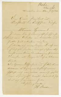
Letter in German from H. Bode to the President and Council of the German Church asking for financial assistance. Bode stated that since times have become so bad and workers can only work three quarters and half times, he would like to receive a small gratuity in recognition for singing in the choir. He further states he does not neglect his duties when he is healthy, and it has been three-quarters of a year since he last sang.
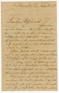
Letter in German from Johannes Heckel to William Ufferhardt referencing his recovery from an illness caused by the long railroad trip and thanking Ufferhardt for Heckel's stay in Charleston. He asked Ufferhardt to review a vocations formula he has written and advice on whether Heckel should also write Dr. Mueller.
Page 164 of the City Engineer's Plat Book with three plats. Plat 1 shows lots located between Meeting Street and Aiken Street, and between Cooper Street and Line Street. Plat 2 shows lots located on Felix Street. Plat 3 shows lots located on Grove Street, and shows a stream and a label reading "Frenchman's Hill."
Page 165 of the City Engineer's Plat Book with three plats. Plat 1 shows lots located near a "Public Road from and to Charleston." It also shows marsh land, a fishpond, and a garden. Plat 2 shows land located near the intersection of America Street and Brigade Street. Plat 3 shows lots located near the intersection of Meeting Street and Riker Street, including a stretch of land labeled "Low Ground."
Page 166 of the City Engineer's Plat Book with five plats. Plat 1 shows lots and structures located near the intersection of Columbus Street and Meeting Street. Plat 2 features lots located along Moultrie Street, between Meeting Street and Russel Street. Plat 2 also shows King Street and Hampton Street. Plat 3 shows lots located between Meeting Street and a line labeled "South Carolina R. R. Company," near Romney Street, Addison Street, and Poinsett Street. Plat 4 shows a lot located on the north side of Amherst Street. Plat 5 shows lots located near the intersection of Bay Street and Blake Street.
Page 167 of the City Engineer's Plat Book with two plats. Plat 1 shows lots located between Meeting Street and a line labelled "So. Ca. R. R." Plat 2 shows lots located between Moultrie Street and Line Street, and between America Street and Meeting Street. Plat 2 also shows lots between Hampton Street and Moultrie Street, West of Meeting Street.
Page 230 of the City Engineer's Plat Book with one plat. The Plat features lots located between Chinquapin Street and President Street, and between Bee Street and Spring Street. It also shows several structures, Pine Street, and Chesnut Street. One lot is labelled "Vegetable Garden."
Page 233 of the City Engineer's Plat Book with one plat. The plat features a stretch of marshland located east of Bay Street. The plat also shows America Street, Cooper Street, Blake Street, several creeks, and land labelled "Magazine."
Page 234 of the City Engineer's Plat Book with one plat. The plat shows lots and structures located on Mill Street, President Street, Lucas Street, and Sixth Street. It also shows a lot labelled "U. S. Arsenal."
Page 231 of the City Engineer's Plat Book with one plat. The plat features lots belonging to "The Cannonsboro Whf & Mill Co." It shows Bee Street, Doughty Street, President Street, Lucas Street, and Mill Street.
Page 221 of the City Engineer's Plat Book with six plats. Plat 1 shows lots along Payne Street, between Mount Street and Fishburne Street. Plat 2 shows lots along Lucas Street, near its intersections with Doughty Street and Mill Street, including a lot labelled "City Hospital." Plat 3 shows lots located along Kirkland Lane, between Wentworth Street and Beaufain Street. Plat 4 shows lots located near the intersection of Gadsden Street and Beaufain Street. Plat 5 shows lots located along Lightwood Alley, between Meeting Street and Church Street. Plat 6 shows a lot and building located on Cannon Street, Between Coming Street and a label reading "Church."
Page 223 of the City Engineer's Plat Book with five plats. Plat 1 shows lots and structures along Poinsett Street, near where it intersects with King Street. Plat 2 shows lots located on Sans Souci Street, near where it intersects with King Street. Plat 3 shows lots located on Line Street, including a lot labelled "City Stables." Plat 4 shows lots along King Street, near where it intersects with Moultrie Street. Plat 5 shows lots and structures located near the intersection of King Street and Romney Street.
Page 227 of the City Engineer's Plat Book with two plats. Plat 1 shows lots and structures located on Grove Street, between King Street and Russell Street. Plat 2 features a "Plot of Ground Surrounding Charleston Colored Industrial School." Plat 2 also shows Fishburne Street, Mount Street, Congress Street, and President Street.
Page 228 of the City Engineer's Plat Book with two plats. Plat 1 shows the ground elevation near Mount Pleasant Street, between the Ashley River Marsh and the Cooper River Marsh. It also shows where Mount Pleasant Street intersects with Meeting Street and King Street. Plat 2 shows lots and structures located on and near Magazine Street, between Franklin Street and Smith Street.
Page 224 of the City Engineer's Plat Book with one plat. The plat features lots and structures belonging to a refining company. It also shows several streams, a right-of-way for a rail line, America Street, Hanover Street, Centre Street, and Meeting Street.
Page 226 of the City Engineer's Plat Book with one plat. It shows lots located between Rutledge Avenue and King Street, and between Race Street and Sheppard Street.
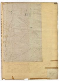
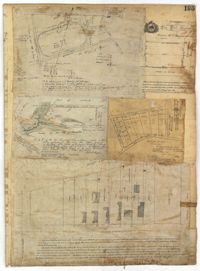
Page 212 of the City Engineer's Plat Book with three plats. Plat 1 shows lots located between Broad Street, Tradd Street, and Savage Street. Plat 2 shows lots and structures located near the intersection of Tradd Street and Chisolm Street, including wharves, a storehouse, a rice mill, an engine house, and a saw mill. Plat 3 shows lots, structures, and geographic features located between New Street and the Ashley River. Plat 3 also includes Tradd Street, Savage Street, Rutledge Street, Lynch Street, and a large stretch of marshland.
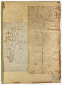
Page 213 of the City Engineer's Plat Book with two plats. Plat 1 features lots located between Savage Street and Chisolm Street, and between Tradd Street and Broad Street. Plat 1 also shows New Street, Rutledge Avenue, Lynch Street, Trapmann Street, and a lot labelled "Chisolm Mill Property." Plat 2 shows Calhoun Street's intersections with Lynch Street and Ashley Street.
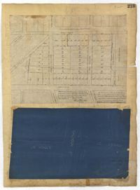
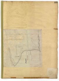
Page 211 of the City Engineer's Plat Book with two plats. Plat 1 features "Pregnal's Ship Yard," located near Concord Street, Laurens Street, Vernon Street, and Wharf Street. Plat 1 also shows structures with labels such as "Rough Rice Storehouse," "Mill," "Coal Yard Office," and "Stable." Plat 2 shows numerous streets including Meeting Street, King Street, Boundary Street, Columbus Street, and Bay Street.
Page 218 of the City Engineer's Plat Book with two plats. Plat 1 features a proposed extension to Boigard Street, located between Ashley Street and Rutledge Avenue. Plat 1 also shows Payne Street, Line Street, and a lot labeled "Thompson's Garden." Plat 2 shows lots and structures located between St. Philips Street and King Street, and between Radcliffe Street and Warren Street.
Page 219 of the City Engineer's Plat Book with one plat. The plat features proposed streets on "Part of the West Point Mill Property," including an extension of Calhoun Street. The plat also shows a dam, a storehouse, and a creek.
Page 217 of the City Engineer's Plat Book with one plat. The plat features city lands known as Potters Field. It also shows streams, marshland, President Street, Mount Street, Fishburne Street, Line Street, and Congress Street.
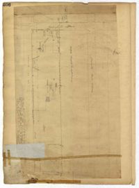
Page 206 of the City Engineer's Plat Book with one plat. The plat shows lots and structures between Charlotte Street and Calhoun Street, near where they intersect with Washington Street. The plat also shows a planing mill, a saw mill, and a dock.
Page 204 of the City Engineer's Plat Book with one plat. The plat shows lots and structures located near the intersection of Meeting Street and Broad Street.
Page 195 of the City Engineer's Plat Book with five plats. Plat 1 shows land located near King Street, Congress Street, and Moultrie Street. Plat 2 shows land located near the intersection of King Street and Simons Street. Plat 3 shows land located near Hassel Street and Pinckney Street. Plat 3 also shows marshland, reclaimed land, several dams, the "Cemetery of the City of Charleston." Plat 4 shows lots located between King Street and Congress Street, and between Moultrie Street and King Street. Plat 5 features lots between Drake Street and America Street, along Cooper Street.
Page 198 of the City Engineer's Plat Book with three plats. Plat 1 shows land between President Street and Rutledge Street, and also shows Ashley Street, Boignard Street, Kennedy Street, Payne Street, Rosemont Street, and Krackes Street. Plat 2 shows lots along Mount Street, between Rutledge Street and Payne Street. Plat 3 shows land between "Town Creek" and Meeting Street, and also shows some marshland and a lot labelled "Roman Catholic Cemetery."
Page 200 of the City Engineer's Plat Book with three plats and two letters written to C.S. Gadsden. Plat 1 shows lots located near President Street, between Spring Street and Line Street, and includes Boigard Street and a projected Kennedy Street. Plat 2 shows lots near President Street, between Line Street and Kennedy Street. Plat 3 shows lots between Line Street and Spring Street, near Rutledge Street.
Page 197 of the City Engineer's Plat Book with three plats. Plat 1 shows lots near the intersection of Payne Street and Nunan Street. Plat 2 shows land near President Street and Congress Street. The last plat shows land located near the intersection of Lenwood Street and Gibbes Street, and also shows Lowndes Street.
Page 194 of the City Engineer's Plat Book with three plats. Plat 1 shows lots located near the intersection of Line Street and Comming Street. Plat 2 shows lots and structures located near Chesnut Street. Plat 3 shows lots and structures located on and near Calhoun Street, between Meeting Street and Anson Street.
Page 196 of the City Engineer's Plat Book with two plats. Plat 1 shows land near the intersection of King Street and Mount Pleasant Street. Plat 2 shows land located near King Street, Mount Pleasant Road, and Sans Souci Street.
Page 191 of the City Engineer's Plat Book with two plats. Plat 1, on the inside of the folded paper, shows lots located between King Street and Rutledge Avenue, and between a city block on Grover Street and a city block on Frances Street. The other plat, on the outside of the folded paper, shows a similar area with less detail.
Page 186 of the City Engineer's Plat Book with two plats. Plat 1 shows lots and "City Lands" located near President Street, near its intersections with Mount Street and Congress Street. Plat 2 shows a farm located along the Ashley River, near Grove Street. Plat 2 also labels marshland, structures, fields, and lawn.
Page 190 of the City Engineer's Plat Book with two plats. Plat 1 shows lots located along Addison's Court, between Meeting Street and a lot owned by the South Carolina Rail Road. Plat 2 shows lots along Kennedy Street, near Line Street and a stretch of Marsh.
Page 178 of the City Engineer's Plat Book with five plats. Plat 1 shows lots and structures located on and near King Street, near the intersection with "Shepheard" Street. Plat 2 shows lots located on and near Spring Street, King Street, and Meeting Street. Plat 3 shows lots and a building located near the intersection of King Street and Sheppard Street. Plat 4 shows lots located on a city block between Cooper Street and Lee Street, and between Aiken Street and America Street. One lot is labelled "Baptist Church Lot." Plat 5 shows Cooper Street, Aiken Street, Lee Street, and America Street.
Page 182 of the City Engineer's Plat Book with three plats. Plat 1 shows lots and structures located along Spring Street, near its intersection and Chesnut Street. Plat 2 shows "the Schützenplatz," located at the end of Heriot Street. It also shows several structures, a marsh extending to the Ashley River, and a label reading "Known as the Village of Rikersville." Plat 3 shows lots and low land located near Meeting Street.
Page 184 of the City Engineer's Plat Book with five plats. Plat 1 shows "a certain plantation" near a "Marsh of Ashley." Plat 2 features a lot located on Congress Street, with several structures and streams. Plat 3 shows lots and structures located on Chesnut Street. Plat 4 shows lots and structures located on and near King Street, near its intersections with Romney Court and Simons Street.
Page 185 of the City Engineer's Plat Book with four plats. Plat 1 shows lots and structures located near [Map too blurry to read, check when in-office]. Plat 2 shows lots and structures located near the intersection of Spring Street and Ashley Street. Plat 3 shows lots located near the intersection of Mount Street and Rutledge Avenue. Plat 4 shows lots located near Rutledge Avenue, between Congress Street and Huger Street.
Page 181 of the City Engineer's Plat Book with one plat. The plat features a survey of Mount Pleasant Farm, focusing on "High land" and "Marsh." The plat also shows the city boundary, several structures, marsh leading to the Ashley River, Hester Street, Sans Souci Street, and Mount Pleasant Road.
Page 179 of the City Engineer's Plat Book with two plats. Plat 1 shows lots located on and near Hinloch Court and Meeting Street. Plat 2 shows lots located between Moultrie Street and Price Street.
Page 180 of the City Engineer's Plat Book with one plat. The plat shows lots located on and near Brigade Street, Lee Street, the City Boundary, and the "N.E.R.R. Right of Way."
Page 176 of the City Engineer's Plat Book with three plats. Plat 1 shows lots located between Meeting Street and land owned by the South Carolina Railroad Company. Plat 2 shows lots located near the intersection of King Street and Line Street. Plat 3 features a proposed road from Clements Ferry Road to Chicora Park. It also shows a stretch of pine woods and a stretch of land labelled as "Bottom."
Page 173 of the City Engineer's Plat Book with five plats. Plat 1 shows lots and structures located near the intersection of Meeting Street and Brigade Street. Plat 2 shows lots located between Meeting Street and Lee Street, and includes a lot labeled "German Cemetery." Plat 3 shows lots located between Cunnington Avenue and Wiliman Street, and between Meeting Street and Lee Street, and shows a lot labeled "4th Brigade." Plat 4 shows lots located near Brigade Street. Plat 5 features lots located in the Village of Hampstead, between Bay Street and Town Creek.
Page 170 of the City Engineer's Plat Book with four plats. Plat 1 shows lots located between King Street and Meeting Street, and between Romney Street and Grove Street. Plat 2 shows lots located between King Street and Meeting Street, and between Brigade Street and Mount Pleasant Street. Plat 4 shows lots located on Butler Street, near its intersection with Russell Street. Plat 5 features a lot labelled "Reservoir," located between Hanover Street and America Street.
Page 172 of the City Engineer's Plat Book with three plats. Plat 1 features a stretch of land located between Nassau Street and "Town Creek," and between Mary Street and Cooper Street. Plat 2 shows lots located near Division Street, Cleland Street, Union Street, and "Town Creek." Plat 3 shows lots located between President Street and Norman Street, near where it intersects with Spring Street.
Page 174 of the City Engineer's Plat Book with two plats. Plat 1 shows lots and structures located between King Street and Meeting Street. Plat 2 features a lot located on Nassau Street, near where it intersects with Stewart Street.
Page 177 of the City Engineer's Plat Book with two plats. Plat 1 shows lots located between Meeting Street and King Street, near Russell Street, "Rumney" Street, and Poinsett Street. Plat 2 shows lots, structures, and streams located near Hanover Street, America Street, and Payne Street.
Page 169 of the City Engineer's Plat Book with three plats. Plat 1 shows lots and structures on and near Dehon Street, between King Street and Meeting Street. Plat 2 shows lots located between King Street and Meeting Street, south of Romney Street. Plat 3 shows lots and structures located between Chapel Street and Charlotte Street, near where they intersect with Elizabeth Street. One lot is labelled "St. Luke's Church."
Page 168 of the City Engineer's Plat Book with one plat. The plat shows lots located between Hanover Street and Meeting Street, including the intersection of Cedar Street and Nassau Street.