City Engineers's Plat Book, 1671-1951, Page 176
Close Viewer
- Title:
- City Engineers's Plat Book, 1671-1951, Page 176
- Date:
- 1897
- Description:
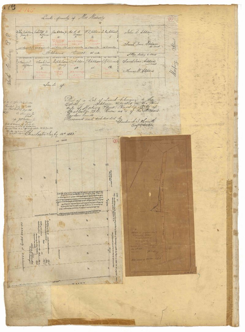
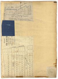
- Page 176 of the City Engineer's Plat Book with three plats. Plat 1 shows lots located between Meeting Street and land owned by the South Carolina Railroad Company. Plat 2 shows lots located near the intersection of King Street and Line Street. Plat 3 features a proposed road from Clements Ferry Road to Chicora Park. It also shows a stretch of pine woods and a stretch of land labelled as "Bottom."
- Collection Title:
- City Engineers's Plat Book, 1671-1951
- Contributing Institution:
- The Charleston Archive at CCPL and City of Charleston
- Media Type:
- Maps
- Personal or Corporate Subject:
- Barbot, Louis J.
Dingle, J. H. (James Hervey), 1869-1938
Smith, Frederick I. - Topical Subject:
- Cadastral maps and Surveys
- Geographic Subject:
- Charleston (S.C.)
- S.C. County:
- Charleston County (S.C.)
- Language:
- English
- Date Digital:
- 2023
- Digitization Specifications:
- 300 dpi, 24-bit depth, color, i2S SupraScan Quartz A0. Archival masters are tiffs.
- Format:
- image/jpeg
- Copyright Status Statement:
- Public domain.
- Access Information:
- This City of Charleston has placed this collection on permanent loan with the Charleston County Public Library. For more information and reuse requirements contact The Charleston Archive at Charleston County Public Library, 68 Calhoun Street, Charleston, SC 29411.
- Admin ID:
- 296709
Permalink