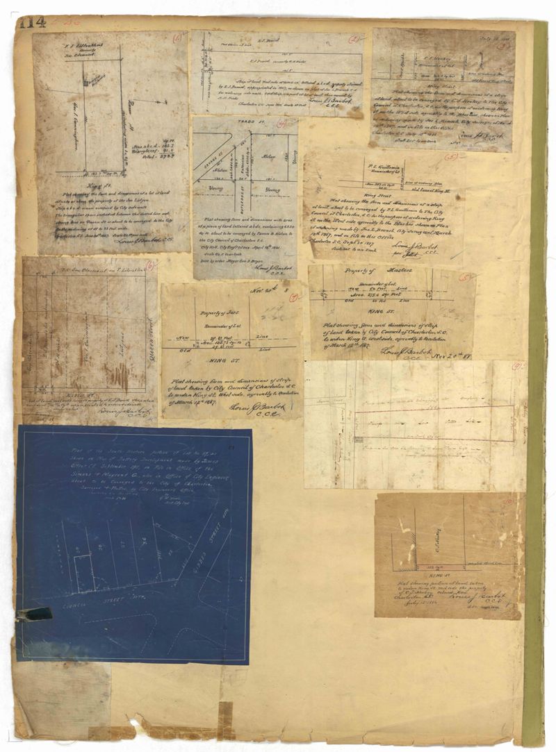
Page 114 of the City Engineer's Plat Book with elven plats. Plat 1 features lots located at the corner of King Street and Queen Street. Plat 2 shows a strip of land on the west side of King Street. Plat 3 shows lots along King Street. Plat 4 shows lots located near the intersection of Savage Street and Tradd Street. Plat 5 shows lots located on King Street. Plat 6 shows lots located near the intersection of King Street and Queen Street. Plat 7 shows lots located on King Street. Plat 8 shows a lot located on King Street. Plat 9 shows lots located near the intersection of South Bay Street and Legare Street. Plat 10 shows a lot on King Street. Plat 11 shows lots located near the intersection of Council Street and Gibbes Street.
This City of Charleston has placed this collection on permanent loan with the Charleston County Public Library. For more information and reuse requirements contact The Charleston Archive at Charleston County Public Library, 68 Calhoun Street, Charleston, SC 29411.