Search


Limit your search
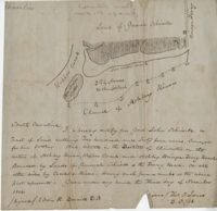
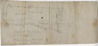
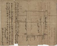
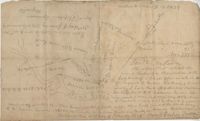
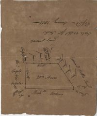
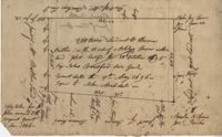
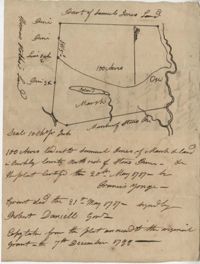
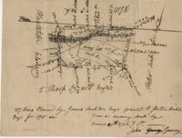
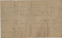
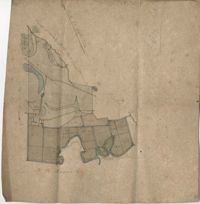
- City Engineers's Plat Book, 1671-1951256
- John McCrady Plats and Deeds Collection246
- Mitchell King Atlas, 1662-169531
- City of Charleston, SC, Report of the City Planning and Zoning Commission, Zone Maps10
- Ansonborough Rehabilitation Project6
- Edmondston-Alston Family Letters and Paper Materials, 1782-19195
- Historic Charleston Foundation's Map Collection3
- Fairfield Plantation Papers2
- Colleton County Memorial Library Map Collection1
- U.S. Engineer Maps of the Waccamaw River, 19031
- Maps✖[remove]561