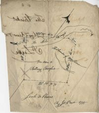
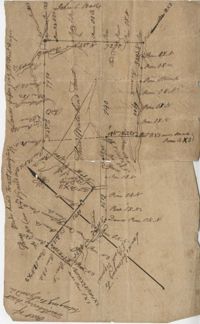
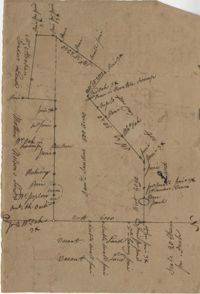
May River Swamp Plat 1775
Title:
May River Swamp Plat 1775
Date:
1775
Description:
Plan of 500 acres of land south of the Mile Swamp and near the May River. Names associated with this plat are J. Pears and Bellamy Crawford. Notable geographic locations are The Thickets, May River, The Mile Swamp and St. Luke's Parish.
Collection Title:
John McCrady Plats and Deeds Collection Contributing Institution:
South Carolina Historical Society Media Type:
Maps Topical Subject:
Conveyancing--South Carolina , Maps , and Surveying--South Carolina Geographic Subject:
Saint Luke’s Parish (S.C.) Language:
English
Shelving Locator:
510.00, Box 1, Folder 50
Date Digital:
2016-02-22
Digitization Specifications:
400 dpi, 24-bit depth, color, Bookeye 4 Basic, Archival masters are tiffs.
Internet Media Type:
image/jpeg
Copyright Status Statement:
Public Domain.
Access Information:
For more information and re-use requirements contact the South Carolina Historical Society, Charleston, SC, 29401.
Admin ID:
223207