Silent film footage of Mr. and Mrs. Clarence E. Chapman at Mulberry Castle a/k/a Mulberry Plantation, ca. 1927-1932. Includes scenes of the Chapmans, their guests, and their laborers. Features vistas of the main house, grounds, and river; scenes of duck and deer hunting, picnicking, fishing, boating, and horseback riding.
Historic Charleston Foundation's, "An Architectural Guide to Charleston, South Carolina, 1700-1900,' written in manuscript form by Albert Simons, F. A. I. A., and W. H. Johnson, compiled by Historic Charleston Foundation, discussing structures from the Colonial Period (1700-1775), Post Revolutionary Period (1782-1820), Ante-Bellum Period (1820-1860), and Post Civil War Period (1865-1900).
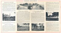
A twelve-part publication about Charleston, South Carolina and the surrounding region. The twelve volumes are mostly composed of black and white photographs and also contain text that runs contiguously throughout. The volumes contain images of well-known homes, monuments, gardens, cemeteries, and buildings, along with notable industrial sites.
This collection of gelatin silver photographs by Kenneth Clark consists of the original prints that were reproduced in three issues of the White Pine Series of Architectural Monographs, published by Russell F. Whitehead. The series was intended to provide 'intimate treatises of the architecture of the American colonies of the early Republic presented with well ordered completeness, to further a broader understanding and to create a permanent record of Early American architecture.'
In 1928, five issues highlighted Charleston architecture. The photographs feature Charleston buildings, street scenes, views, and architectural details. They appeared in three of the five Charleston issues: 'The Charm of Charleston: A New World City of Old World Memories' (vol. XIV, no. 2), 'Some Charleston Mansions' (vol. XIV, no. 4), and 'The Edwards-Smyth House' (vol. XIV, no.6).
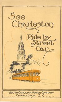
Guide to how to reach many places of interest in Charleston by street car. Includes route information, time tables, running times, and a guide map of Charleston with routes highlighted. Published by Southern Printing & Publishing Co. (Charleston, S.C.). 12 p., 16 cm. + 1 map, 19 x 27 cm. folded to 10 x 15 cm.
Souvenir program for what appears to be a U.S. Navy event that occurred in Charleston during the Coolidge administration. Focuses on the U.S. Navy, with naval history and lists of ships and ship personnel, and historical information about the Charleston Navy Yard. Also provides Charleston history and information on various sites, including churches. Advertisements for local businesses, many of which are directed specifically to the Navy visitors, are interspersed throughout. [80] p., ill., 22 x 30 cm.
Souvenir booklet for guests of the Charleston Hotel [200 Meeting Street] at the time it was under the proprietorship of Riddock & Byrns. Includes description of the hotel and its history, and illustrations of various points of interest. Published by Art Press, Loughead & Co. (Philadelphia). [14] p. : ill. ; 16 cm.
A guide to many points of historic interest in Charleston, presented as a sightseeing stroll or drive. Released through the Office of Port Development, City of Charleston. One folded sheet (6.25" x 24.5" folded to 6.25" x 3.5").
Provides local history and information on various sites and points of interest. Also includes advertisements for local businesses, sites, artists, etc., and a map of Charleston (1930). "Winter 1929-30." Published by W.W. De Renne (Savannah, Ga.). 16 p. : ill., map ; 23 cm.
Brief descriptions of points of historic interest in and around Charleston. Maps show landmarks in historic Charleston and also points of interest "on the motor roads and bridle paths near Charleston," including James Island and West Ashley sites. Possibly published by Wecco (Charleston, S.C.) One sheet : ill., maps; 22 x 57 cm. folded to 22 x 10 cm.
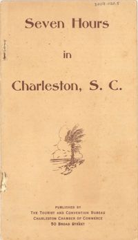
A ready reference to the most important points of historic interest in and around Charleston. Published by The Tourist and Convention Bureau, Charleston Chamber of Commerce, 50 Broad Street. 19 p., 16 cm.
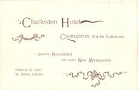
Souvenir booklet for guests of the Charleston Hotel, produced after the hotel's renovation and when it was under the new management of Francis G. Cart and W. Irving Davids. Includes a description of the hotel and its remodeling, along with a brief history of Charleston and photographs of points of interest. [16] p., ill., 11x15 cm. (Note: The Charleston Hotel was located on the 200 block of the east side of Meeting Street. It was demolished in 1960.)
Describes various features of Charleston and the vicinity including art and literature; climate; hunting and fishing; yachting; beaches; transportation; highways; golf; farming; manufacturing; educational; colleges and preparatory schools; societies, clubs, associations; hotels, apartments and dwellings, port facilities; theaters; navy yard; military; U.S. Lighthouse Department; U.S. Engineers Corps; churches; conventions; populations; water supply; banks; living conditions; streets; business; information; U.S. Scouting Fleet; parks and playgrounds; harbor forts; street cars; sight-seeing busses; boats. Also describes various points of interest. "Donated by the City to the Publicity, Tourist & Convention Bureau, Chamber of Commerce, Charleston, South Carolina." 12 p. ; 53 x 16 cm. folded to 9 x 16 cm.
Souvenir booklet and guide to Charleston, featuring a brief overview of the city, chronology of historic events, and descriptions of various points of interest. Includes color illustrations of houses, public buildings, houses of worship, and other sites. "Made in U.S.A. by E.C. Kropp Co., Milwaukee, Wis." (Booklet published ca. 1948 but illustrations appear to be reprints of E.C. Kropp Co. early-20th century postcards.) [30] p. : ill. ; 17 cm.
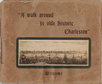
Guide for a walking tour of Charleston, containing a brief history of Charleston; descriptions of each location on the tour; and photographs of notable buildings. Published by Lanneau's Art Store (Charleston, S.C.). [6] p., [24] leaves : ill. ; 27 x 32 cm.
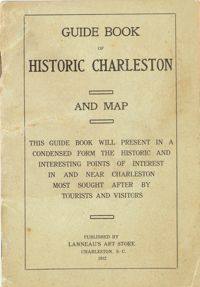
Presents "in a condensed form the historic and interesting points of interest in and near Charleston most sought after by tourists and visitors." Includes "interesting facts about the first churches and congregations; old historic buildings, halls and colleges; historical houses; relics of the old days; queer streets, alleys and lanes; parks, squares, cemeteries." Map of the peninsula includes "a sketch of the resorts and historical points in and around Charleston." Cover title: Guide Book of Historic Charleston and Map. Published by Lanneau's Art Store (Charleston, S.C.). 24 p., 16 cm. + 1 map, 40 x 50 cm. folded to 10 x 14 cm. (Note: paging begins at page 3.)
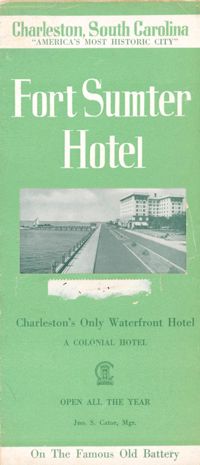
Brochure for the Fort Sumter Hotel [1 King Street]. Includes description and floor plan of the hotel, information about Charleston, and photographs of points of interest. Also includes map showing travel routes to Charleston from Jacksonville, Florida, to New York, New York. "A Colonial Hotel. Jno. S. Cator, Mgr." One sheet : ill., map ; 23 x 41 cm., folded to 23 x 10 cm.
Guidebook to Charleston, containing a history of Charleston; descriptions of many points of interest; street guide; and map featuring ward boundaries and points of interest. Advertisements interspersed throughout. Published by Walker, Evans & Cogswell. 95 p. : ill., fold. map ; 20 cm.
Descriptions of some points of historic interest in and around Charleston, with suggestions on what to see and how to see it. Illustrated with photographs. Published by Walker, Evans & Cogswell. [5] p. derived from two folded sheets (1st sheet 23 x 41 cm. folded to 10 x 23 cm.; 2nd sheet 23 x 81 cm. folded to 23 x 10 cm.).
Travel brochure. Includes brief description of Charleston history, points of interest, hotels, and recreational activities, and a map featuring travel routes to Charleston between Jacksonville, Florida to New York, New York. Designed by Advertising Service Agency and printed by J.J. Furlong & Sons, Charleston, SC. Two sheets : ill., map ; 23 x 41 cm., folded (quartered) to 23 x 10 cm.