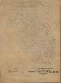
Hand-colored, linen map showing Charleston peninsula heights of buildings from Murray Boulevard to the northern limits of the city at Mount Pleasant Road. Height in stories is indicated by color coding. Map shows buildings of three stories or more. Map measures 42" by 60".
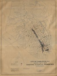
Hand-colored, linen map showing Charleston peninsula existing business properties, public garages, and gasoline service stations from Murray Boulevard to the northern limits of the city at Mount Pleasant Road. Map measures 46.75" by 63".
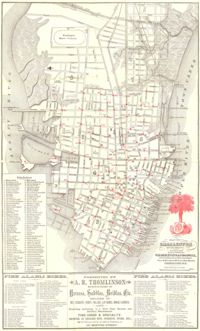
Map of the Charleston peninsula. Revised in 1879; published by Walker, Evans & Cogswell. Features locations of fire alarm boxes and public buildings, with indexes to each. Presented by A.R. Thomlinson, manufacturer of harness, saddles, bridles, etc., located at 137 Meeting Street. Measures 21.875" x 13.625"
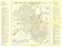
Map of the Charleston peninsula with historic points of interest identified and noted. Includes a welcome to visitors by Mayor Burnet R. Maybank and a map of "The Garden Club Walk" route. "Released by the Office of Port Development." Measures 16" x 22".
Plat of land with rice fields and highlands noted along with the neighboring properties. Very little other detail or explanation given. Names associated with this plat include Carson, Isaac Waight, and Ann Stanyarn.
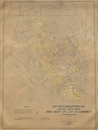
Hand-colored, linen map showing Charleston peninsula lot occupancy from Murray Boulevard to the northern limits of the city at Mount Pleasant Road. Map is color coded to show lot occupancy percentages on the peninsula. Map measures 46.5" x 63".
Farm of 54 across for sale by Rutherford, individual plots lettered A-S. Names associated with this plat are Birkman, Rutledge Phokes, Fitch, Kinsman and Rutherford. Notable geographic locations include Broad Street and Dorchester Road.
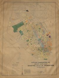
Hand-colored, linen map showing Charleston peninsula existing lot uses from Murray Boulevard to the northern limits of the city at Mount Pleasant Road. Map shows one, two, and multiple dwelling units, service stations, garages, industrial sites, and railroads. Information on map was compiled during field observations made from October through December 1930. Map measures 46.25" by 63."
Linen map showing distribution of schools in Charleston from Murray Boulevard to the northern limits of the city at Mount Pleasant Road. Map shows school district lines, developed and undeveloped school properties and racial population disbursement indicated by white circles for white residents and black circles for black residents. Map is found on page 11 of the Report of the City Planning and Zoning Commission. Map measures 41.25" by 59".