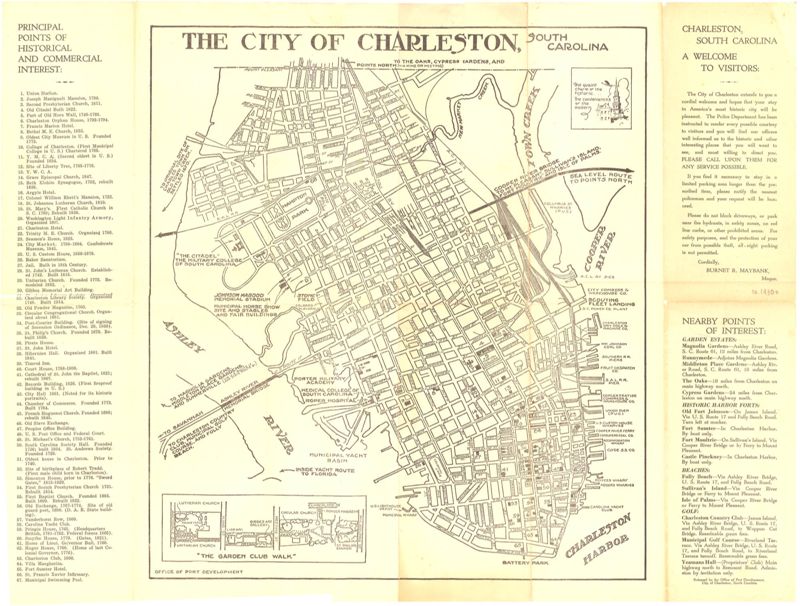
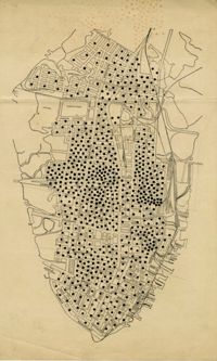
Map of the Charleston peninsula with historic points of interest identified and noted. Includes a welcome to visitors by Mayor Burnet R. Maybank and a map of "The Garden Club Walk" route. "Released by the Office of Port Development." Measures 16" x 22".
300 ppi, 24-bit depth color, HP Scanjet 4890. Archival Masters are tiffs.
Internet Media Type:
image/jpeg
Copyright Status Statement:
Digital image copyright 2010, Historic Charleston Foundation. All rights reserved. For more information contact Margaretta Childs Archives at HCF, P.O. Box 1120, Charleston, SC 29402.