City Engineers's Plat Book, 1671-1951, Page 9
Close Viewer
- Title:
- City Engineers's Plat Book, 1671-1951, Page 9
- Date:
- 1857
- Description:
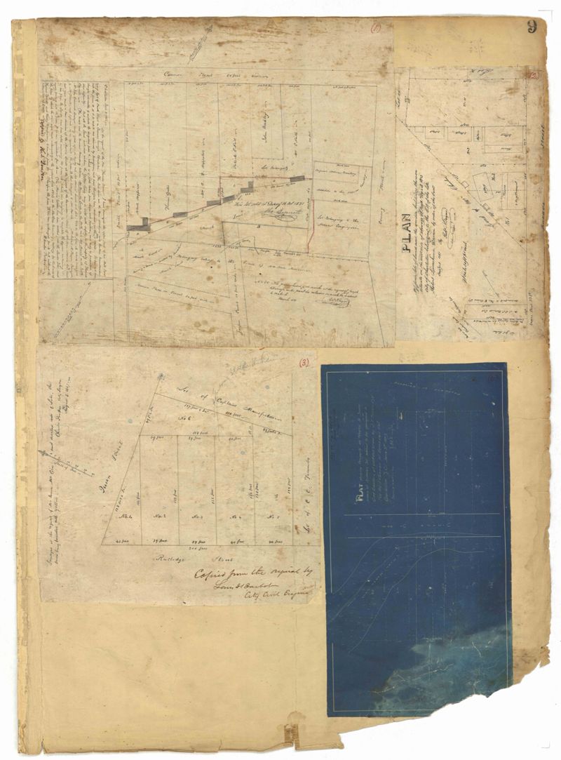
- Page 9 of the City Engineer's Plat Book with four plats. Plat 1 shows lots near the intersection of Cannon Street and Smith Street. Plat 2 features plots of land and buildings located near Savage Street. Plat 3 shows plots of land located near the intersection of Queen Street and Rutledge Street. Plat 4 features lots on Simons Street.
- Collection Title:
- City Engineers's Plat Book, 1671-1951
- Contributing Institution:
- The Charleston Archive at CCPL and City of Charleston
- Media Type:
- Maps
- Personal or Corporate Subject:
- Parker, Charles
Payne, Robert K.
Dingle, J. H. (James Hervey), 1869-1938 - Topical Subject:
- Cadastral maps and Surveys
- Geographic Subject:
- Charleston (S.C.)
- S.C. County:
- Charleston County (S.C.)
- Language:
- English
- Date Digital:
- 2023
- Digitization Specifications:
- 300 dpi, 24-bit depth, color, i2S SupraScan Quartz A0. Archival masters are tiffs.
- Format:
- image/jpeg
- Copyright Status Statement:
- Public domain.
- Access Information:
- This City of Charleston has placed this collection on permanent loan with the Charleston County Public Library. For more information and reuse requirements contact The Charleston Archive at Charleston County Public Library, 68 Calhoun Street, Charleston, SC 29411.
- Admin ID:
- 296544
Permalink