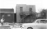
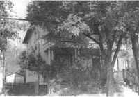
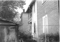
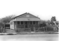
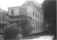
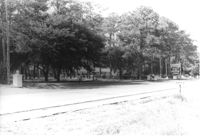
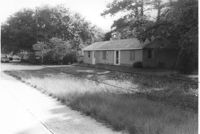
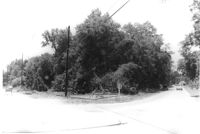
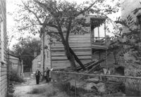
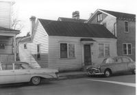
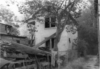
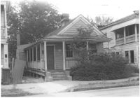
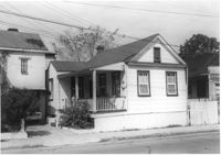
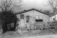
House (side view) on site affected by the construction of the Crosstown. On Cooper Street; address unknown. Surveyor notations on back of photo: "Dkt.: 10.518. Property owner: Louise McLead Drayton. Tract: 30-B. Station: 14+60 Lt. (Cooper Street). 41+70 Rt. (U.S. Rt. 17). Date: Apr. 20, 1965. Partially in R/W." [See collection description for explanation of surveyor notations.]
House, likely on Spruill Avenue, on site affected by the construction of Interstate 26 (I-26). Surveyor notations on back of photo: "Dkt.: 10.490. Property owner: Ernestine M. Taft. Tract: 3. Station: 47+00 (Spruill Ave.). Date: November 4, 1965. Range poles on new R/W. Proximity." [See collection description for explanation of surveyor notations.]
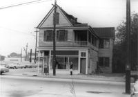
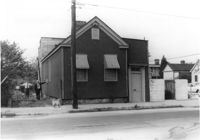
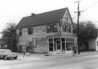
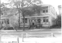
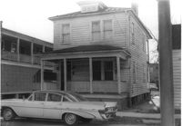
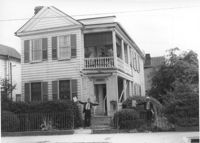
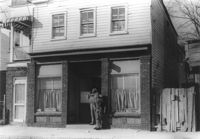
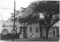
House (side view) on site affected by the construction of Interstate 26 (I-26). Address: 1226 King Street. View of street corner; corner of King Street and Mount Pleasant Street. First story is Sanex Cleaners. Directional sign for St. John Hotel and sign for Coastal Carolina Fair posted on side of building. Surveyor notations on back of photo: "Dkt.: 10.503. Property owner: Mary E. Lea Ward. Tract: 14-B. Station: 11+50 Rt. (Mt. Pleasant St.). Date: Apr. 20, 1965." [See collection description for explanation of surveyor notations.]
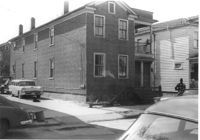
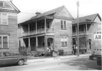
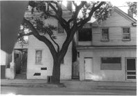
House (rear and side view) on site affected by the construction of Interstate 26 (I-26). Address: 310 St. Philip Street. Surveyor notations on back of photo: "Dkt.: 10.517. Property owner: Benjamin W. Steed. Tract: 131. Station: 20+10 Lt. and Rt. (Line "1"). Date: November 4, 1965. Rear view of residence and lot all in R/W." [See collection description for explanation of surveyor notations.]
House (front and side view) on site affected by the construction of Interstate 26 (I-26). Address: 84 Fishburne Street. Surveyor notations on back of photo: "Dkt.: 10.517. Property owner: Miss Fannie A. Patrick. Tract: 126. Station: 23+50 Rt. (Line "1" survey). Date: November 4, 1965. Side view of building and showing garage in rear, all in R/W. Condemned." [See collection description for explanation of surveyor notations.]
House (side view towards rear) on site affected by the construction of Interstate 26 (I-26). Address: 82 Fishburne Street. Surveyor notations on back of photo: "Dkt.: 10.517. Property owner: Ernest And Mabel Garner. Tract: 125. Station: 23+50 Rt. (Line "1" survey). Date: November 4, 1965. Side view of subject building entirely in R/W. Bought." [See collection description for explanation of surveyor notations.]
House on site affected by the construction of Interstate 26 (I-26). Address: 78 Fishburne Street. Surveyor notations on back of photo: "Dkt.: 10.517. Property owner: Rosetta E. Richardson. Tract: 124. Station: 24+00 Lt. (Line "1" survey). Date: November 4, 1965. Subject building and entire lot entirely in R/W. Bought." [See collection description for explanation of surveyor notations.]
House on site affected by the construction of Interstate 26 (I-26). Address: 5 Carolina Street. Surveyor notations on back of photo: "Dkt.: 10.517. Property owner: I.S. Keith Ellsworth, Sr. Tract: 128. Station: 22+00 Rt. (Line "1"). Date: November 4, 1965. Front and side view of residence and property entirely in R/W." [See collection description for explanation of surveyor notations.]
House (rear) on site affected by the construction of Interstate 26 (I-26). Address: 3 Carolina Street. Surveyor notations on back of photo: "Dkt.: 10.517. Property owner: Benjamin J. Finklea. Tract: 129. Station: 21+65 Rt. (Line "1"). Date: November 4, 1965. Rear view of subject property and building entirely in R/W." [See collection description for explanation of surveyor notations.]
House on site affected by the construction of Interstate 26 (I-26). Address: 3 Carolina Street. Surveyor notations on back of photo: "Dkt.: 10.517. Property owner: Benjamin J. Finklea. Tract: 129. Station: 21+65 Rt. (Line "1"). Date: November 4, 1965. Front view of subject residence entirely in R/W." [See collection description for explanation of surveyor notations.]
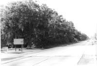
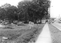
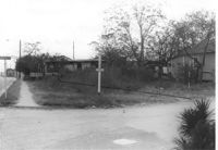
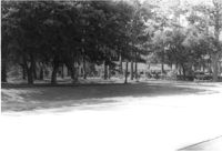
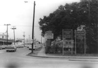
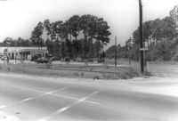
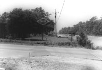
Lot on site affected by the widening of U.S. Route 17. Posted signs for Basha's Garage. Presumably located in Mount Pleasant or vicinity. Surveyor notations on back of photo: "Dkt.: 10.439. Property owner: Bernard H. Bastain, et al. Tract: 23. Station: 247+45 to 248+45 Lt. Date: Jul. 22, 1965. Looking northerly along road from southwest side of property." [See collection description for explanation of surveyor notations.]
Lot on site affected by the widening of U.S. Route 17. Presumably located in Mount Pleasant or vicinity. Surveyor notations on back of photo: "Dkt.: 10.439. Property owner: Anton G. Borosky. Tract: 24. Station: 248+45 to 250+45 Lt. Date: Jul. 22, 1965. Looking north along property." [See collection description for explanation of surveyor notations.]
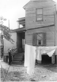
House (rear view), likely on Spruill Avenue, on site affected by the construction of Interstate 26 (I-26). Surveyor notations on back of photo: "Dkt.: 10.490. Property owner: Ernestine M. Taft. Tract: 3. Station: 47+00 (Spruill Ave.). Date: November 4, 1965. Looking north at residence. Proximity." [See collection description for explanation of surveyor notations.]
House, likely on Spruill Avenue, on site affected by the construction of Interstate 26 (I-26). Surveyor notations on back of photo: "Dkt.: 10.490. Property owner: Ellen Hartfield, Estate. Tract: 2. Station: 46+15 Rt. (Spruill Ave.). Date: November 4, 1965. Range poles on new R/W. Proximity." [See collection description for explanation of surveyor notations.]
House, likely on Spruill Avenue, on site affected by the construction of Interstate 26 (I-26). Surveyor notations on back of photo: "Dkt.: 10.490. Property owner: Ernestine M. Taft. Tract: 3. Station: 47+00 (Spruill Ave.). Date: November 4, 1965. Range poles on new R/W. Proximity." [See collection description for explanation of surveyor notations.]
House on site affected by the construction of Interstate 26 (I-26). Address: 1226 King Street. View of street corner; corner of King Street and Mount Pleasant Street. First story is Sanex Cleaners. Surveyor notations on back of photo: "Dkt.: 10.503. Property owner: Mary E. Lea Ward. Tract: 14-B. Station: 11+50 Rt. (Mt. Pleasant St.). Date: Apr. 20, 1965. Partially in R/W." [See collection description for explanation of surveyor notations.]
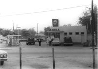
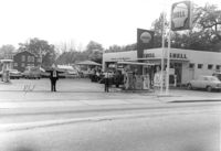
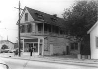
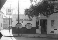
Shell gas station on site affected by the construction of Interstate 26 (I-26). Address: 1227 King Street. Surveyor notations on back of photo: "Dkt.: 10.503. Property owner: Shell Oil Co. Tract: 14-A. Station: 9+50 Rt. (Mt. Pleasant St.). Date: Apr. 20, 1965." [See collection description for explanation of surveyor notations.]
Shell gas station on site affected by the construction of Interstate 26 (I-26). Address: 1227 King Street. Surveyor notations on back of photo: "Dkt.: 10.503. Property owner: Shell Oil Co. Tract: 14-A. Station: 9+50 Rt. (Mt. Pleasant St.). Date: Apr. 20, 1965." [See collection description for explanation of surveyor notations.]
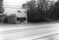
Roadside building and lot on site affected by the widening of U.S. Route 17. Presumably located in Mount Pleasant or vicinity. Surveyor notations on back of photo: "Dkt.: 10.439. Property owner: Morris C. Poulas. Tract: 2. Station: 228+20 Rt. Date: Jul. 22, 1965. Proximity." [See collection description for explanation of surveyor notations.]
Roadside building and lot on site affected by the widening of U.S. Route 17. Presumably located in Mount Pleasant or vicinity. Surveyor notations on back of photo: "Dkt.: 10.439. Property owner: Morris C. Poulas. Tract: 2. Station: 228+20 Rt. Date: Jul. 22, 1965. Proximity." [See collection description for explanation of surveyor notations.]
House (front and side view) on site affected by the construction of Interstate 26 (I-26). Address: 7 Carolina Street. Surveyor notations on back of photo: "Dkt.: 10.517. Property owner: Carrie M. Leaphart. Tract: 127. Station: 22+20 Rt. (Line "1"). Date: November 4, 1965. Side view of building and lot that is entirely in R/W." [See collection description for explanation of surveyor notations.]
House on site affected by the construction of Interstate 26 (I-26). Address: 5 Carolina Street. Surveyor notations on back of photo: "Dkt.: 10.517. Property owner: I.S. Keith Ellsworth, Sr. Tract: 128. Station: 22+00 Rt. (Line "1"). Date: November 4, 1965. View of subject building and lot entirely in R/W." [See collection description for explanation of surveyor notations.]
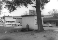
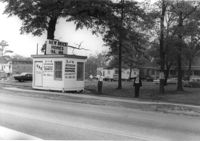
Sign "Opening soon - New 7-11 Food Store," on site affected by the widening of State Road 31 (Reynolds Avenue). Surveyor notations on back of photo: "Dkt.: 10.541. Property owner: Morris P. Sokol, et al. Tract: 1. Station: 2+80 Lt. Date: Apr. 20, 1965. Portion of office building in R/W." [See collection description for explanation of surveyor notations.]
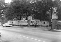
Entrance to Idamor Trailer Park and Apartments, on site affected by the widening of State Road 31 (Reynolds Avenue). Surveyor notations on back of photo: "Dkt.: 10.541. Property owner: Morris P. Sokol, et al. Tract: 1. Station: 3t-4t Lt. Date: Apr. 20, 1965. Taken from southeast side. [See collection description for explanation of surveyor notations.]
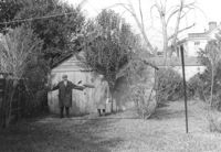
Garage behind house on site affected by the construction of Interstate 26 (I-26). Address: 1 Carolina Street. Surveyor notations on back of photo: "Dkt.: 10.517. Property owner: I.S. Keith Ellsworth, Sr. Tract: 128. Station: 22+50 Rt. (Line "1"). Date: November 4, 1965. Garage entirely in R/W." [See collection description for explanation of surveyor notations.]
House on site affected by the construction of the Crosstown. On Cooper Street; address unknown. Surveyor notations on back of photo: "Dkt.: 10.518. Property owner: Louise McLead Drayton. Tract: 30-B. Station: 14+60 Lt. (Cooper Street). 41+70 Rt. (U.S. Rt. 17). Date: Apr. 20, 1965. Partially in R/W." [See collection description for explanation of surveyor notations.]
Lot on Spruill Avenue at intersection of Hugo Avenue, on site affected by the construction of Interstate 26 (I-26). View of street corner. House in photo 1103 in background. Surveyor notations on back of photo: "Dkt.: 10.490. Property owner: Bunch Realty Co. Tract: 28-D. Station: 48+00 Rt. (Spruill Ave.) Date: November 4, 1965. Take includes entire lot. Range poles on new R/W." [See collection description for explanation of surveyor notations.]
House (corner view) on site affected by the construction of Interstate 26 (I-26). Address: 1226 King Street. View of street corner; corner of King Street and Mount Pleasant Street. First story is Sanex Cleaners. Directional sign for St. John Hotel and sign for Coastal Carolina Fair posted on side of building. Surveyor notations on back of photo: "Dkt.: 10.503. Property owner: Mary E. Lea Ward. Tract: 14-B. Station: 11+50 Rt. (Mt. Pleasant St.). Date: Apr. 20, 1965." [See collection description for explanation of surveyor notations.]
House (corner view) on site affected by the construction of Interstate 26 (I-26). Address: 1226 King Street. View of street corner; corner of King Street and Mount Pleasant Street. First story is Sanex Cleaners. Sign for Coastal Carolina Fair posted on side of building. Surveyor notations on back of photo: "Dkt.: 10.503. Property owner: Mary E. Lea Ward. Tract: 14-B. Station: 11+50 Rt. (Mt. Pleasant St.). Date: Apr. 20, 1965." [See collection description for explanation of surveyor notations.]
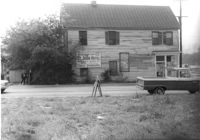
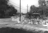
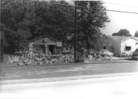
Roadside gift shop on site affected by the widening of U.S. Route 17. Lots of statuary on lot in front of structure. Presumably located in Mount Pleasant or vicinity. Surveyor notations on back of photo: "Dkt.: 10.439. Property owner: Adolph Benton, et al. Tract: 8. Station: 236+45 Rt. Date: Jul. 22, 1965. Range poles on 33' & 50' R/W - Cond." [See collection description for explanation of surveyor notations.]
Roadside gift shop on site affected by the widening of U.S. Route 17. Lots of statuary on lot in front of structure. Presumably located in Mount Pleasant or vicinity. Surveyor notations on back of photo: "Dkt.: 10.439. Property owner: Adolph Benton, et al. Tract: 8. Station: 236+45 Rt. Date: Jul. 22, 1965. Range poles on 33' & 50' R/W - Cond." [See collection description for explanation of surveyor notations.]
Lot and house on site affected by the widening of U.S. Route 17. Presumably located in Mount Pleasant or vicinity. Surveyor notations on back of photo: "Dkt.: 10.439. Property owner: W.G. Benton, et al. Tract: 7. Station: 234±00 Rt. Date: Jul. 22, 1965. Range poles on 33' & 50' R/W - Cond." [See collection description for explanation of surveyor notations.]
House on site affected by the construction of Interstate 26 (I-26). Address: 7 Carolina Street. Surveyor notations on back of photo: "Dkt.: 10.517. Property owner: Carrie M. Leaphart. Tract: 127. Station: 22+20 Rt. (Line "1" survey). Date: November 4, 1965. Front view of residence. Entire building and lot in R/W." [See collection description for explanation of surveyor notations.]
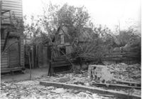
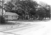
Lot and outbuildings on site affected by the construction of the Crosstown. On Cooper Street; address unknown. Surveyor notations on back of photo: "Dkt.: 10.518. Property owner: Louise McLead Drayton. Tract: 30-B. Station: 14+60 Lt. (Cooper Street). 41+70 Rt. (U.S. Rt. 17). Date: Apr. 20, 1965. Partially in R/W." [See collection description for explanation of surveyor notations.]
Rear view of structure with advertisement for "New Brick Homes," on site affected by the widening of State Road 31 (Reynolds Avenue). Surveyor notations on back of photo: "Dkt.: 10.541. Property owner: Morris P. Sokol, et al. Tract: 1. Station: 2+80 Lt. Date: Apr. 20, 1965." [See collection description for explanation of surveyor notations.]
Small structure with advertisement for "New Brick Homes," on site affected by the widening of State Road 31 (Reynolds Avenue). Surveyor notations on back of photo: "Dkt.: 10.541. Property owner: Morris P. Sokol, et al. Tract: 1. Station: 2+80 Lt. Date: Apr. 20, 1965." [See collection description for explanation of surveyor notations.]
Site affected by the widening of State Road 31 (Reynolds Avenue). Surveyor notations on back of photo: "Dkt.: 10.541. Property owner: Morris P. Sokol, et al. Tract: 1. Station: 2+80 Lt. Date: Apr. 20, 1965." [See collection description for explanation of surveyor notations.]
Roadside gift shop on site affected by the widening of U.S. Route 17. Lots of statuary on lot in front of structure. Presumably located in Mount Pleasant or vicinity. Surveyor notations on back of photo: "Dkt.: 10.439. Property owner: Adolph Benton, et al. Tract: 8. Station: 236+00 Rt. Date: Jul. 22, 1965. Range poles on 33' & 50' R/W - Cond." [See collection description for explanation of surveyor notations.]
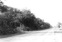
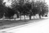
Lot and house (obscured by trees) on site affected by the widening of U.S. Route 17. Presumably located in Mount Pleasant or vicinity. Surveyor notations on back of photo: "Dkt.: 10.439. Property owner: Adolph Benton, et al. Tract: 8. Station: 234+73 to 236+73 Rt. Date: Jul. 22, 1965. Range poles on 33' & 50' R/W - Cond." [See collection description for explanation of surveyor notations.]
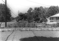
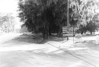
House (barely visible) and lot on site affected by the widening of U.S. Route 17. Presumably located in Mount Pleasant or vicinity. Surveyor notations on back of photo: "Dkt.: 10.439. Property owner: Willard B. Causey. Tract: 5. Station: 231+85 Rt. Date: Jul. 22, 1965. Proximity." [See collection description for explanation of surveyor notations.]
Lot on site affected by the widening of U.S. Route 17. Posted sign says: Speed checked by radar. Presumably located in Mount Pleasant or vicinity. Surveyor notations on back of photo: "Dkt.: 10.439. Property owner: Francis F. Coleman, et al. Tract: 13. Station: 243+73 to 247+33 Rt. Date: Jul. 22, 1965. Taken from Rt. 17 - west side of property showing along front." [See collection description for explanation of surveyor notations.]
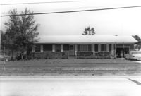
Mt. Pleasant Motel, on site affected by the widening of U.S. Route 17. Presumably located in Mount Pleasant or vicinity. Surveyor notations on back of photo: "Dkt.: 10.439. Property owner: George A. Kaiser, et al. Tract: 16. Station: 225+51 to 228+52 Lt. Date: Jul. 22, 1965. Looking from across road at range poles on 50' R/W." [See collection description for explanation of surveyor notations.]
House on site affected by the widening of U.S. Route 17. Presumably located in Mount Pleasant or vicinity. Surveyor notations on back of photo: "Dkt.: 10.439. Property owner: Adolph Benton, et al. Tract: 8. Station: 235+20 Rt. Date: Jul. 22, 1965. Range poles on 33' & 50' R/W - Cond." [See collection description for explanation of surveyor notations.]
House on site affected by the widening of U.S. Route 17. Presumably located in Mount Pleasant or vicinity. Surveyor notations on back of photo: "Dkt.: 10.439. Property owner: W.G. Benton, et al. Tract: 7. Station: 234±15 Rt. Date: Jul. 22, 1965. Range poles on 33' & 50' R/W - Cond." [See collection description for explanation of surveyor notations.]
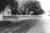
Lot and building (Basha's Garage) on site affected by the widening of U.S. Route 17. Posted signs for Basha's Garage. Presumably located in Mount Pleasant or vicinity. Surveyor notations on back of photo: "Dkt.: 10.439. Property owner: Ernest P. Basha, et al. Tract: 22-A. Station: 246+94 Lt. Date: Jul. 22, 1965. Proximity." [See collection description for explanation of surveyor notations.]
Mt. Pleasant Motel, on site affected by the widening of U.S. Route 17. Presumably located in Mount Pleasant or vicinity. Surveyor notations on back of photo: "Dkt.: 10.439. Property owner: George A. Kaiser, et al. Tract: 16. Station: 225+51 to 228+52 Lt. Date: Jul. 22, 1965. Range poles on 50' R/W. Face of brick columns on 33' R/W - Cond." [See collection description for explanation of surveyor notations.]
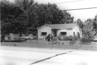
Houses on site affected by the widening of U.S. Route 17. Presumably located in Mount Pleasant or vicinity. Surveyor notations on back of photo: "Dkt.: 10.439. Property owner: Doretha B. Chavis. Tract: 15. Station: 225+00 Lt. Date: Jul. 22, 1965. Proximity." [See collection description for explanation of surveyor notations.]
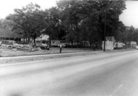
Corner view of Idamor Trailer Park and Apartments, with signage for Commissary Store - Navy Exchange Country Store and for E.M. Club - Eliza Lucas Hall, on site affected by the widening of State Road 31 (Reynolds Avenue). Surveyor notations on back of photo: "Dkt.: 10.541. Property owner: Morris P. Sokol, et al. Tract: 1. Station: 4+8 Lt. Date: Apr. 20, 1965." [See collection description for explanation of surveyor notations.]
House, likely on Spruill Avenue, on site affected by the construction of Interstate 26 (I-26). Surveyor notations on back of photo: "Dkt.: 10.490. Property owner: Ellen Hartfield, Estate. Tract: 2. Station: 46+15 Rt. (Spruill Ave.). Date: November 4, 1965. Side view of subject property. Range poles on new R/W. Proximity." [See collection description for explanation of surveyor notations.]
House on Spruill Avenue on site affected by the construction of Interstate 26 (I-26). Surveyor notations on back of photo: "Dkt.: 10.490. Property owner: Julia M. Pritchard. Tract: 28-B. Station: 48+80 Rt. (Spruill Ave.) Date: November 4, 1965. South side of residence that is partially in R/W. Range poles on new R/W." [See collection description for explanation of surveyor notations.]
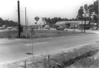
Esso Service Station: at intersection of Orange Grove Road and SC Highway 7 (Sam Rittenberg Boulevard), on site affected by the widening of Routes 7 & 171. Surveyor notations on back of photo: "Dkt.: 10.551. Property owner: Humble Oil Co. Tract: 1. Station: 36±00 Rt. Date: Jul. 22, 1965. West from east side Orange Grove Rd. of range poles on corners of ? area. [See collection description for explanation of surveyor notations.]
Esso Service Station: at intersection of Orange Grove Road and SC Highway 7 (Sam Rittenberg), on site affected by the widening of Routes 7 & 171. Surveyor notations on back of photo: "Dkt.: 10.551. Property owner: Humble Oil Co. Tract: 1. Station: 36±00 Rt. Date: Jul. 22, 1965. Taken from intersection of Orange Grove Rd. and Rte. 7 & 171. [See collection description for explanation of surveyor notations.]
Ashley Lanes (bowling alley), on site affected by the widening of Routes 7 & 171. Surveyor notations on back of photo: "Dkt.: 10.551. Property owner: Ashley Lanes, Inc. Tract: 3. Station: 128±00 Lt. Date: Jul. 22, 1965. Looking SE from Ashley Hall Road and Rt. 7 intersection, at range poles on corners of ? area. [See collection description for explanation of surveyor notations.]
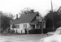
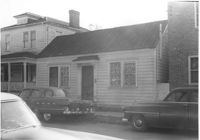
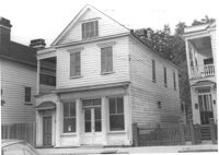
House on site by the construction of Interstate 26 (I-26). Address: 35 Mount Pleasant Street. Corner view from railroad tracks at Mount Pleasant Street. Surveyor notations on back of photo: "Dkt.: 10.503. Property owner: Henry Fritz. Tract: 14-C. Station: 12+10 Rt. (Mt. Pleasant St.). Date: Apr. 20, 1965." [See collection description for explanation of surveyor notations.]
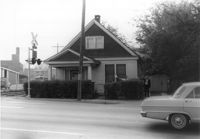
House on site by the construction of Interstate 26 (I-26). Address; 35 Mount Pleasant Street. Number 7 on porch column. At corner of railroad tracks and Mount Pleasant Street. Surveyor notations on back of photo: "Dkt.: 10.503. Property owner: Henry Fritz. Tract: 14-C. Station: 12+10 Rt. (Mt. Pleasant St.). Date: Apr. 20, 1965." [See collection description for explanation of surveyor notations.]
Lot and building (Basha's Garage) on site affected by the widening of U.S. Route 17. Posted signs for Basha's Garage. Presumably located in Mount Pleasant or vicinity. Surveyor notations on back of photo: "Dkt.: 10.439. Property owner: Ernest P. Basha, et al. Tract: 22-A. Station: 246+94 Lt. Date: Jul. 22, 1965. Looking from west at range poles on 33' & 50' R/W with trees in R/W." [See collection description for explanation of surveyor notations.]
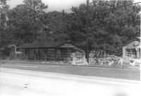
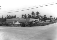
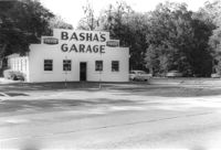
Basha's Garage on site affected by the widening of U.S. Route 17. Building facade has stepped parapet. Presumably located in Mount Pleasant or vicinity. Surveyor notations on back of photo: "Dkt.: 10.439. Property owner: Ernest P. Basha, et al. Tract: 22-A. Station: 246+94 Lt. Date: Jul. 22, 1965. Proximity." [See collection description for explanation of surveyor notations.]
Lot and building on site affected by the widening of U.S. Route 17. Billboard for Busch Bavarian [beer] in background. Presumably located in Mount Pleasant or vicinity. Surveyor notations on back of photo: "Dkt.: 10.439. Property owner: Marie Basha. Tract: 22. Station: 245+45 to 246+45 Lt. Date: Jul. 22, 1965. Range poles on pres. & 50'R/W. Trees in R/W." [See collection description for explanation of surveyor notations.]
Lot on site affected by the widening of U.S. Route 17. Posted signs for Champion Spark Plugs and Goodyear Tires. Presumably located in Mount Pleasant or vicinity. Surveyor notations on back of photo: "Dkt.: 10.439. Property owner: Marie Basha. Tract: 22. Station: 245+45 to 246+45 Lt. Date: Jul. 22, 1965. Range poles on 33' & 50' R/W. Trees in R/W." [See collection description for explanation of surveyor notations.]
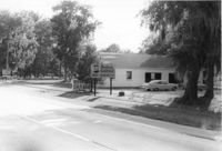
Structure on site affected by the widening of U.S. Route 17. Signs for Armstrong Tires and Charleston Tire Company in background. Presumably located in Mount Pleasant or vicinity. Surveyor notations on back of photo: "Dkt.: 10.439. Property owner: Joseph M. Bustos. Tract: 21. Station: 243+82 Lt. Date: Jul. 22, 1965. Proximity." [See collection description for explanation of surveyor notations.]
Structure on site affected by the widening of U.S. Route 17. Sign for Armstrong Tires. Presumably located in Mount Pleasant or vicinity. Surveyor notations on back of photo: "Dkt.: 10.439. Property owner: Joseph M. Bustos. Tract: 21. Station: 243+82 Lt. Date: Jul. 22, 1965. Proximity." [See collection description for explanation of surveyor notations.]
House (side view) on site affected by the construction of the Crosstown. On Cooper Street; address unknown. Surveyor notations on back of photo: "Dkt.: 10.518. Property owner: Louise McLead Drayton. Tract: 30-B. Station: 14+60 Lt. (Cooper Street). 41+70 Rt. (U.S. Rt. 17). Date: Apr. 20, 1965. Partially in R/W." [See collection description for explanation of surveyor notations.]
House (side view) on site affected by the construction of the Crosstown. On Cooper Street; address unknown. Surveyor notations on back of photo: "Dkt.: 10.518. Property owner: Louise McLead Drayton. Tract: 30-B. Station: 14+60 Lt. (Cooper Street). 41+70 Rt. (U.S. Rt. 17). Date: Apr. 20, 1965. Partially in R/W." [See collection description for explanation of surveyor notations.]
Site affected by the widening of Routes 7 & 171. Surveyor notations on back of photo: "Dkt.: 10.551. Property owner: Lucille S. Dwight. Tract: 2. Station: 120±00 Lt. Date: Jul. 22, 1965. Looking west from Rd. S-80 of range poles on corners of ? area. [See collection description for explanation of surveyor notations.]
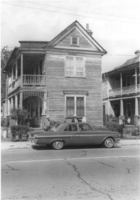
House (rear) on site affected by the construction of Interstate 26 (I-26). Address: 691 King Street. Surveyor notations on back of photo: "Dkt.: 10.517. Property owner: Henry Deas Jr., et al. Tract: 133. Station: 18+60 Rt. (Line "1"). Date: November 4, 1965. Rear view of subject residence. Not in R/W. Range poles on new R/W." [See collection description for explanation of surveyor notations.]
House (corner view, rear) on site affected by the construction of Interstate 26 (I-26). Address: 693 King Street. Surveyor notations on back of photo: "Dkt.: 10.517. Property owner: Rose Sokol. Tract: 132. Station: 19+85 Lt. and Rt. (Line "1"). Date: November 4, 1965. Rear view of residence. Complete lot and building in R/W." [See collection description for explanation of surveyor notations.]
House on site affected by the construction of Interstate 26 (I-26). Address: 310 St. Philip Street. Surveyor notations on back of photo: "Dkt.: 10.517. Property owner: Benjamin W. Steed. Tract: 131. Station: 20+65 Lt. and Rt. (Line "1"). Date: November 4, 1965. Front view of subject residence and lot, all in R/W." [See collection description for explanation of surveyor notations.]
House on site affected by the construction of Interstate 26 (I-26). Address: 691 King Street. Surveyor notations on back of photo: "Dkt.: 10.517. Property owner: Henry Deas Jr., et al. Tract: 133. Station: 18+60 Rt. (Line "1"). Date: November 4, 1965. Front view of subject residence showing portion in R/W. Range poles on new R/W." [See collection description for explanation of surveyor notations.]
Orkin Pest Control - Termite Control, corner of Ashley Hall Road and Route 7 (Sam Rittenberg Boulevard), on site affected by the widening of Routes 7 & 171. Surveyor notations on back of photo: "Dkt.: 10.551. Property owner: Atlantic Investment & Development Co. Tract: 4. Station: 127±00 Rt. Date: Jul. 22, 1965. Same as Photo 5, view from across Ashley Hall Rd. looking north. [See collection description for explanation of surveyor notations.]
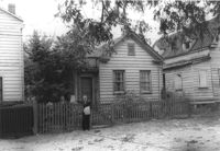
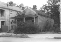
House (freedman's cottage) on site affected by the construction of the Crosstown. Address: 72 Kracke Street [note: 29 Kracke Street today]. Surveyor notations on back of photo: "Dkt.: 10.524. Property owner: Carlotta Alston. Tract: 67. Station: 76+45 Lt. Date: Oct. 14, 1964. Proximity." [See collection description for explanation of surveyor notations.]
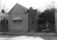
Structure on site affected by the construction of the Crosstown. Address: 122 Sheppard Street. Surveyor notations on back of photo: "Dkt.: 10.524. Property owner: Archie B. Hollins. Tract: 136. Station: 17+40 Lt. S.B. lane. Date: Dec. 2, 1964. Outside R/W." [See collection description for explanation of surveyor notations.]
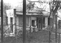
Rear view of house on site affected by the construction of the Crosstown. Address: 5 Rosemont Street. Backyard strewn with wood boards, etc. Surveyor notations on back of photo: "Dkt.: 10.524. Property owner: Harold I. Sherman. Tract: 53. Station: 71+20 Rt. Date: Oct. 14, 1964. Portion in R/W already torn down by property owner." [See collection description for explanation of surveyor notations.]
House (freedman's cottage) on site affected by the construction of the Crosstown. Address: 118 Bogard Street. Surveyor notations on back of photo: "Dkt.: 10.524. Property owner: Marion Holmes Wright, Est., et al. Tract: 62. Station: 75+10 CL Lt. Date: Oct. 14, 1964. Partially in R/W." [See collection description for explanation of surveyor notations.]
House on Sheppard Street (rear view) on site affected by the construction of the Crosstown. Address: 137 Sheppard Street. Surveyor notations on back of photo: "Dkt.: 10.524. Property owner: Frank Williams. Tract: 126. Station: 89+40 Lt. Date: Dec. 2, 1964. In R/W - Bought." [See collection description for explanation of surveyor notations.]
House on Sheppard Street on site affected by the construction of the Crosstown. Address: 135 Sheppard Street. Surveyor notations on back of photo: "Dkt.: 10.524. Property owner: William Delestine, et al. Tract: 127. Station: 89+80 CL. Date: Dec. 2, 1964. In R/W - Bought." [See collection description for explanation of surveyor notations.]
House on site affected by the construction of the Crosstown. Address: 139 Sheppard Street. Surveyor notations on back of photo: "Dkt.: 10.524. Property owner: Wilmot J. Frasier. Tract: 125. Station: 89+15 Lt. Date: Dec. 2, 1964. In R/W - Bought." [See collection description for explanation of surveyor notations.]
House on site affected by the construction of the Crosstown. Address: 139 Sheppard Street. Surveyor notations on back of photo: "Dkt.: 10.524. Property owner: Wilmot J. Frasier. Tract: 125. Station: 89+15 Lt. Date: Dec. 2, 1964. In R/W - Bought." [See collection description for explanation of surveyor notations.]
House on Sheppard Street on site affected by the construction of the Crosstown. Address: 137 Sheppard Street. Surveyor notations on back of photo: "Dkt.: 10.524. Property owner: Frank Williams. Tract: 126. Station: 89+40 Lt. Date: Dec. 2, 1964. In R/W - Bought." [See collection description for explanation of surveyor notations.]
House on site affected by the construction of the Crosstown. Address: 163 Line Street. (Possibly a freedman's cottage with altered entry and porch.) Surveyor notations on back of photo: "Dkt.: 10.524. Property owner: Lucille Beall. Tract: 93. Station: 81+50 CL. Date: Dec. 1, 1964. In R/W - Bought." [See collection description for explanation of surveyor notations.]
Rear view of house on site affected by the construction of the Crosstown. Address: 5 Rosemont Street (rear). Backyard strewn with wood boards, etc. Surveyor notations on back of photo: "Dkt.: 10.524. Property owner: Harold I. Sherman. Tract: 53. Station: 71+70 Rt. Date: Oct. 14, 1964. In R/W - Bought." [See collection description for explanation of surveyor notations.]
House (rear view) on site affected by the construction of the Crosstown. Address: 152-150 Line Street. Surveyor notations on back of photo: "Dkt.: 10.524. Property owner: John N. Peeksen. Tract: 117. Station: 86+70 Rt. Date: Dec. 1, 1964. In R/W." [See collection description for explanation of surveyor notations.]
House on site affected by the construction of the Crosstown. Address: 195 Spring Street. Surveyor notations on back of photo: "Dkt.: 10.524. Property owner: Charlotte M. and John Pembroke. Tract: 12. Station: 23+40 Rt. (Spring Street). Date: Oct. 13, 1964. Steps to be removed by property owner; wrought iron fence bought." [See collection description for explanation of surveyor notations.]
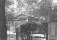
Shed and backyard on site affected by the construction of the Crosstown. Address: 112 Sheppard Street. Surveyor notations on back of photo: "Dkt.: 10.524. Property owner: Alston O. Crum, Est. Tract: 146. Station: 19+60 Lt. S.B. lane. Date: Dec. 2, 1964. Proximity." [See collection description for explanation of surveyor notations.]
House (freedman's cottage) on site affected by the construction of the Crosstown. Address: 149 President Street. Surveyor notations on back of photo: "Dkt.: 10.524. Property owner: Mamie B. Motte. Tract: 32. Station: 67+90 Rt. Date: Oct. 13, 1964. In R/W - Bought." [See collection description for explanation of surveyor notations.]
House (freedman's cottage) on site affected by the construction of the Crosstown. Address: 149 President Street. Surveyor notations on back of photo: "Dkt.: 10.524. Property owner: Mamie B. Motte. Tract: 32. Station: 67+90 Rt. Date: Oct. 13, 1964. In R/W - Bought." [See collection description for explanation of surveyor notations.]
House (rear view) on site affected by the construction of the Crosstown. Address: 22 Wescott Street. Surveyor notations on back of photo: "Dkt.: 10.524. Property owner: Ida J. Gantt. Tract: 10. Station: 61+20 Lt. Date: Oct. 13, 1964. Portion in R/W to be removed by property owner." [See collection description for explanation of surveyor notations.]
House (rear view) on site affected by the construction of the Crosstown. Address: 11 Presidents Place. Surveyor notations on back of photo: "Dkt.: 10.524. Property owner: Lucille Smalls. Tract: 9. Station: 63+10 Rt. Date: Oct. 13, 1964. In R/W - Bought." [See collection description for explanation of surveyor notations.]
House on site affected by the construction of the Crosstown. Address: 162 Cannon Street. Surveyor notations on back of photo: "Dkt.: 10.524. Property owner: Willie Williams. Tract: 4. Station: 61+15 Rt. Date: Oct. 13, 1964. In R/W - Bought." [See collection description for explanation of surveyor notations.]
House on site affected by the construction of the Crosstown. Address: 162 Cannon Street. Surveyor notations on back of photo: "Dkt.: 10.524. Property owner: Willie Williams. Tract: 4. Station: 61+15 Rt. Date: Oct. 13, 1964. In R/W - Bought." [See collection description for explanation of surveyor notations.]
House on site affected by the construction of the Crosstown. Address: 166 Cannon Street. Surveyor notations on back of photo: "Dkt.: 10.524. Property owner: Andrew J. McGuinness, Est. Tract: 1. Station: 59+60 Lt. Date: Oct. 13, 1964. Proximity." [See collection description for explanation of surveyor notations.]
House on site affected by the construction of the Crosstown. Address: 164 Cannon Street. Surveyor notations on back of photo: "Dkt.: 10.524. Property owner: Leola G. McKelvin. Tract: 2. Station: 60+00 Lt. Date: Oct. 13, 1964. Proximity." [See collection description for explanation of surveyor notations.]
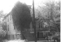
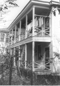
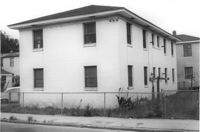
Rear view of apartment building on site affected by the construction of the Crosstown. Address: 123 Bogard Street. Surveyor notations on back of photo: "Dkt.: 10.524. Property owner: Henry W. Smith. Tract: 48. Station: 73+10 CL. Date: Oct. 14, 1964. In R/W - Bought." [See collection description for explanation of surveyor notations.]
House on site affected by the construction of the Crosstown. Address: 158 Line Street. First story appears to be a store (or office) front. Signs for W.L. Metz, Jr. and H.L. Davis in window. Surveyor notations on back of photo: "Dkt.: 10.524. Property owner: William A. Williams. Tract: 102. Station: 83+70 CL. Date: Dec. 1, 1964. In R/W - Bought. [See collection description for explanation of surveyor notations.]
House on site affected by the construction of the Crosstown. Address: 182 Spring Street. First floor appears to have been a store. Surveyor notations on back of photo: "Dkt.: 10.524. Property owner: A.J.R. Kornahrens. Tract: 27. Station: 65+75 Rt. Date: Oct. 13, 1964. In R/W - Bought." [See collection description for explanation of surveyor notations.]
House (and neighboring house) on site affected by the construction of the Crosstown. Address: 495 Rutledge Avenue. Surveyor notations on back of photo: "Dkt.: 10.524. Property owner: Elise C. Goldberg, et al. Tract: 105. Station: 84+15 Rt. Date: Dec. 1, 1964. In R/W - Bought." [See collection description for explanation of surveyor notations.]
House and driveway on site affected by the construction of the Crosstown. Address: 6 Norman Street. Surveyor notations on back of photo: "Dkt.: 10.524. Property owner: Julia Williams Glover. Tract: 22. Station: 67+00 Lt. Date: Oct. 13, 1964. In R/W - Bought." [See collection description for explanation of surveyor notations.]
House on site affected by the construction of the Crosstown. Address: 10 Kennedy Street. Surveyor notations on back of photo: "Dkt.: 10.524. Property owner: Lucille Beall. Tract: 93. Station: 81+50 CL. Date: Dec. 1, 1964. In R/W - Bought." [See collection description for explanation of surveyor notations.]
Carl's House on site affected by the construction of the Crosstown. Address: 493 Rutledge Avenue. View of street corner. Neighboring house in photo. Surveyor notations on back of photo: "Dkt.: 10.524. Property owner: Elise C. Goldberg, et al. Tract: 105. Station: 84+40 Rt. Date: Dec. 1, 1964. In R/W - Bought." [See collection description for explanation of surveyor notations.]
House and neighboring houses on site affected by the construction of the Crosstown. Address: 495 Rutledge Avenue and 497 Rutledge Avenue. Surveyor notations on back of photo: "Dkt.: 10.524. Property owner: Elise C. Goldberg, et al. Tract: 105. Station: 84+15 Rt. Date: Dec. 1, 1964. In R/W - Bought." [See collection description for explanation of surveyor notations.]
House (rear view) on Sheppard Street on site affected by the construction of the Crosstown. Address: 131 Sheppard Street. Surveyor notations on back of photo: "Dkt.: 10.524. Property owner: William Delestine, et al. Tract: 127. Station: 89+80 CL. Date: Dec. 2, 1964. In R/W - Bought." [See collection description for explanation of surveyor notations.]