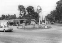
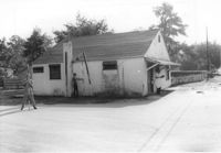
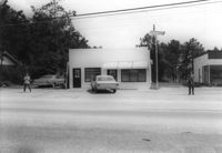
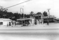
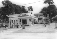
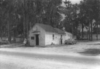
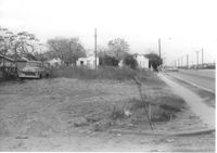
Gulf gas Station [Berkeley Gulf Service], on site affected by the widening of State Road 13 (Remount Road), with directional signs for Yeaman's Hall and Hanahan Baptist Church. Surveyor notations on back of photo: "Dkt.: 10.562. Property owner: C.D. Hoffecker Estate. Tract: 24. Date: Jul. 12, 1967." [See collection description for explanation of surveyor notations.]
Kayo gas station, on site affected by the widening of State Road 13 (Remount Road). Surveyor notations on back of photo: "Dkt.: 10.562. Property owner: S.R. Hill - K.O. Station. Tract: 66. Date: Jul. 19, 1967." [See collection description for explanation of surveyor notations.]
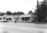
Bowers Hardware, on site affected by the widening of State Road 13 (Remount Road). Surveyor notations on back of photo: "Dkt.: 10.562. Property owner: J.R. Herrin. Tract: 82. Date: Jul. 19, 1967." [See collection description for explanation of surveyor notations.]
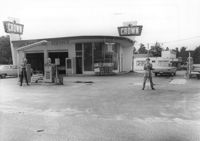
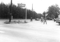
Crown gas station, on site affected by the widening of State Road 13 (Remount Road). Possibly the corner of North Rhett Avenue and Remount Road. Surveyor notations on back of photo: "Dkt.: 10.562. Property owner: Corco Realty Co. (Crown). Tract: 142. Date: Jul. 19, 1967." [See collection description for explanation of surveyor notations.]
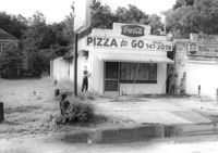
Little Italy pizza restaurant, next door to Remount Repair & Salvage, on site affected by the widening of State Road 13 (Remount Road). Surveyor notations on back of photo: "Dkt.: 10.562. Property owner: George Constantino. Tract: 116. Date: Jul. 19, 1967." [See collection description for explanation of surveyor notations.]
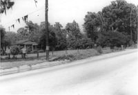
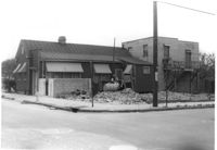
Building on site affected by the widening of State Road 13 (Remount Road). Corner view of building in State Road 13 Photo 34, corner of S-10-798 and Remount Road. View of street corner. Sign for the A&P across the street. Surveyor notations on back of photo: "Dkt.: 10.562. Property owner: Fannie Lou Owens. Tract: 32. Date: Jul. 12, 1967." [See collection description for explanation of surveyor notations.]
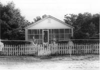
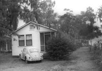
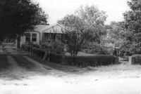
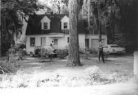
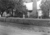
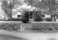
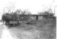
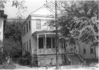
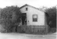
House on site affected by the widening of State Road 13 (Remount Road). (1488 Remount Road.) Surveyor notations on back of photo: "Dkt.: 10.562. Property owner: Mrs. J.L. McFadyen. Tract: 69. Date: Jul. 19, 1967." [See collection description for explanation of surveyor notations.]
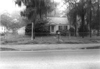
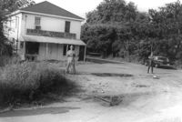
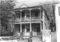
House on site affected by the widening of State Road 13 (Remount Road). Surveyor notations on back of photo: "Dkt.: 10.562. Property owner: Charles R. Roberson. Tract: 36. Date: Jul. 19, 1967." [See collection description for explanation of surveyor notations.]
House on site affected by the widening of State Road 13 (Remount Road). Surveyor notations on back of photo: "Dkt.: 10.562. Property owner: Charles R. Roberson. Tract: 36-A. Date: Jul. 19, 1967." [See collection description for explanation of surveyor notations.]
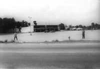
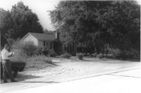
Site affected by the widening of State Road 13 (Remount Road). A&P barely visible in background. Surveyor notations on back of photo: "Dkt.: 10.562. Property owner: E.H. Eickmeyer. Tract: 35. Date: Jul. 19, 1967." [See collection description for explanation of surveyor notations.]
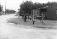
10-Mile News, on site affected by the widening of State Road 13 (Remount Road). Trailer park in background. Surveyor notations on back of photo: "Dkt.: 10.562. Property owner: Edna M. Tant. Tract: 5. Date: Jul. 12, 1967." [See collection description for explanation of surveyor notations.]
House on site affected by the widening of State Road 13 (Remount Road). Surveyor notations on back of photo: "Dkt.: 10.562. Property owner: Joseph W. Cooper. Tract: 9. Date: Jul. 12, 1967." [See collection description for explanation of surveyor notations.]
House on site affected by the widening of State Road 12 (Remount Road). Surveyor notations on back of photo: "Dkt.: 10.562. Property owner: Joseph W. Cooper. Tract: 9. Date: Jul. 12, 1967." [See collection description for explanation of surveyor notations.]
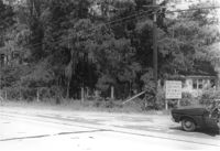
Site affected by the widening of State Road 13 (Remount Road). Esso gas Station: in background. Surveyor notations on back of photo: "Dkt.: 10.562. Property owner: Edna M. Tant. Tract: 5. Date: Jul. 12, 1967." [See collection description for explanation of surveyor notations.]
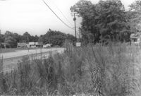
Gulf gas station, on site affected by the widening of State Road 13 (Remount Road). Arrow Restaurant and Trucker's Billiard Academy across the street. Surveyor notations on back of photo: "Dkt.: 10.562. Property owner: E.R. Gassman. Tract: 1. Date: Jul. 12, 1967." [See collection description for explanation of surveyor notations.]
Shell gas station, on site affected by the widening of State Road 13 (Remount Road). Arrow Restaurant in background. Surveyor notations on back of photo: "Dkt.: 10.562. Property owner: Shell Oil Co., Inc. Tract: 2. Date: Jul. 12, 1967." [See collection description for explanation of surveyor notations.]
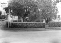
House on site affected by the widening of State Road 13 (Remount Road). View of street corner. Corner of Hardy Avenue and Remount Road. Directional sign for The Taxidermy House. Surveyor notations on back of photo: "Dkt.: 10.562. Property owner: Harry R. Parkinson, et al. Tract: 61. Date: Jul. 19, 1967." [See collection description for explanation of surveyor notations.]
House on site affected by the widening of State Road 13 (Remount Road). Surveyor notations on back of photo: "Dkt.: 10.562. Property owner: Mrs. J.L. McFadyen. Tract: 69. Date: Jul. 19, 1967." [See collection description for explanation of surveyor notations.]
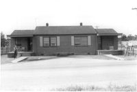
House on site affected by the widening of State Road 13 (Remount Road). Surveyor notations on back of photo: "Dkt.: 10.562. Property owner: William M. Nelson. Tract: 111. Date: Jul. 19, 1967." [See collection description for explanation of surveyor notations.]
House on site affected by the widening of State Road 13 (Remount Road). Surveyor notations on back of photo: "Dkt.: 10.562. Property owner: Lolie Driggers. Tract: 80. Date: Jul. 19, 1967." [See collection description for explanation of surveyor notations.]
House on site affected by the widening of State Road 13 (Remount Road). Surveyor notations on back of photo: "Dkt.: 10.562. Property owner: Melbry Grimes. Tract: 91. Date: Jul. 19, 1967." [See collection description for explanation of surveyor notations.]
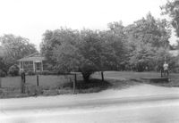
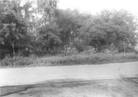
Site affected by the widening of State Road 13 (Remount Road). Surveyor notations on back of photo: "Dkt.: 10.562. Property owner: Elizabeth Gilmoor. Tract: 107. Date: Jul. 19, 1967." [See collection description for explanation of surveyor notations.]
Law Offices of William Chrisanthis, on site affected by the widening of State Road 13 (Remount Road). Surveyor notations on back of photo: "Dkt.: 10.562. Property owner: Ethel Barnes Morris. Tract: 22. Date: Jul. 12, 1967." [See collection description for explanation of surveyor notations.]
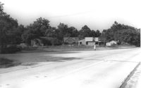
Building (industrial use?) on site affected by the widening of State Road 13 (Remount Road). Texaco and Gulf gas stations in background, across street). Surveyor notations on back of photo: "Dkt.: 10.562. Property owner: A.G. Boone Co. Tract: 15. Date: Jul. 12, 1967." [See collection description for explanation of surveyor notations.]
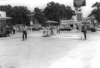
A&P store and parking lot, on site affected by the widening of State Road 13 (Remount Road). Surveyor notations on back of photo: "Dkt.: 10.562. Property owner: S.S. and B. Inc. Tract: 31. Date: Jul. 12, 1967." [See collection description for explanation of surveyor notations.]
A&P parking lot, on site affected by the widening of State Road 13 (Remount Road). Surveyor notations on back of photo: "Dkt.: 10.562. Property owner: S.S. and B. Inc. Tract: 31. Date: Jul. 12, 1967." [See collection description for explanation of surveyor notations.]
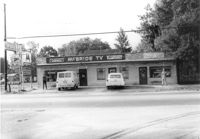
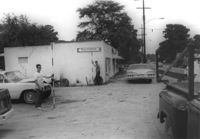
Lot next to McBride TV and Roy's Barber Shop, on site affected by the widening of State Road 13 (Remount Road). Atlantic gas Station: across the street. Surveyor notations on back of photo: "Dkt.: 10.562. Property owner: Pearl T. Leiderman. Tract: 40. Date: Jul. 19, 1967." [See collection description for explanation of surveyor notations.]
Bowers Hardware, on site affected by the widening of State Road 13 (Remount Road). Surveyor notations on back of photo: "Dkt.: 10.562. Property owner: J.R. Herrin. Tract: 82. Date: Jul. 19, 1967." [See collection description for explanation of surveyor notations.]
U-Nita-Do-It Yourself Store, on site affected by the widening of State Road 13 (Remount Road). Surveyor notations on back of photo: "Dkt.: 10.562. Property owner: John D. Stratos. Tract: 90. Date: Jul. 19, 1967." [See collection description for explanation of surveyor notations.]
Opal Oil Co., on site affected by the widening of State Road 13 (Remount Road). Gulf gas Station: across the street. Surveyor notations on back of photo: "Dkt.: 10.562. Property owner: Ethel Barnes Morris. Tract: 22. Date: Jul. 12, 1967." [See collection description for explanation of surveyor notations.]
Opal Oil Co., on site affected by the widening of State Road 13 (Remount Road). Surveyor notations on back of photo: "Dkt.: 10.562. Property owner: Ethel Barnes Morris. Tract: 22. Date: Jul. 12, 1967." [See collection description for explanation of surveyor notations.]
Site affected by the widening of State Road 13 (Remount Road). (Same as State Road 13 Photo 18.) Surveyor notations on back of photo: "Dkt.: 10.562. Property owner: A.G. Boone Co. Tract: 15. Date: Jul. 12, 1967." [See collection description for explanation of surveyor notations.]
Site affected by the widening of State Road 13 (Remount Road). (Same as State Road 13 Photo 18.) Surveyor notations on back of photo: "Dkt.: 10.562. Property owner: A.G. Boone Co. Tract: 15. Date: Jul. 12, 1967." [See collection description for explanation of surveyor notations.]
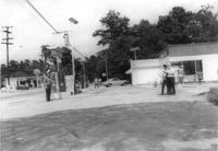
Crown gas station, on site affected by the widening of State Road 13 (Remount Road). View of street corner. Possibly the corner of North Rhett Avenue and Remount Road. Surveyor notations on back of photo: "Dkt.: 10.562. Property owner: Corco Realty Co. (Crown). Tract: 142. Date: Jul. 19, 1967." [See collection description for explanation of surveyor notations.]
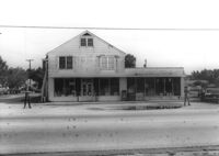
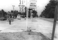
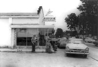
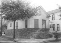
Leiderman's Sky Way Cafe, on site affected by the widening of Route 171 (Folly Road). Front facade has stepped parapet. "Dkt.: 10.562. Property owner: H.W. Leiderman. Tract: 41. Date: Jul. 19, 1967." [See collection description for explanation of surveyor notations.]
McBride TV and Roy's Barber Shop, on site affected by the widening of State Road 13 (Remount Road). Surveyor notations on back of photo: "Dkt.: 10.562. Property owner: Pearl T. Leiderman. Tract: 39. Date: Jul. 19, 1967." [See collection description for explanation of surveyor notations.]
Kayo gas station, on site affected by the widening of State Road 13 (Remount Road). Surveyor notations on back of photo: "Dkt.: 10.562. Property owner: S.R. Hill - K.O. Station. Tract: 66. Date: Jul. 19, 1967." [See collection description for explanation of surveyor notations.]
Shell gas station, on site affected by the widening of State Road 13 (Remount Road). Surveyor notations on back of photo: "Dkt.: 10.562. Property owner: Shell Oil Co., Inc. Tract: 2. Date: Jul. 12, 1967." [See collection description for explanation of surveyor notations.]
Gulf gas station, on site affected by the widening of State Road 13 (Remount Road). Surveyor notations on back of photo: "Dkt.: 10.562. Property owner: E.R. Gassman. Tract: 1. Date: Jul. 12, 1967." [See collection description for explanation of surveyor notations.]
House on site affected by the widening of State Road 13 (Remount Road). View of street corner. Corner of Hardy Avenue and Remount Road. Directional sign for The Taxidermy House. Surveyor notations on back of photo: "Dkt.: 10.562. Property owner: Harry R. Parkinson, et al. Tract: 61. Date: Jul. 19, 1967." [See collection description for explanation of surveyor notations.]
House on site affected by the widening of State Road 13 (Remount Road). View of street corner. Corner of S-10-282 (Sumner Avenue and North Rhett Avenue(?). Surveyor notations on back of photo: "Dkt.: 10.562. Property owner: Leonella Padgett. Tract: 148. Date: Jul. 19, 1967." [See collection description for explanation of surveyor notations.]
House on site affected by the widening of State Road 13 (Remount Road). Surveyor notations on back of photo: "Dkt.: 10.562. Property owner: Alline S. Crum. Tract: 139. Date: Jul. 19, 1967." [See collection description for explanation of surveyor notations.]
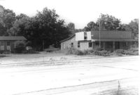
Avondale Laundry and Dry Cleaners, on site affected by the widening of State Road 13 (Remount Road). Trailer park in background. Surveyor notations on back of photo: "Dkt.: 10.562. Property owner: Edwards Realty Co. Tract: 4. Date: Jul. 12, 1967." [See collection description for explanation of surveyor notations.]
Avondale Laundry and Dry Cleaners, on site affected by the widening of State Road 13 (Remount Road). Trailer park in background. Surveyor notations on back of photo: "Dkt.: 10.562. Property owner: Edwards Realty Co. Tract: 4. Date: Jul. 12, 1967." [See collection description for explanation of surveyor notations.]
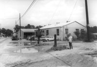
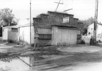
Mike's (possibly a garage), on site affected by the widening of State Road 13 (Remount Road). Trailer park in background. Surveyor notations on back of photo: "Dkt.: 10.562. Property owner: Edwards Realty Co. Tract: 5. Date: Jul. 12, 1967." [See collection description for explanation of surveyor notations.]
Shell gas station, on site affected by the widening of State Road 13 (Remount Road). Gulf gas Station: across the street. Surveyor notations on back of photo: "Dkt.: 10.562. Property owner: Shell Oil Co., Inc. Tract: 2. Date: Jul. 12, 1967." [See collection description for explanation of surveyor notations.]
Site affected by the widening of State Road 13 (Remount Road). Surveyor notations on back of photo: "Dkt.: 10.562. Property owner: W.W. Walker, et al. Tract: 36-B. Date: Jul. 19, 1967." [See collection description for explanation of surveyor notations.]
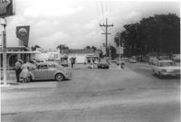
Texaco gas station, on site affected by the widening of State Road 13 (Remount Road). Neighboring Gulf gas Station: in background. Surveyor notations on back of photo: "Dkt.: 10.562. Property owner: W.L. Dyches, et al. Tract: 23. Date: Jul. 12, 1967." [See collection description for explanation of surveyor notations.]
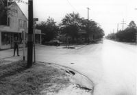
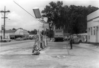
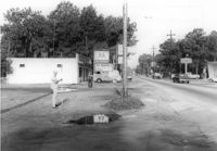
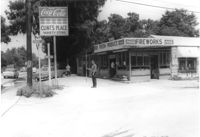
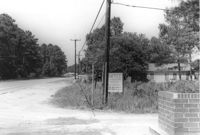
Clint's Place - Variety Store, corner of Craig Road, on site affected by the widening of State Road 13 (Remount Road). View of street corner. Surveyor notations on back of photo: "Dkt.: 10.562. Property owner: Samuel C. Rollings. Tract: 10. Date: Jul. 12, 1967." [See collection description for explanation of surveyor notations.]
House on site affected by the widening of State Road 13 (Remount Road). Surveyor notations on back of photo: "Dkt.: 10.562. Property owner: Harry R. Parkinson, et al. Tract: 61. Date: Jul. 19, 1967." [See collection description for explanation of surveyor notations.]
House on site affected by the widening of State Road 13 (Remount Road). 1552 Remount Road. Surveyor notations on back of photo: "Dkt.: 10.562. Property owner: Robert W. Kimbel. Tract: 60. Date: Jul. 19, 1967." [See collection description for explanation of surveyor notations.]
House on site affected by the widening of State Road 13 (Remount Road). Surveyor notations on back of photo: "Dkt.: 10.562. Property owner: Leonella Padgett. Tract: 148. Date: Jul. 19, 1967." [See collection description for explanation of surveyor notations.]
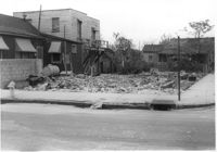
Site (affected by the widening of State Road 13 (Remount Road). Surveyor notations on back of photo: "Dkt.: 10.562. Property owner: West Virginia Pulp and Paper Co. Tract: 129. Date: Jul. 19, 1967." [See collection description for explanation of surveyor notations.]
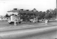
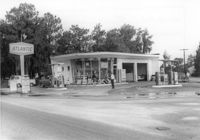
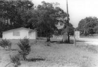
Atlantic gas station, on site affected by the widening of State Road 13 (Remount Road). Surveyor notations on back of photo: "Dkt.: 10.562. Property owner: Atlantic Refining Co. Tract: 37. Date: Jul. 19, 1967." [See collection description for explanation of surveyor notations.]
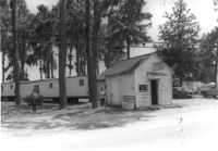
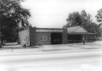
North Charleston Fire Department Station: No. 3, on site affected by the widening of State Road 13 (Remount Road). Trailer park in background. Surveyor notations on back of photo: "Dkt.: 10.562. Property owner: North Charleston Public Service. Tract: 6. Date: Jul. 12, 1967." [See collection description for explanation of surveyor notations.]
Office building with sign for Joe Grooms State Farm Insurance, on site affected by the widening of State Road 13 (Remount Road). Surveyor notations on back of photo: "Dkt.: 10.562. Property owner: Joseph J. Grooms. Tract: 18. Date: Jul. 12, 1967." [See collection description for explanation of surveyor notations.]
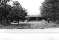
Office building on site affected by the widening of State Road 13 (Remount Road). Surveyor notations on back of photo: "Dkt.: 10.562. Property owner: Joseph J. Grooms. Tract: 18. Date: Jul. 12, 1967." [See collection description for explanation of surveyor notations.]
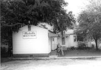
Michelle's Beauty Salon, on site affected by the widening of State Road 13 (Remount Road). Surveyor notations on back of photo: "Dkt.: 10.562. Property owner: Jerry Gray. Tract: 120. Date: Jul. 19, 1967." [See collection description for explanation of surveyor notations.]
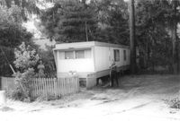
Mobile home on site affected by the widening of State Road 13 (Remount Road). Surveyor notations on back of photo: "Dkt.: 10.562. Property owner: Alline S. Crum. Tract: 139. Date: Jul. 19, 1967." [See collection description for explanation of surveyor notations.]
Arrow Restaurant, on site affected by the widening of State Road 13 (Remount Road). Surveyor notations on back of photo: "Dkt.: 10.562. Property owner: F.L. Parks, Jr. Tract: 3. Date: Jul. 12, 1967." [See collection description for explanation of surveyor notations.]
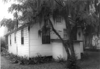
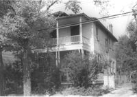
House on site affected by the widening of State Road 13 (Remount Road). Rear view. Surveyor notations on back of photo: "Dkt.: 10.562. Property owner: Charles R. Roberson. Tract: 36-A. Date: Jul. 19, 1967." [See collection description for explanation of surveyor notations.]
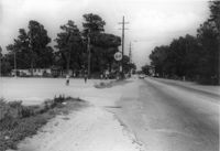
Site affected by the widening of State Road 13 (Remount Road). Surveyor notations on back of photo: "Dkt.: 10.562. Property owner: F.L. Parks, Jr. Tract: 3. Date: Jul. 12, 1967." [See collection description for explanation of surveyor notations.]
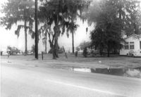
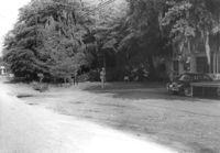
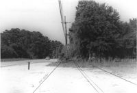
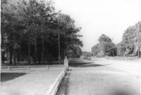
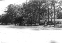
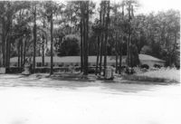
Lot on Spruill Avenue, on site affected by the construction of Interstate 26 (I-26). Houses in background. Surveyor notations on back of photo: "Dkt.: 10.490. Property owner: E.C. Brown. Tract: 28-A. Station: 51+50 Rt. (Spruill Ave.). Date: November 4, 1965. General view of land located in radius at intersection of Spruill Ave. and I-26. Line 'A'." [See collection description for explanation of surveyor notations.]
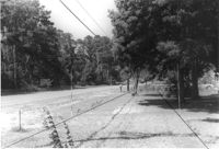
House on Spruill Avenue on site affected by the construction of Interstate 26 (I-26). [Intersection of Hugo Avenue.] Surveyor notations on back of photo: "Dkt.: 10.490. Property owner: Julia M. Pritchard. Tract: 28-B. Station: 48+80 Rt. (Spruill Ave.) Date: November 4, 1965. Range poles on new R/W. Building partially in R/W." [See collection description for explanation of surveyor notations.]
Lot and house (side view) on site affected by the widening of U.S. Route 17. Posted sign says: Edna's Ceramic Chop: Greenware, supplies, firing, lessons. Presumably located in Mount Pleasant or vicinity. Surveyor notations on back of photo: "Dkt.: 10.439. Property owner: Doretha B. Chavis. Tract: 15. Station: 224+51 to 225+51 Lt. Date: Jul. 22, 1965. Proximity." [See collection description for explanation of surveyor notations.]
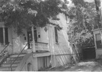
House (side view, rear) on site affected by the construction of Interstate 26 (I-26). Address: 1 Carolina Street. Surveyor notations on back of photo: "Dkt.: 10.517. Property owner: Ella W. Britton. Tract: 130. Station: 21+30 Lt. and Rt. (Line "1"). Date: November 4, 1965. Side and rear view of residence and lot, all entirely in R/W." [See collection description for explanation of surveyor notations.]
House on site affected by the construction of Interstate 26 (I-26). Address: 3 Carolina Street. Surveyor notations on back of photo: "Dkt.: 10.517. Property owner: Benjamin J. Finklea. Tract: 129. Station: 21+65 Rt. (Line "1"). Date: November 4, 1965. Subject residence and lot entirely in R/W." [See collection description for explanation of surveyor notations.]
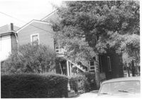
House on site affected by the construction of Interstate 26 (I-26). Address: 693 King Street. Surveyor notations on back of photo: "Dkt.: 10.517. Property owner: Rose Sokol. Tract: 132. Station: 19+20 Lt. and Rt. (Line "1"). Date: November 4, 1965. Front view of subject residence and lot, all in R/W." [See collection description for explanation of surveyor notations.]
House on site affected by the construction of Interstate 26 (I-26). Address: 310 St. Philip Street. Surveyor notations on back of photo: "Dkt.: 10.517. Property owner: Benjamin W. Steed. Tract: 131. Station: 20+65 Lt. and Rt. (Line "1"). Date: November 4, 1965. Side view of residence entirely in R/W." [See collection description for explanation of surveyor notations.]
House on site affected by the construction of Interstate 26 (I-26). Address: 1 Carolina Street. Surveyor notations on back of photo: "Dkt.: 10.517. Property owner: Ella W. Britton. Tract: 130. Station: 21+30 Lt. and Rt. (Line "1"). Date: November 4, 1965. Front view of residence and lot entirely in R/W." [See collection description for explanation of surveyor notations.]
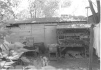
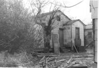
Shed behind house on site affected by the construction of Interstate 26 (I-26). Address: 5 Carolina Street. Surveyor notations on back of photo: "Dkt.: 10.517. Property owner: I.S. Keith Ellsworth, Sr. Tract: 128. Station: 22+50 Rt. (Line "1"). Date: November 4, 1965. Backyard with shed, entirely in R/W." [See collection description for explanation of surveyor notations.]
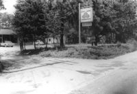
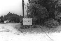
Lot on site affected by the widening of U.S. Route 17. Posted sign says: You just passed last motel for 50 miles, Mt. Pleasant Motel, ¼ mile back. Presumably located in Mount Pleasant or vicinity. Surveyor notations on back of photo: "Dkt.: 10.439. Property owner: Charleston County Public Works. Tract: 12. Station: 239+45 to 243+73 Rt. Date: Jul. 22, 1965. Range poles on 50' R/W & fence on 33' R/W - Cond." [See collection description for explanation of surveyor notations.]
Lot on site affected by the widening of U.S. Route 17. Posted sign says: Speed checked by radar. Presumably located in Mount Pleasant or vicinity. Surveyor notations on back of photo: "Dkt.: 10.439. Property owner: Francis F. Coleman, et al. Tract: 13. Station: 245+50 Rt. Date: Jul. 22, 1965. Range poles on 33' & 50' R/W showing house (portion)." [See collection description for explanation of surveyor notations.]
Lot on site affected by the widening of U.S. Route 17. Presumably located in Mount Pleasant or vicinity. Surveyor notations on back of photo: "Dkt.: 10.439. Property owner: Charleston County Public Works. Tract: 12. Station: 239+45 to 243+73 Rt. Date: Jul. 22, 1965. Looking from the east at range poles on 50' R/W & fence on 33' R/W - Cond." [See collection description for explanation of surveyor notations.]
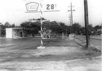
Lot on site affected by the widening of U.S. Route 17. Presumably located in Mount Pleasant or vicinity. Surveyor notations on back of photo: "Dkt.: 10.439. Property owner: Charleston Oil Co. Tract: 11. Station: 237+26 to 239+45 Rt. Date: Jul. 22, 1965. Range poles on 33' & 50' R/W - Cond." [See collection description for explanation of surveyor notations.]
House on site affected by the construction of Interstate 26 (I-26). Address: 310 St. Philip Street. View of street corner; corner of St. Philip Street and Carolina Street. Surveyor notations on back of photo: "Dkt.: 10.517. Property owner: Benjamin W. Steed. Tract: 131. Station: 20+50 Lt. and Rt. (Line "1"). Date: November 4, 1965. Side view of residence in R/W." [See collection description for explanation of surveyor notations.]
Lot on site affected by the widening of U.S. Route 17. Posted sign says: You just passed last motel for 50 miles, Mt. Pleasant Motel, ¼ mile back. Portion of house visible. Presumably located in Mount Pleasant or vicinity. Surveyor notations on back of photo: "Dkt.: 10.439. Property owner: Charleston County Public Works. Tract: 12. Station: 240+00 Rt. Date: Jul. 22, 1965. Looking from west at range poles on 50' R/W & fence on 33' R/W - Cond." [See collection description for explanation of surveyor notations.]
Roadside lot on site affected by the widening of U.S. Route 17. Presumably located in Mount Pleasant or vicinity. Surveyor notations on back of photo: "Dkt.: 10.439. Property owner: Louise S. Carter. Tract: 3. Station: 230±50 Rt. Date: Jul. 22, 1965. Looking NE from Carter Ave. at range poles on 33' & 50' R/Ws - Cond." [See collection description for explanation of surveyor notations.]
Roadside lot on site affected by the widening of U.S. Route 17. Presumably located in Mount Pleasant or vicinity. Surveyor notations on back of photo: "Dkt.: 10.439. Property owner: Louise S. Carter. Tract: 3. Station: 229±50 Rt. Date: Jul. 22, 1965. Looking NE at range on 33' R/W & 50' R/W - Cond." [See collection description for explanation of surveyor notations.]
Lot on site affected by the widening of U.S. Route 17. Presumably located in Mount Pleasant or vicinity. Surveyor notations on back of photo: "Dkt.: 10.439. Property owner: Samuel D. Causey. Tract: 6. Station: 233±00 Rt. Date: Jul. 22, 1965. Range poles on 33' & 50' R/W - Cond." [See collection description for explanation of surveyor notations.]
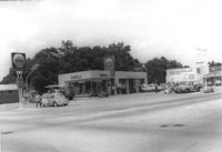
Lot and building on site affected by the widening of U.S. Route 17. Billboard for Busch Bavarian [beer] in background. Presumably located in Mount Pleasant or vicinity. Surveyor notations on back of photo: "Dkt.: 10.439. Property owner: A.J. Ashley. Tract: 19. Station: 241+92 Lt. Date: Jul. 22, 1965. Range poles on new R/W & man & range poles on pres. 33' R/W. Portion of bldg within R/W." [See collection description for explanation of surveyor notations.]
Lot and building on site affected by the widening of U.S. Route 17. Billboard for Busch Bavarian [beer] in background. Presumably located in Mount Pleasant or vicinity. Surveyor notations on back of photo: "Dkt.: 10.439. Property owner: A.J. Ashley. Tract: 19. Station: 241+92 Lt. Date: Jul. 22, 1965. Range poles on new R/W & man & range poles on pres. 33' R/W. Portion of bldg within R/W." [See collection description for explanation of surveyor notations.]
Lot and buildings on site affected by the widening of U.S. Route 17. Billboard for Busch Bavarian [beer] in background. Presumably located in Mount Pleasant or vicinity. Surveyor notations on back of photo: "Dkt.: 10.439. Property owner: A.J. Ashley. Tract: 19. Station: 238+85 to 242+45 Lt. Date: Jul. 22, 1965. Range poles on pres. & 75' R/W - Cond. 2 frame bldg." [See collection description for explanation of surveyor notations.]
Lot in front of Mt. Pleasant Motel, on site affected by the widening of U.S. Route 17. Presumably located in Mount Pleasant or vicinity. Surveyor notations on back of photo: "Dkt.: 10.439. Property owner: George A. Kaiser, et al. Tract: 16. Station: 225+51 to 228+52 Lt. Date: Jul. 22, 1965. Taken from west side showing range poles on 50' R/W & brick columns on 33' R/W - Cond." [See collection description for explanation of surveyor notations.]
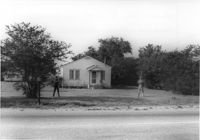
House on site affected by the widening of U.S. Route 17. Presumably located in Mount Pleasant or vicinity. Surveyor notations on back of photo: "Dkt.: 10.439. Property owner: A.J. Ashley. Tract: 20. Station: 242+85 Lt. Date: Jul. 22, 1965. Proximity." [See collection description for explanation of surveyor notations.]
Buildings on site affected by the widening of U.S. Route 17. Presumably located in Mount Pleasant or vicinity. Surveyor notations on back of photo: "Dkt.: 10.439. Property owner: A.J. Ashley. Tract: 19. Station: 241+00 Lt. Date: Jul. 22, 1965. Range poles on pres. & 75' R/W - front of both bldg." [See collection description for explanation of surveyor notations.]
House on site affected by the construction of Interstate 26 (I-26). Address: 82 Fishburne Street. Surveyor notations on back of photo: "Dkt.: 10.517. Property owner: Ernest And Mabel Garner. Tract: 125. Station: 23+75 Lt. & Rt. (Line "1" survey). Date: November 4, 1965. Subject building and entire lot entirely in R/W. Bought." [See collection description for explanation of surveyor notations.]
House on site affected by the construction of Interstate 26 (I-26). Address: 84 Fishburne Street. Surveyor notations on back of photo: "Dkt.: 10.517. Property owner: Miss Fannie A. Patrick. Tract: 126. Station: 23+50 Rt. (Line "1" survey). Date: November 4, 1965. Subject building and lot entirely in R/W. Condemned." [See collection description for explanation of surveyor notations.]
House on site affected by the construction of Interstate 26 (I-26). Address: 78 Fishburne Street. Surveyor notations on back of photo: "Dkt.: 10.517. Property owner: Rosetta E. Richardson. Tract: 124. Station: 24+00 Lt. (Line "1" survey). Date: November 4, 1965. Subject building and entire lot entirely in R/W. Bought." [See collection description for explanation of surveyor notations.]
Mt. Pleasant Motel, on site affected by the widening of U.S. Route 17. Presumably located in Mount Pleasant or vicinity. Surveyor notations on back of photo: "Dkt.: 10.439. Property owner: George A. Kaiser, et al. Tract: 16. Station: 225+51 to 228+52 Lt. Date: Jul. 22, 1965. From across road showing brick columns on 33' R/W & range poles on 50' R/W - Cond." [See collection description for explanation of surveyor notations.]
Mt. Pleasant Motel, on site affected by the widening of U.S. Route 17. Presumably located in Mount Pleasant or vicinity. Surveyor notations on back of photo: "Dkt.: 10.439. Property owner: George A. Kaiser, et al. Tract: 16. Station: 228+52 Lt. Date: Jul. 22, 1965. Taken from east side with brick columns on 33' R/W & range poles on 50' R/W - Cond." [See collection description for explanation of surveyor notations.]
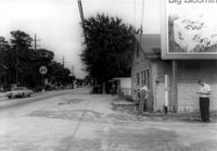
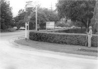
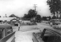
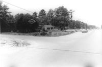
Orkin Pest Control - Termite Control, corner of Ashley Hall Road and Route 7 (Sam Rittenberg Boulevard), on site affected by the widening of Routes 7 & 171. Surveyor notations on back of photo: "Dkt.: 10.551. Property owner: Atlantic Investment & Development Co. Tract: 4. Station: 127±00 Rt. Date: Jul. 22, 1965. Range poles on corners of ? area - photographer standing in Rt. 7. [See collection description for explanation of surveyor notations.]
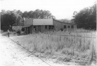
House on Spruill Avenue (rear view) on site affected by the construction of Interstate 26 (I-26). Surveyor notations on back of photo: "Dkt.: 10.490. Property owner: Julia M. Pritchard. Tract: 28-B. Station: 49+20 Rt. (Spruill Ave.) Date: November 4, 1965. Rear view of residence that is partially in R/W. Range poles on new R/W." [See collection description for explanation of surveyor notations.]
House on Spruill Avenue (rear view) on site affected by the construction of Interstate 26 (I-26). Surveyor notations on back of photo: "Dkt.: 10.490. Property owner: Julia M. Pritchard. Tract: 28-B. Station: 49+20 Rt. (Spruill Ave.) Date: November 4, 1965. Rear view of residence that is partially in R/W. Range poles on new R/W." [See collection description for explanation of surveyor notations.]
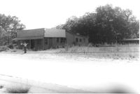
House on Spruill Avenue on site affected by the construction of Interstate 26 (I-26). Surveyor notations on back of photo: "Dkt.: 10.490. Property owner: Julia M. Pritchard. Tract: 28-B. Station: 49+50 Rt. (Spruill Ave.) Date: November 4, 1965. Front view of residence that is partially in R/W. Range poles on new R/W." [See collection description for explanation of surveyor notations.]
House (front and side view) on site affected by the construction of Interstate 26 (I-26). (Presumably where the Crosstown is today or the vicinity.) Address number 82. Surveyor notations on back of photo: "Dkt.: 10.517. Property owner: Ernest And Mabel Garner. Tract: 125. Station: 23+75 Rt. (Line "1" survey). Date: November 4, 1965. Side view of subject building entirely in R/W. Bought." [See collection description for explanation of surveyor notations.]
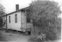
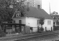
House on site by the construction of Interstate 26 (I-26). Address: 35 Mount Pleasant Street. Corner (rear) view from railroad tracks in foreground. Joseph Floyd Manor (Mount Pleasant Street and King Street) in background. Surveyor notations on back of photo: "Dkt.: 10.503. Property owner: Henry Fritz. Tract: 14-C. Station: 12+10 Rt. (Mt. Pleasant St.). Date: Apr. 20, 1965." [See collection description for explanation of surveyor notations.]
House (side view) on site by the construction of Interstate 26 (I-26). Address: 35 Mount Pleasant Street. View of house from railroad tracks at Mount Pleasant Street. View of street corner, looking down King Street. Surveyor notations on back of photo: "Dkt.: 10.503. Property owner: Henry Fritz. Tract: 14-C. Station: 12+10 Rt. (Mt. Pleasant St.). Date: Apr. 20, 1965." [See collection description for explanation of surveyor notations.]
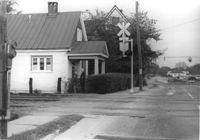
House (corner view, street elevation) and lot on site affected by the construction of the Crosstown. On Cooper Street; address unknown. View of street corner. Surveyor notations on back of photo: "Dkt.: 10.518. Property owner: Louise McLead Drayton. Tract: 30-B. Station: 14+60 Lt. (Cooper Street). 41+70 Rt. (U.S. Rt. 17). Date: Apr. 20, 1965. Partially in R/W." [See collection description for explanation of surveyor notations.]
Lot and house on corner, on site affected by the construction of the Crosstown. On Cooper Street; address unknown. View of street corner. Surveyor notations on back of photo: "Dkt.: 10.518. Property owner: Louise McLead Drayton. Tract: 30-B. Station: 14+60 Lt. (Cooper Street). 41+70 Rt. (U.S. Rt. 17). Date: Apr. 20, 1965. Partially in R/W." [See collection description for explanation of surveyor notations.]