I-26 Photo 1007
Close Viewer
- Title:
- I-26 Photo 1007
- Date:
- 1965
- Creator (Corporate):
- South Carolina. Dept. of Transportation
- Description:
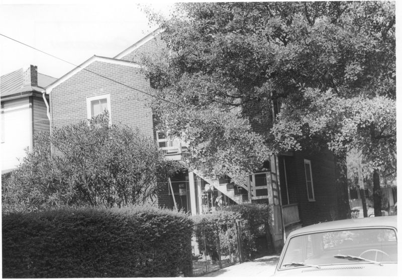
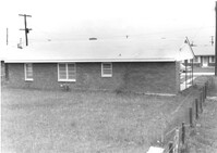
- House (side view, rear) on site affected by the construction of Interstate 26 (I-26). Address: 1 Carolina Street. Surveyor notations on back of photo: "Dkt.: 10.517. Property owner: Ella W. Britton. Tract: 130. Station: 21+30 Lt. and Rt. (Line "1"). Date: November 4, 1965. Side and rear view of residence and lot, all entirely in R/W." [See collection description for explanation of surveyor notations.]
- Collection Title:
- SCDOT Photographs: Properties in the Right-of-Way
- Contributing Institution:
- Historic Charleston Foundation
- Media Type:
- Images
- Topical Subject:
- Right of way--South Carolina--Charleston County, Highway planning--South Carolina--Charleston County, Vernacular architecture--South Carolina--Charleston County, Lost architecture--South Carolina--Charleston County, and Dwellings--South Carolina--Charleston County
- Geographic Subject:
- Charleston County (S.C.)--Buildings, structures, etc.
- S.C. County:
- Charleston County (S.C.)
- Shelving Locator:
- 2009.022.1, photo ID# 17,DOTPhoto_1806
- Date Digital:
- 2011-07
- Digitization Specifications:
- 600 ppi, 24-bit depth color, HP Scanjet 4890. Archival Masters are tiffs.
- Copyright Status Statement:
- Digital image copyright 2010, Historic Charleston Foundation. All rights reserved. For more information contact Margaretta Childs Archives at HCF, P.O. Box 1120, Charleston, SC 29402.
- Admin ID:
- 46406
Permalink