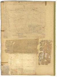
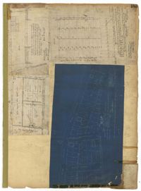
Page 162 of the City Engineer's Plat Book with three plats. Plat 1 shows land located near Payne Street with several streams. Plat 2 shows lots located in the Village of Hampstead, located near America Street. The plat also shows marshland and streams. Plat 3 has numerous tears and holes. Plat 4 shows lots and structures located between Meeting Street and Lynch Street.
Page 233 of the City Engineer's Plat Book with one plat. The plat features a stretch of marshland located east of Bay Street. The plat also shows America Street, Cooper Street, Blake Street, several creeks, and land labelled "Magazine."
Page 223 of the City Engineer's Plat Book with five plats. Plat 1 shows lots and structures along Poinsett Street, near where it intersects with King Street. Plat 2 shows lots located on Sans Souci Street, near where it intersects with King Street. Plat 3 shows lots located on Line Street, including a lot labelled "City Stables." Plat 4 shows lots along King Street, near where it intersects with Moultrie Street. Plat 5 shows lots and structures located near the intersection of King Street and Romney Street.
Page 187 of the City Engineer's Plat Book with four plats. Plat 1 shows lots and buildings located near a street. Plat 2 shows lots located on Mount Street. Plat 3 shows lots and structures located on and near King Street, between Sans Souci Road and Mount Pleasant Road. Plat 4 shows lots located on and near King Street, near its intersections with Sans Souci Street and Lenox Street.
Page 190 of the City Engineer's Plat Book with two plats. Plat 1 shows lots located along Addison's Court, between Meeting Street and a lot owned by the South Carolina Rail Road. Plat 2 shows lots along Kennedy Street, near Line Street and a stretch of Marsh.
Page 176 of the City Engineer's Plat Book with three plats. Plat 1 shows lots located between Meeting Street and land owned by the South Carolina Railroad Company. Plat 2 shows lots located near the intersection of King Street and Line Street. Plat 3 features a proposed road from Clements Ferry Road to Chicora Park. It also shows a stretch of pine woods and a stretch of land labelled as "Bottom."
Page 170 of the City Engineer's Plat Book with four plats. Plat 1 shows lots located between King Street and Meeting Street, and between Romney Street and Grove Street. Plat 2 shows lots located between King Street and Meeting Street, and between Brigade Street and Mount Pleasant Street. Plat 4 shows lots located on Butler Street, near its intersection with Russell Street. Plat 5 features a lot labelled "Reservoir," located between Hanover Street and America Street.
A report from the mayor, city council, and various governmental departments of Charleston, South Carolina, for the year 1883. The Year Book opens with an address from Mayor Courtenay followed by reports from various departments and an appendix recounting the history of Charleston.