Page 187 of the City Engineer's Plat Book with four plats. Plat 1 shows lots and buildings located near a street. Plat 2 shows lots located on Mount Street. Plat 3 shows lots and structures located on and near King Street, between Sans Souci Road and Mount Pleasant Road. Plat 4 shows lots located on and near King Street, near its intersections with Sans Souci Street and Lenox Street.
Page 176 of the City Engineer's Plat Book with three plats. Plat 1 shows lots located between Meeting Street and land owned by the South Carolina Railroad Company. Plat 2 shows lots located near the intersection of King Street and Line Street. Plat 3 features a proposed road from Clements Ferry Road to Chicora Park. It also shows a stretch of pine woods and a stretch of land labelled as "Bottom."
Page 190 of the City Engineer's Plat Book with two plats. Plat 1 shows lots located along Addison's Court, between Meeting Street and a lot owned by the South Carolina Rail Road. Plat 2 shows lots along Kennedy Street, near Line Street and a stretch of Marsh.
Page 170 of the City Engineer's Plat Book with four plats. Plat 1 shows lots located between King Street and Meeting Street, and between Romney Street and Grove Street. Plat 2 shows lots located between King Street and Meeting Street, and between Brigade Street and Mount Pleasant Street. Plat 4 shows lots located on Butler Street, near its intersection with Russell Street. Plat 5 features a lot labelled "Reservoir," located between Hanover Street and America Street.
A report from the mayor, city council, and various governmental departments of Charleston, South Carolina, for the year 1883. The Year Book opens with an address from Mayor Courtenay followed by reports from various departments and an appendix recounting the history of Charleston.
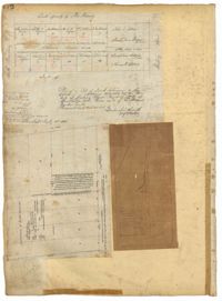
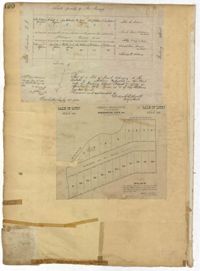
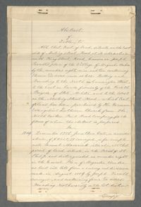
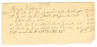
This document packet is the abstract of the title to a tract of land located near the southeast corner of Meeting Street and Cunnington Street. St. Matthew's Lutheran Church (then the German Evangelical Lutheran Church) purchased the land from the Northeastern Railroad Company (N.E.R.R. Company) in 1883 for the purpose of creating a cemetery. The cemetery became known as Bethany Cemetery. The abstract lists the property's previous owners and the means through which they acquired the land. It also includes legal documentation showing the N.E.R.R. paid taxes on the land and other confirmation that they had the right to sell the land.
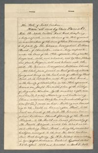
A document conveying a tract of land to the German Evangelical Lutheran Church. The church purchased this land from the North Eastern Rail Road Company.
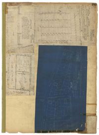
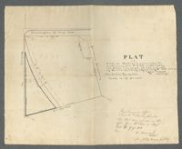
Land Survey of a lot near the corner of Meeting and Cunnington Streets. The survey describes the land as consisting of 9.45 acres, and that a representative of the German Evangelical Lutheran Church requested the survey.