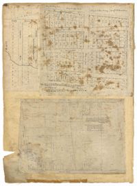
Page 32 of the City Engineer's Plat Book with three plats. Plat 1 shows lots located near the intersection of Tradd Street and Limehouse Street. Plat 2 shows lots located near Elliott Street, Broad Street, and Line Street, near the intersections with Rose Lane, Laurel Street, Percy Street, and Coming Street. Plat 3 shows lots and buildings located between St. Phillip Street and King Street, and Radcliffe Street and Warren Street.
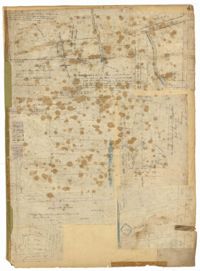
Page 51 of the City Engineer's Plat Book with seven plats. Plat 1 shows land located between Tradd Street and the Ashley River, and labels several features of geography such as a patch of marsh and some land labelled "Hard at low water." Plat 1 also shows a lot labelled "City Lands." Plat 2 shows lots and buildings located near the intersection of Tradd Street and Savage Street. Plat 3 shows land located on the west side of New Street. Plat 4 features a lot located at the intersection of New Street and Tradd Street. Plat 5 features lots located near the intersection of New Street and Tradd Street. Plat 6 shows lots located on and near Tradd Street. Plat 7 shows structures located near the intersection of New Street and Broad Street, including a building labelled "Theatre."
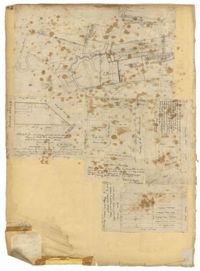
Page 49 of the City Engineer's Plat Book with six plats. Plat 1 shows land on the Cooper River. Plat 2 shows land located near Broad Street's intersections with Gadsden Street and Lynch Street, and a stream labelled "Comings Creek." Plat 3 shows wharfs and buildings along the Cooper River and near Champney Street. Plat 4 shows wharves and other structures between East Bay Street and the Cooper River. Plat 5 shows land near South Bay Street's intersections with Meeting Street and Church Street, including a lot labelled "Battery Garden" and a structure labelled "Bathing House."
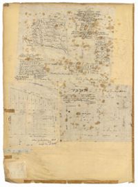
Page 42 of the City Engineer's Plat Book with five plats. Plat 1 shows land between King Street and the Ashley River, and shows bodies of water. Plat 2 shows land between Tradd Street and Payne Street, and several buildings. Plat 3 shows land and buildings on Cumberland Street, and shows two cemeteries, "Cemetery of the Circular Church," and "St Philip's Cemetery." Plat 4 shows plots near the intersection of Henrietta Street and Elizabeth Street. Plat 5 shows lots between "Marsh Street" and "Back Street."
Page 36 of the City Engineer's Plat Book with three plats. Plat 1 shows land located near President Street and Rutledge Avenue, and labels certain marshlands and bodies of water. Plat 2 shows lots located near the intersection of King Street and Grove Street, near Milligan Street. Plat 3 shows land and buildings located near the intersection of Pitt Street and Bull Street.
Page 56 of the City Engineer's Plat Book with seven plats. Plat 1 shows lots between Savage Street and Tradd Street. Plat 2 shows lots and some buildings on South Bay Street. Plat 3 shows lots between Savage Street and Broad Street. Plat 4 shows a lot and several buildings at the intersection of Friend and Queen Street. Plat 5 shows land near the corner of Legare Street and Gibbes Street, and a few buildings. Plat 6 shows a lot on the west side of Friend Street. Plat 7 shows lots located between Broad Street and Tradd Street, and between Lynch Street and the Ashley River.