City Engineers's Plat Book, 1671-1951, Page 42
Close Viewer
- Title:
- City Engineers's Plat Book, 1671-1951, Page 42
- Date:
- 1853
- Description:
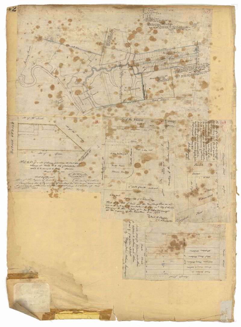
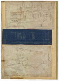
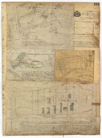
- Page 42 of the City Engineer's Plat Book with five plats. Plat 1 shows land between King Street and the Ashley River, and shows bodies of water. Plat 2 shows land between Tradd Street and Payne Street, and several buildings. Plat 3 shows land and buildings on Cumberland Street, and shows two cemeteries, "Cemetery of the Circular Church," and "St Philip's Cemetery." Plat 4 shows plots near the intersection of Henrietta Street and Elizabeth Street. Plat 5 shows lots between "Marsh Street" and "Back Street."
- Collection Title:
- City Engineers's Plat Book, 1671-1951
- Contributing Institution:
- The Charleston Archive at CCPL and City of Charleston
- Media Type:
- Maps
- Personal or Corporate Subject:
- Payne, Robert K.
Diamond, John - Topical Subject:
- Cadastral maps and Surveys
- Geographic Subject:
- Charleston (S.C.)
- S.C. County:
- Charleston County (S.C.)
- Language:
- English
- Date Digital:
- 2023
- Digitization Specifications:
- 300 dpi, 24-bit depth, color, i2S SupraScan Quartz A0. Archival masters are tiffs.
- Format:
- image/jpeg
- Copyright Status Statement:
- Public domain.
- Access Information:
- This City of Charleston has placed this collection on permanent loan with the Charleston County Public Library. For more information and reuse requirements contact The Charleston Archive at Charleston County Public Library, 68 Calhoun Street, Charleston, SC 29411.
- Admin ID:
- 296577
Permalink