Caption: 'Cook's Earthquake Views of Charleston and Vicinity. Taken after the 31st of August, 1886. No.51, Wide fissure, Ten Mile Hill.' Handwritten at bottom, front: 'Charleston Earthquake scene - Large geyser near Ten Mile Hill.'
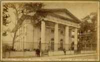
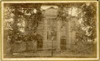
Caption: 'Cook's Earthquake Views of Charleston and Vicinity. Taken after the 31st of August, 1886. No. 17, St. Paul's Church.' St. Luke and St. Paul's Episcopal Cathedral, Coming Street.
Caption: 'Cook's Earthquake Views of Charleston and Vicinity. Taken after the 31st of August, 1886. No.76, First Baptist Church, front.' Handwritten at bottom, front: 'Charleston Earthquake scene - First Baptist Church, Church Street.'
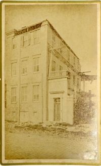
Charleston Earthquake scene. Written on front, at bottom: 'Sailor's Home, Charleston, S.C. after the Earthquake.' Sign at top of building reads: 'Charleston Port Society.'
Caption: 'Cook's Earthquake Views of Charleston and Vicinity. Taken after the 31st of August, 1886. No.133, 5 and 7 Broad Street.' Written on front, at bottom: 'Walker, Evans & Cogswell, Broad St.' Charleston City Directory for 1886 shows Walker, Evans & Cogswell at 3-5 Broad Street. Etiwan[Phosphate] Company is at 7 Broad.
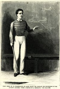
Caption: 'West Point, N.Y.--examination of Cadet Grant--he displays his knowledge of his father's battles.--from a sketch by A. Berghaus.--see page 241.' [full date June 24, 1871.]
Caption: 'Cook's Earthquake Views of Charleston and Vicinity. Taken after the 31st of August, 1886. No.21, Broad Street, south side.' Sign on building, at right, reads: 'Cigars & Tobacco' and 'W.W. Smith, 27.' Charleston city directory for 1886 lists William M. Smith, seal, stencil and stamp works, at 29 Broad Street.
Caption: 'Cook's Earthquake Views of Charleston and Vicinity. Taken after the 31st of August, 1886. No.25, Vendue Range.' Written on front, at bottom: 'Charleston Earthquake scene - Vendue Range, foot of Queen St. near the wharf.' Sign for John Werner visible. Charleston city directory for 1886 shows business at 27 Vendue Range.
Caption: 'Cook's Earthquake Views of Charleston and Vicinity. Taken after the 31st of August, 1886. No.62, Wm. [William] Ravenel, East Battery, front.' Written on front, at bottom: 'Earthquake scene, Charleston, So.Ca. - Ravenel House'
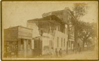
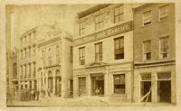
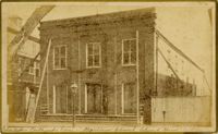
Charleston Earthquake scene. Written on front, at bottom: 'Broad St.' Image shows The News and Courier. Charleston city directory for 1886 lists it at 19 Broad Street.
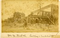
Charleston Earthquake scene. Written on front, at bottom: 'Wm M. Bird & Co. East Bay & Cumberland St.' Sign on building reads: '205, Wm. M. Bird & Co' and '203, Wm E. Holmes.'
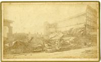
Caption: 'Cook's Earthquake Views of Charleston and Vicinity. Taken after the 31st of August, 1886. No.27, Hayne Street - ruins of three large buildings.' Sign on column at left reads: 'Charleston Bag Factory.' Charleston city directory for 1886 shows a bag factory at 15-19 Hayne Street.
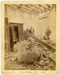
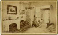
Charleston Earthquake scene. Sign at bottom of image: 'Mr. August Melm's room, 21 King Street.' Also, written on front, at bottom: 'Earthquake - Charleston S.C. 1886.' Charleston city directory for 1886 lists August Melm, a local attorney, as boarding at 21 King Street.
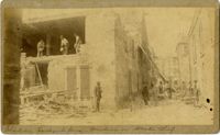
Caption: 'Cook's Earthquake Views of Charleston and Vicinity. Taken after the 31st of August, 1886. No.115, Corner [of] Market and Anson Streets.' Sign on building reads: 'Ship & Family Groceries.' Written on front, at bottom: 'Charleston Earthquake view - cor. Market and Anson sts.'
Charleston Earthquake scene. Written on reverse: 'East Battery, just below Atlantic Street. Edmonston [sic] House, later the Charles Alston residence. Now (1947) the residence of J.J. Pringle Smith. Old Holmes house on left. Earthquake of 1886 - Charleston, S.C.'
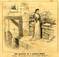
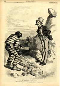
Political cartoon, caption: 'The Commandments in South Carolina. "We've pretty well smashed that; but I suppose, Massa Moses, you can get another one."' [full date September 26, 1874]
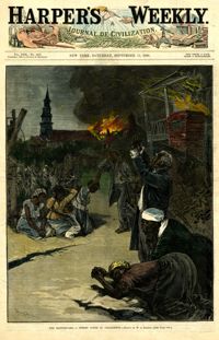
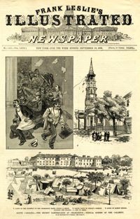
Caption: 'South Carolina.--The recent earthquakes at Charleston--typical scenes of the calamity. From sketches by C. Upham--see page 71. 1. Scene on the stairway of the Charleston Hotel during a shock. 2. Taking down St. Philip's Steeple. 3. Scene on Marion Square, opposite the Citadel--a city of tents.' [full date September 18, 1886.]
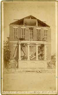
Caption: 'Cook's Earthquake Views of Charleston and Vicinity. Taken after the 31st of August, 1886. No.40, Bishop's house, Broad Street.' Handwritten at bottom, front: 'Charleston Earthquake scene - Bishop Northrup's Residence.' Charleston city directory for 1886 shows Bishop Henry P. Northrop at 114 Broad Street.
Caption: 'Cook's Earthquake Views of Charleston and Vicinity. Taken after the 31st of August, 1886. No.150, Mariner's Church, exterior." Also, handwritten at bottom of image: 'Charleston Earthquake scene - Mariners' Church, Church Street ? East Bay'
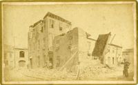
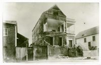
Charleston Earthquake Scene. Possibly from Cook's Earthquake Views, No.56, Alderman Murray's residence, Wentworth Street.' Charleston city directory for 1886 shows Andrew B. Murray at 175 Wentworth.
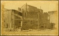
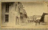
Charleston Earthquake scene. Written on front, at bottom: 'Charleston Earthquake scene - warehouse on Atlantic Wharf.' Charleston city directory for 1886 lists Atlantic Wharf at the rear of the Post Office.
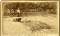
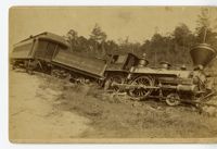
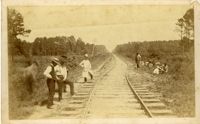
Charleston Earthquake scene. Handwritten on reverse: '9 mile bottom - South Carolina railroad - chasm on left. Track was originally a tangent. Caused by earthquake, 1886. Track cut of line.'
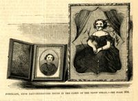
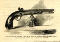
Caption: 'Articles fished out from the cabin of the sloop Spray--Naval pistol supposed to have been used in the murder, and a locket.--see page 304.' [full date April 14, 1860.]
Caption: 'Cook's Earthquake Views of Charleston and Vicinity. Series No.2.' No.156, Scene near Brown's Wharf.' Charleston city directory for 1886 lists Brown's Wharf as opposite Vendue Range.