Plat includes 500 acres on the Cypress Swamp. Names associated with this plat are James Sanders, Matthew Nelson, William Abraham, Abraham Sanders, and Samuel Sanders. Notable geographic locations include St George’s Parish, Cypress Swamp, Dorchester, and Thorntree Swamp.
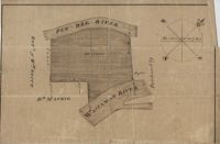
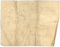
161 acres of land southeast of Pee Dee River. Details include rivers, a canal, and trees. Names associated with this plat are Mackie and William Stitt. Notable geographic locations include Waccamaw River and Pee Dee River.
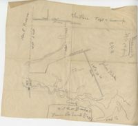
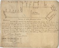
Plat of land laid out to Huggins of 58 acres situated on the NE side of Pee Dee River butting and bounding to the North on William Alston's land and to the south and southwest on unknown land. Names associated with this plat are Huggins, William Alston, Job Roshmahler and John Hardwick.
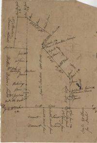
Copy of plat of land being 903 belonging to Archer Smith in Georgetown District on the side of Pee Dee. Names associated with this plat are Archer Smith, Thomas Water, Abraham Livingston, J. Roshnakler, W. Glover, Preugh [?], Thomas Skrine [?], John J. Pringle, Alexander Roses and John Coates. Notable geographic locations include Pee Dee, Georgetown District, and Path to Black River from Pee Dee.
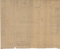
Plat of 53 acres off of Dorchester Road which is divided into lots. Very little details or information. Names associated with this plat are Fitch and Beckman. Notable geographic locations include Dorchester Road.
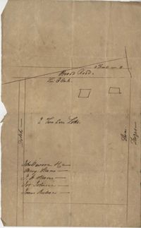
Sketch of lots near Dorchester now belonging to James Kennedy. Names associated with this plat are James Kennedy, Thomas Droger, John Dawson, M. Strom, J.H. Strom, J. Johnson, and J. Nilson. Notable geographic locations include Dorchester, St. George's Parish and Broad Road.
300 acres of land belonging to Richard Downes at Stono. Names associated with this plat include Richard Downes, Edmond Bellinger, Thomas Mellichamp, Christopher Welkin and Archibald Stanyarn.
Plat contains 500 acres on the Edisto River. Names associated with this plat are William John Gerardeau, John Stock, William Livingston, Thomas Broughtors, Charles Craven, Charles Parker. Notable geographic locations include South Edisto River and Colleton County.
Resurvey of a tract of land measuring 510 acres called Egan Hall belonging to John Egan situated in St. James Parish, Santee. Names associated with this plat are John Egan, Gredless and Ball. Notable geographic locations include St. James Parish, Santee, Egan Hall, and Bunker's Hill.