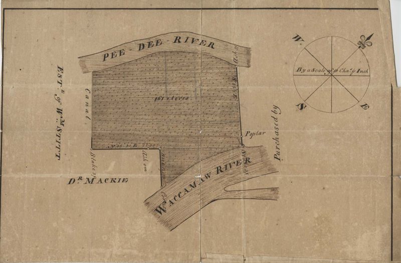
Pee Dee River Plat
Title:
Pee Dee River Plat
Description:
161 acres of land southeast of Pee Dee River. Details include rivers, a canal, and trees. Names associated with this plat are Mackie and William Stitt. Notable geographic locations include Waccamaw River and Pee Dee River.
Collection Title:
John McCrady Plats and Deeds Collection Contributing Institution:
South Carolina Historical Society Media Type:
Maps Topical Subject:
Conveyancing--South Carolina , Maps , and Surveying--South Carolina Geographic Subject:
Waccamaw River (N.C. and S.C.) and Pee Dee River (N.C. and S.C.) Language:
English
Shelving Locator:
510.00, Box 2, Folder 39
Date Digital:
2016-02-29
Digitization Specifications:
400 dpi, 24-bit depth, color, Bookeye 4 Basic, Archival masters are tiffs.
Internet Media Type:
image/jpeg
Copyright Status Statement:
Public Domain.
Access Information:
For more information and re-use requirements contact the South Carolina Historical Society, Charleston, SC, 29401.
Admin ID:
223261