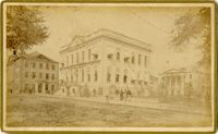
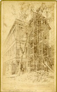
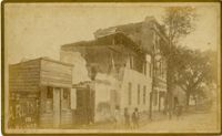
Caption: 'Cook's Earthquake Views of Charleston and Vicinity. Taken after the 31st of August, 1886. No.36, Court House, City Hall, and Fireproof Building.'
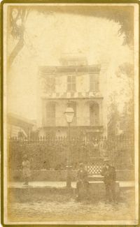
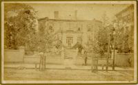
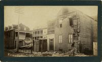
Caption: 'Cook's Earthquake Views of Charleston and Vicinity. Series No.2. No.170, Buist residence, Rutledge Street.' Written on front, at bottom: Buist Residence, 43 Rutledge St.' Charleston city directory for 1886 shows listing for Samuel S. Buist at 43 Rutledge Avenue.
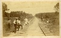
Charleston Earthquake scene. Handwritten on reverse: '9 mile bottom - South Carolina railroad - chasm on left. Track was originally a tangent. Caused by earthquake, 1886. Track cut of line.'
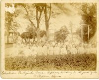
Caption: 'Charleston Earthquake. Photographs by Dr. E.P. Howland, taken on his visit to Charleston and the earthquake region of Ten Mile Hill and Summerville. Over 150 photographs were taken. Orphans and tents in which they lived.' Written on front, at bottom: 'Charleston Earthquake scene - orphans, standing the yard of the Orphan House.'
Limit your search
Charleston Museum Earthquake Photographs✖[remove]203