174 acres laid out to George Wilkie in Charleston. Names associated with this plat are G. Manigault, Thomas Mell, Ellis, William Moultrie, and George Wilkie.
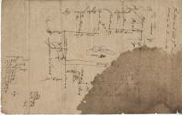
732 acre plot of land with Boggy Branch River running through the middle of it, includes some trees and run off creeks, shows surrounding neighbors and their properties. Names associated with this plat are Arch Taylor, Stephen Ford, Lessesne and Moses Glover.
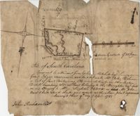
"Pursuant to a Warrant for, [?] Mitchell Esquire Surveyor General Sha [?] Ad measured and laid out unto William Peter Reahimer a tract of land containing 136 acres situated in Charleston District, bounding SW on land belonging to Thomas Broughton Esquire South on land belonging to William Singleton [?] on Mr. John Ansil and has such shape and mark as the above plat represents Surveyed 9th day of April 1785." Includes two water sources dividing the property. Names associated with this plat are William Peter Redhimer, Thomas Broughton, William Singleton, John William Ansil, and John Richardson.
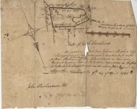
Persuant to [?] from Ephraim Mitchell Esquire Surveyor General that admeasured and laid out un to William Peter Redhimer a tract of land containing 97 acres of land situated in Charleston District bounding NW [?] as represented in the plat and hath such shape and marks as the above plat Surveyed this 9th day of April 1785. Names associated with this plat are William Peter Redhimer, John Richardson, Colonel Isaac Motte, Thomas Singleton, Reating Simoner, Ephraim Mitchell and Keating Simone.
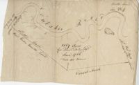
Plan of the land claimed by James Sinkler on Santee River and comprehended with the claim of White Oak Plantation belonging to Ralph Izard. Names associated with this plat are Ralph Izard, James Sinkler, Peter Sinkler, John Guerry, and Stephens.
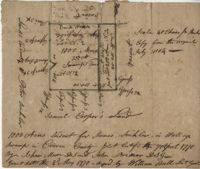
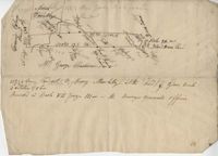
Plat of 220 acres on the Black River belonging to John Luck. Details include the areas of the river and marsh, and the location of trees on the property lines. Names associated with this plat are John Luch and John Hardwick. Notable geographic locations include Black River and Craven County Craven County [now in parts of Berkeley, Charleston, Georgetown, and Williamsburg counties].
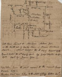
Plat of land along the Combahee River containing 5567 acres laid out for Daniel Doiley. Names associated with this plat are Daniel Doiley, Smith, Gordon Garrett, and Philips. Notable geographic locations include the Combahee River, Prince William's Parish and Farr Bluff.
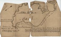
BACK: John Griggs 1220 acres Charleston 1 June 1786 [?] Peter Freneau. FRONT: “Pursuant to a warrant from Ephraim Mitchell Esquire Surveyor General and laid out unto John Griggs a Tract of land containing one thousand two hundred and twenty acres (1220) situated in St. Bartholomew's Parish Charleston District and has such shape form and marks as the above plat represents. Likewise butting and bounding as the said plat specifies." Names associated with this plat are John Griggs, Ephraim Mitchell, Daniel Doyley, Edmund Belling, Gochran, Gabriel Stock, Gochnan [?], and Peter Freneau [?]. Notable geographic locations include the Ch[?]aw River, Charleston District and St. Bartholomew's Parish.
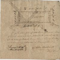
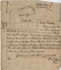
“Pursuant to a War- Mitchell Esquire Surveyor General [having been] admeasured and laid out unto John Griggs a tract of land containing one hundred and ninety (190) acres situated in Charleston District on the South side of Ashepoo River Bounded South-Westwardly on Lands of [?] Ladson, and part on Mr. Smiths lands on all other sides upon the said Ashepoo River and hath such form and marks as the above plat represents. Certified...this 26 day of June 1786 William Tate D. S." Names associated with this plat are John Griggs, William Tate, Ladson, Smith, Peter Freneau, and Ephraim Mitchell.