Boggy Branch Plat 1785
Close Viewer
- Title:
- Boggy Branch Plat 1785
- Date:
- 1785
- Description:
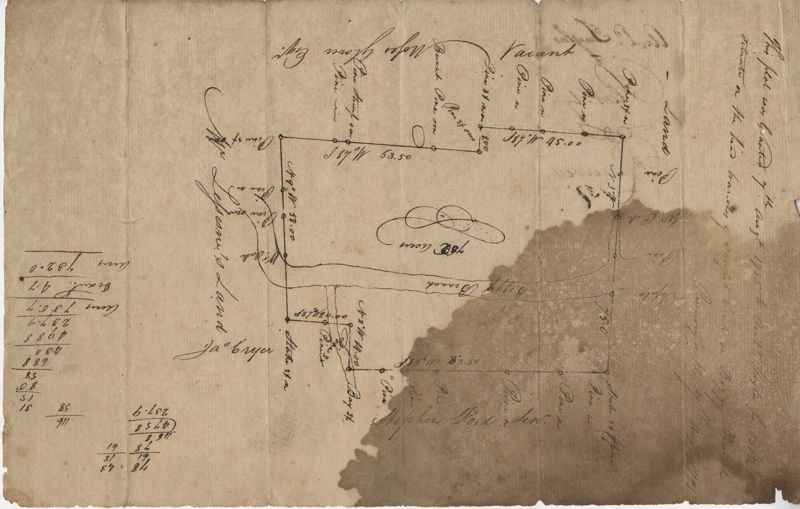
- 732 acre plot of land with Boggy Branch River running through the middle of it, includes some trees and run off creeks, shows surrounding neighbors and their properties. Names associated with this plat are Arch Taylor, Stephen Ford, Lessesne and Moses Glover.
- Collection Title:
- John McCrady Plats and Deeds Collection
- Contributing Institution:
- South Carolina Historical Society
- Media Type:
- Maps
- Topical Subject:
- Conveyancing--South Carolina, Maps, and Surveying--South Carolina
- Language:
- English
- Shelving Locator:
- 510.00, Box 2, Folder 22
- Date Digital:
- 2016-02-22
- Digitization Specifications:
- 400 dpi, 24-bit depth, color, Bookeye 4 Basic, Archival masters are tiffs.
- Internet Media Type:
- image/jpeg
- Copyright Status Statement:
- Public Domain.
- Access Information:
- For more information and re-use requirements contact the South Carolina Historical Society, Charleston, SC, 29401.
- Admin ID:
- 223245
Permalink