Describes various features of Charleston and the vicinity including art and literature; climate; hunting and fishing; yachting; beaches; transportation; highways; golf; farming; manufacturing; educational; colleges and preparatory schools; societies, clubs, associations; hotels, apartments and dwellings, port facilities; theaters; navy yard; military; U.S. Lighthouse Department; U.S. Engineers Corps; churches; conventions; populations; water supply; banks; living conditions; streets; business; information; U.S. Scouting Fleet; parks and playgrounds; harbor forts; street cars; sight-seeing busses; boats. Also describes various points of interest. "Donated by the City to the Publicity, Tourist & Convention Bureau, Chamber of Commerce, Charleston, South Carolina." 12 p. ; 53 x 16 cm. folded to 9 x 16 cm.
Souvenir program for what appears to be a U.S. Navy event that occurred in Charleston during the Coolidge administration. Focuses on the U.S. Navy, with naval history and lists of ships and ship personnel, and historical information about the Charleston Navy Yard. Also provides Charleston history and information on various sites, including churches. Advertisements for local businesses, many of which are directed specifically to the Navy visitors, are interspersed throughout. [80] p., ill., 22 x 30 cm.
A guide to many points of historic interest in Charleston, presented as a sightseeing stroll or drive. Released through the Office of Port Development, City of Charleston. One folded sheet (6.25" x 24.5" folded to 6.25" x 3.5").
Travel brochure. Includes brief description of Charleston history, points of interest, hotels, and recreational activities, and a map featuring travel routes to Charleston between Jacksonville, Florida to New York, New York. Designed by Advertising Service Agency and printed by J.J. Furlong & Sons, Charleston, SC. Two sheets : ill., map ; 23 x 41 cm., folded (quartered) to 23 x 10 cm.
Guidebook to Charleston, containing a history of Charleston; descriptions of many points of interest; street guide; and map featuring ward boundaries and points of interest. Advertisements interspersed throughout. Published by Walker, Evans & Cogswell. 95 p. : ill., fold. map ; 20 cm.
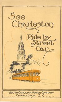
Guide to how to reach many places of interest in Charleston by street car. Includes route information, time tables, running times, and a guide map of Charleston with routes highlighted. Published by Southern Printing & Publishing Co. (Charleston, S.C.). 12 p., 16 cm. + 1 map, 19 x 27 cm. folded to 10 x 15 cm.
Provides local history and information on various sites and points of interest. Also includes advertisements for local businesses, sites, artists, etc., and a map of Charleston (1930). "Winter 1929-30." Published by W.W. De Renne (Savannah, Ga.). 16 p. : ill., map ; 23 cm.
Brief descriptions of points of historic interest in and around Charleston. Maps show landmarks in historic Charleston and also points of interest "on the motor roads and bridle paths near Charleston," including James Island and West Ashley sites. Possibly published by Wecco (Charleston, S.C.) One sheet : ill., maps; 22 x 57 cm. folded to 22 x 10 cm.
A ready reference to the most important points of historic interest in and around Charleston. Published by The Tourist and Convention Bureau, Charleston Chamber of Commerce, 50 Broad Street. 19 p., 16 cm.
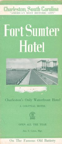
Brochure for the Fort Sumter Hotel [1 King Street]. Includes description and floor plan of the hotel, information about Charleston, and photographs of points of interest. Also includes map showing travel routes to Charleston from Jacksonville, Florida, to New York, New York. "A Colonial Hotel. Jno. S. Cator, Mgr." One sheet : ill., map ; 23 x 41 cm., folded to 23 x 10 cm.