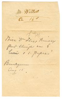
Plat includes 500 acres on the Cypress Swamp. Names associated with this plat are James Sanders, Matthew Nelson, William Abraham, Abraham Sanders, and Samuel Sanders. Notable geographic locations include St George’s Parish, Cypress Swamp, Dorchester, and Thorntree Swamp.
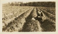
A color photograph of a man inspecting his crops, using his hat to look underneath the growth. Photograph has a caption on the back that reads, 'Results of too much fertilizer on spuds [informal term for potato] - 4,000 pounds per acre. Beaufort, S.C.'
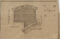
Plat of land laid out to Huggins of 58 acres situated on the NE side of Pee Dee River butting and bounding to the North on William Alston's land and to the south and southwest on unknown land. Names associated with this plat are Huggins, William Alston, Job Roshmahler and John Hardwick.
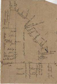
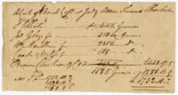
161 acres of land southeast of Pee Dee River. Details include rivers, a canal, and trees. Names associated with this plat are Mackie and William Stitt. Notable geographic locations include Waccamaw River and Pee Dee River.
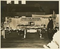
A black and white photograph of an exhibit booth by the Food Committee and Women's Defense Committee for 'Food for Defense.' Upon entering the exhibit the attendee is prompted with the question of, 'Are you a Perky or a Poky?' and then confronted with good and bad dietary choices. Dolls are used as an attempt to provide an example of a 'Perky' woman and a 'Poky' woman.