Map of the Charleston peninsula with historic points of interest identified and noted. Includes a welcome to visitors by Mayor Burnet R. Maybank and a map of "The Garden Club Walk" route. "Released by the Office of Port Development." Measures 16" x 22".
Silent film footage of Mr. and Mrs. Clarence E. Chapman at Mulberry Castle a/k/a Mulberry Plantation, ca. 1927-1932. Includes scenes of the Chapmans, their guests, and their laborers. Features vistas of the main house, grounds, and river; scenes of duck and deer hunting, picnicking, fishing, boating, and horseback riding.
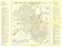
Provides local history and information on various sites and points of interest. Also includes advertisements for local businesses, sites, artists, etc., and a map of Charleston (1930). "Winter 1929-30." Published by W.W. De Renne (Savannah, Ga.). 16 p. : ill., map ; 23 cm.
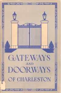
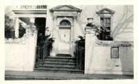
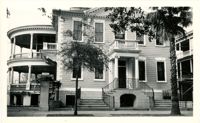
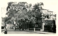
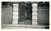
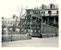
Booklet features "pictures and text arranged in sequence by street on each street, making easy identification of all interesting and historic doorways and gateways." Also includes map of the Charleston peninsula with points of interest indicated. Distributed by Legerton & Company, Inc. (Charleston, S.C.). 43 p. : ill., map ; 22 cm.
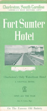
Brochure for the Fort Sumter Hotel [1 King Street]. Includes description and floor plan of the hotel, information about Charleston, and photographs of points of interest. Also includes map showing travel routes to Charleston from Jacksonville, Florida, to New York, New York. "A Colonial Hotel. Jno. S. Cator, Mgr." One sheet : ill., map ; 23 x 41 cm., folded to 23 x 10 cm.