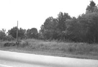
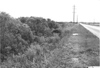
Lot on site affected by the widening of U.S. Route 17. Presumably located in southern Charleston County. Surveyor notations on back of photo: "Dkt.: 10.600. Property owner: John D. Postell, Sr., Estate. Tract: 12. Station: 605± Rt. Date: Sept. 18, 1968." [See collection description for explanation of surveyor notations.]
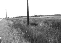
Lot on site affected by the widening of U.S. Route 17. Presumably located in Mount Pleasant or vicinity. Surveyor notations on back of photo: "Dkt.: 10.597. Property owner: Alexandera E. Stone, Est. Tract: 55. Station: 302± Lt. looking east. Date: Sept. 17, 1968." [See collection description for explanation of surveyor notations.]
Lot on site affected by the widening of U.S. Route 17. Presumably located in southern Charleston County. Surveyor notations on back of photo: "Dkt.: 10.600. Property owner: John D. Postell, Jr. Tract: 15. Station: 620± Rt. Date: Sept. 18, 1968." [See collection description for explanation of surveyor notations.]
Lot on site affected by the widening of U.S. Route 17. Presumably located in southern Charleston County. Surveyor notations on back of photo: "Dkt.: 10.600. Property owner: Thomas H. Lemacks. Tract: 19. Station: 611± Lt. Date: Sept. 18, 1968." [See collection description for explanation of surveyor notations.]
Lot on site affected by the widening of U.S. Route 17. Presumably located in southern Charleston County. Surveyor notations on back of photo: "Dkt.: 10.600. Property owner: Fred Stewart. Tract: 1-B. Station: 509± Lt. Date: Sept. 18, 1968." [See collection description for explanation of surveyor notations.]
Lot on site affected by the widening of U.S. Route 17. Presumably located in southern Charleston County. Surveyor notations on back of photo: "Dkt.: 10.600. Property owner: Johnnie Ford. Tract: 1-C. Station: 505± Lt. Date: Sept. 18, 1968." [See collection description for explanation of surveyor notations.]
Lot on site affected by the widening of U.S. Route 17. Presumably located in southern Charleston County. Surveyor notations on back of photo: "Dkt.: 10.600. Property owner: McLeod Lumber Co. & E.W. Durant. Tract: 9. Station: 585± Rt. Date: Sept. 18, 1968." [See collection description for explanation of surveyor notations.]
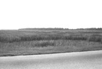
Lot on site affected by the widening of U.S. Route 17. Presumably located in southern Charleston County. Surveyor notations on back of photo: "Dkt.: 10.600. Property owner: Lula A. Dickenson, et al. Tract: 5. Station: 525± Lt. & Rt. Date: Sept. 18, 1968." [See collection description for explanation of surveyor notations.]
Lot on site affected by the widening of U.S. Route 17. Presumably located in southern Charleston County. Surveyor notations on back of photo: "Dkt.: 10.600. Property owner: R. Maude P. Postell, Estate. Tract: 13. Station: 613± Lt. Date: Sept. 18, 1968." [See collection description for explanation of surveyor notations.]
Lot on site affected by the widening of U.S. Route 17. Presumably located in southern Charleston County. Surveyor notations on back of photo: "Dkt.: 10.600. Property owner: Dr. T.W. Messervy. Tract: 7. Station: 545± Lt. Date: Sept. 18, 1968." [See collection description for explanation of surveyor notations.]
Lot on site affected by the widening of U.S. Route 17. Presumably located in southern Charleston County. Surveyor notations on back of photo: "Dkt.: 10.600. Property owner: Michah Jenkins. Tract: 6. Station: 546± Rt. Date: Sept. 18, 1968." [See collection description for explanation of surveyor notations.]
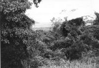
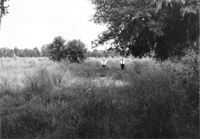
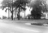
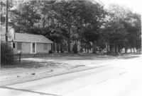
Lot on site affected by the widening of U.S. Route 17. Small house in background, obscured by trees. Presumably located in Mount Pleasant or vicinity. Surveyor notations on back of photo: "Dkt.: 10.597. Property owner: Mrs. Nancy T. McRae. Tract: 64. Station: 409+40 Lt. Date: Sept. 17, 1968." [See collection description for explanation of surveyor notations.]
Lot on site affected by the widening of U.S. Route 17. Presumably located in Mount Pleasant or vicinity. Surveyor notations on back of photo: "Dkt.: 10.597. Property owner: O.D. Hamlin. Tract: 110. Station: 479± - 487± Rt. Date: Sept. 17, 1968." [See collection description for explanation of surveyor notations.]
Lot on site affected by the widening of U.S. Route 17. Presumably located in southern Charleston County. Surveyor notations on back of photo: "Dkt.: 10.600. Property owner: The Summerville Land Corp., Inc. Tract: 8. Station: 570± Rt. Date: Sept. 18, 1968." [See collection description for explanation of surveyor notations.]
Lot on site affected by the widening of U.S. Route 17. Presumably located in southern Charleston County. Surveyor notations on back of photo: "Dkt.: 10.600. Property owner: R. Arnold Postell. Tract: 16. Station: 630± Rt. Date: Sept. 18, 1968." [See collection description for explanation of surveyor notations.]
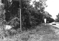
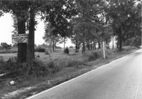
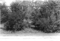
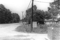
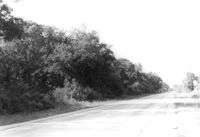
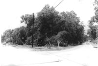
Lot on site affected by the widening of U.S. Route 17. Sign posted to tree: This land cleared by Atlantic Land Corp. Presumably located in southern Charleston County. Surveyor notations on back of photo: "Dkt.: 10.600. Property owner: Arthur J. Stark. Tract: 1. Station: 515± Lt. Date: Sept. 18, 1968." [See collection description for explanation of surveyor notations.]
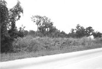
Lot on site affected by the widening of U.S. Route 17. Presumably located in southern Charleston County. Surveyor notations on back of photo: "Dkt.: 10.600. Property owner: Gas Lines, Inc. & Arthur J. Stark. Tract: 1-A. Station: 506± Lt. Date: Sept. 18, 1968." [See collection description for explanation of surveyor notations.]
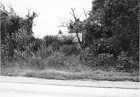
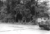
Site affected by the widening of State Road 13 (Remount Road). Surveyor notations on back of photo: "Dkt.: 10.562. Property owner: Barbara Pringle. Tract: 43. Date: Jul. 19, 1967." [See collection description for explanation of surveyor notations.]
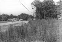
Site affected by the widening of State Road 13 (Remount Road). A&P barely visible in background. Surveyor notations on back of photo: "Dkt.: 10.562. Property owner: E.H. Eickmeyer. Tract: 35. Date: Jul. 19, 1967." [See collection description for explanation of surveyor notations.]
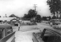
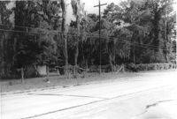
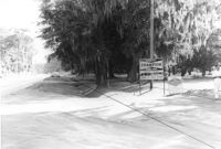
Site affected by the widening of State Road 13 (Remount Road). Esso gas Station: in background. Surveyor notations on back of photo: "Dkt.: 10.562. Property owner: Edna M. Tant. Tract: 5. Date: Jul. 12, 1967." [See collection description for explanation of surveyor notations.]
Site affected by the widening of State Road 13 (Remount Road). Surveyor notations on back of photo: "Dkt.: 10.562. Property owner: Elizabeth Gilmoor. Tract: 107. Date: Jul. 19, 1967." [See collection description for explanation of surveyor notations.]
Site affected by the widening of State Road 13 (Remount Road). (Same as State Road 13 Photo 18.) Surveyor notations on back of photo: "Dkt.: 10.562. Property owner: A.G. Boone Co. Tract: 15. Date: Jul. 12, 1967." [See collection description for explanation of surveyor notations.]
Site affected by the widening of State Road 13 (Remount Road). (Same as State Road 13 Photo 18.) Surveyor notations on back of photo: "Dkt.: 10.562. Property owner: A.G. Boone Co. Tract: 15. Date: Jul. 12, 1967." [See collection description for explanation of surveyor notations.]
Site affected by the widening of State Road 13 (Remount Road). Surveyor notations on back of photo: "Dkt.: 10.562. Property owner: W.W. Walker, et al. Tract: 36-B. Date: Jul. 19, 1967." [See collection description for explanation of surveyor notations.]
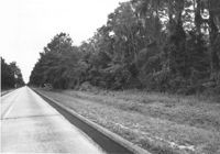
Site (affected by the widening of State Road 13 (Remount Road). Surveyor notations on back of photo: "Dkt.: 10.562. Property owner: West Virginia Pulp and Paper Co. Tract: 129. Date: Jul. 19, 1967." [See collection description for explanation of surveyor notations.]
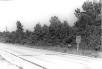
Site affected by the widening of State Road 13 (Remount Road). Surveyor notations on back of photo: "Dkt.: 10.562. Property owner: F.L. Parks, Jr. Tract: 3. Date: Jul. 12, 1967." [See collection description for explanation of surveyor notations.]
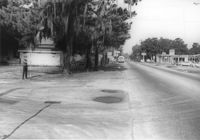
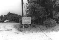
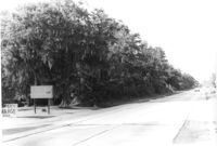
Lot on site affected by the widening of U.S. Route 17. Posted sign says: You just passed last motel for 50 miles, Mt. Pleasant Motel, ¼ mile back. Presumably located in Mount Pleasant or vicinity. Surveyor notations on back of photo: "Dkt.: 10.439. Property owner: Charleston County Public Works. Tract: 12. Station: 239+45 to 243+73 Rt. Date: Jul. 22, 1965. Range poles on 50' R/W & fence on 33' R/W - Cond." [See collection description for explanation of surveyor notations.]
Lot on site affected by the widening of U.S. Route 17. Posted sign says: Speed checked by radar. Presumably located in Mount Pleasant or vicinity. Surveyor notations on back of photo: "Dkt.: 10.439. Property owner: Francis F. Coleman, et al. Tract: 13. Station: 245+50 Rt. Date: Jul. 22, 1965. Range poles on 33' & 50' R/W showing house (portion)." [See collection description for explanation of surveyor notations.]
Lot on site affected by the widening of U.S. Route 17. Presumably located in Mount Pleasant or vicinity. Surveyor notations on back of photo: "Dkt.: 10.439. Property owner: Charleston County Public Works. Tract: 12. Station: 239+45 to 243+73 Rt. Date: Jul. 22, 1965. Looking from the east at range poles on 50' R/W & fence on 33' R/W - Cond." [See collection description for explanation of surveyor notations.]
Lot on site affected by the widening of U.S. Route 17. Presumably located in Mount Pleasant or vicinity. Surveyor notations on back of photo: "Dkt.: 10.439. Property owner: Charleston Oil Co. Tract: 11. Station: 237+26 to 239+45 Rt. Date: Jul. 22, 1965. Range poles on 33' & 50' R/W - Cond." [See collection description for explanation of surveyor notations.]
Lot on site affected by the widening of U.S. Route 17. Posted sign says: You just passed last motel for 50 miles, Mt. Pleasant Motel, ¼ mile back. Portion of house visible. Presumably located in Mount Pleasant or vicinity. Surveyor notations on back of photo: "Dkt.: 10.439. Property owner: Charleston County Public Works. Tract: 12. Station: 240+00 Rt. Date: Jul. 22, 1965. Looking from west at range poles on 50' R/W & fence on 33' R/W - Cond." [See collection description for explanation of surveyor notations.]
Roadside lot on site affected by the widening of U.S. Route 17. Presumably located in Mount Pleasant or vicinity. Surveyor notations on back of photo: "Dkt.: 10.439. Property owner: Louise S. Carter. Tract: 3. Station: 230±50 Rt. Date: Jul. 22, 1965. Looking NE from Carter Ave. at range poles on 33' & 50' R/Ws - Cond." [See collection description for explanation of surveyor notations.]
Roadside lot on site affected by the widening of U.S. Route 17. Presumably located in Mount Pleasant or vicinity. Surveyor notations on back of photo: "Dkt.: 10.439. Property owner: Louise S. Carter. Tract: 3. Station: 229±50 Rt. Date: Jul. 22, 1965. Looking NE at range on 33' R/W & 50' R/W - Cond." [See collection description for explanation of surveyor notations.]
Lot on site affected by the widening of U.S. Route 17. Presumably located in Mount Pleasant or vicinity. Surveyor notations on back of photo: "Dkt.: 10.439. Property owner: Samuel D. Causey. Tract: 6. Station: 233±00 Rt. Date: Jul. 22, 1965. Range poles on 33' & 50' R/W - Cond." [See collection description for explanation of surveyor notations.]
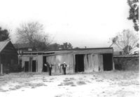
Lot on site affected by the widening of U.S. Route 17. Posted signs for Basha's Garage. Presumably located in Mount Pleasant or vicinity. Surveyor notations on back of photo: "Dkt.: 10.439. Property owner: Bernard H. Bastain, et al. Tract: 23. Station: 247+45 to 248+45 Lt. Date: Jul. 22, 1965. Looking northerly along road from southwest side of property." [See collection description for explanation of surveyor notations.]
Lot on site affected by the widening of U.S. Route 17. Presumably located in Mount Pleasant or vicinity. Surveyor notations on back of photo: "Dkt.: 10.439. Property owner: Anton G. Borosky. Tract: 24. Station: 248+45 to 250+45 Lt. Date: Jul. 22, 1965. Looking north along property." [See collection description for explanation of surveyor notations.]
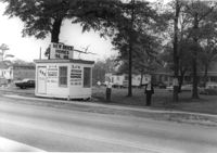
Rear view of structure with advertisement for "New Brick Homes," on site affected by the widening of State Road 31 (Reynolds Avenue). Surveyor notations on back of photo: "Dkt.: 10.541. Property owner: Morris P. Sokol, et al. Tract: 1. Station: 2+80 Lt. Date: Apr. 20, 1965." [See collection description for explanation of surveyor notations.]
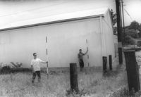
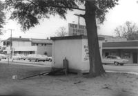
Small structure with advertisement for "New Brick Homes," on site affected by the widening of State Road 31 (Reynolds Avenue). Surveyor notations on back of photo: "Dkt.: 10.541. Property owner: Morris P. Sokol, et al. Tract: 1. Station: 2+80 Lt. Date: Apr. 20, 1965." [See collection description for explanation of surveyor notations.]
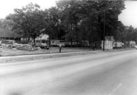
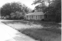
Site affected by the widening of State Road 31 (Reynolds Avenue). Surveyor notations on back of photo: "Dkt.: 10.541. Property owner: Morris P. Sokol, et al. Tract: 1. Station: 2+80 Lt. Date: Apr. 20, 1965." [See collection description for explanation of surveyor notations.]
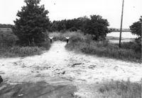
Site affected by the widening of Routes 7 & 171. Surveyor notations on back of photo: "Dkt.: 10.551. Property owner: Lucille S. Dwight. Tract: 2. Station: 120±00 Lt. Date: Jul. 22, 1965. Looking west from Rd. S-80 of range poles on corners of ? area. [See collection description for explanation of surveyor notations.]
Lot on site affected by the widening of U.S. Route 17. Posted sign says: Speed checked by radar. Presumably located in Mount Pleasant or vicinity. Surveyor notations on back of photo: "Dkt.: 10.439. Property owner: Francis F. Coleman, et al. Tract: 13. Station: 243+73 to 247+33 Rt. Date: Jul. 22, 1965. Taken from Rt. 17 - west side of property showing along front." [See collection description for explanation of surveyor notations.]
Lot on site affected by the widening of U.S. Route 17. Posted signs for Champion Spark Plugs and Goodyear Tires. Presumably located in Mount Pleasant or vicinity. Surveyor notations on back of photo: "Dkt.: 10.439. Property owner: Marie Basha. Tract: 22. Station: 245+45 to 246+45 Lt. Date: Jul. 22, 1965. Range poles on 33' & 50' R/W. Trees in R/W." [See collection description for explanation of surveyor notations.]
Structure on site affected by the widening of U.S. Route 17. Signs for Armstrong Tires and Charleston Tire Company in background. Presumably located in Mount Pleasant or vicinity. Surveyor notations on back of photo: "Dkt.: 10.439. Property owner: Joseph M. Bustos. Tract: 21. Station: 243+82 Lt. Date: Jul. 22, 1965. Proximity." [See collection description for explanation of surveyor notations.]
Structure on site affected by the widening of U.S. Route 17. Sign for Armstrong Tires. Presumably located in Mount Pleasant or vicinity. Surveyor notations on back of photo: "Dkt.: 10.439. Property owner: Joseph M. Bustos. Tract: 21. Station: 243+82 Lt. Date: Jul. 22, 1965. Proximity." [See collection description for explanation of surveyor notations.]
Structure on site affected by the construction of the Crosstown. Address: 122 Sheppard Street. Surveyor notations on back of photo: "Dkt.: 10.524. Property owner: Archie B. Hollins. Tract: 136. Station: 17+40 Lt. S.B. lane. Date: Dec. 2, 1964. Outside R/W." [See collection description for explanation of surveyor notations.]
Structure and lot on site affected by the construction of the Crosstown. Address: 160 Cannon Street. Surveyor notations on back of photo: "Dkt.: 10.524. Property owner: Mabel M. Cecil McIherney. Tract: 7. Station: 62+75 CL Lt. Date: Oct. 13, 1964. Portion In R/W - Bought." [See collection description for explanation of surveyor notations.]
Structure (rear view) on site affected by the construction of the Crosstown. Address: 185 Spring Street. Surveyor notations on back of photo: "Dkt.: 10.524. Property owner: Star Gospel Mission. Tract: 15. Station: 24+50 Rt. (Spring Street). Date: Oct. 13, 1964. Portion in R/W to be removed." [See collection description for explanation of surveyor notations.]
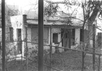
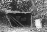
Structure (shed?) in dilapidated condition on site affected by the construction of the Crosstown. Address: 79 Kracke Street. Surveyor notations on back of photo: "Dkt.: 10.524. Property owner: Ella Lawrence, Est. Tract: 70. Station: 77+30 Lt. Date: Oct. 14, 1964. In R/W - Bought." [See collection description for explanation of surveyor notations.]
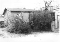
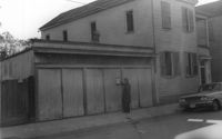
Structure (garage?) on site affected by the construction of the Crosstown. Address: 161B Line Street [161 Line Street]. Neighboring house in picture; see US Route 17 Photo 363. Surveyor notations on back of photo: "Dkt.: 10.524. Property owner: John H. Rathjen, et al. Tract: 104. Station: 83+05 Rt. Date: Dec. 1, 1964. Owner to move from R/W." [See collection description for explanation of surveyor notations.]
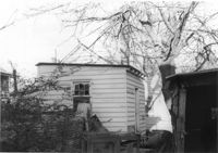
Structure on site affected by the construction of the Crosstown. Address: 3 Todd Street. On property of previous photos 413-415. Surveyor notations on back of photo: "Dkt.: 10.524. Property owner: John W. Bonaparte, et al. Tract: 118. Station: 87+35 Rt. Date: Dec. 1, 1964. In R/W - Bought." [See collection description for explanation of surveyor notations.]