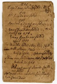
The Foaling Register, 1745-1777, is a bound register kept by Elias Ball II recording the selling and purchasing of horses, mules and mares and the births of colts at Kensington and Limerick Plantations.
FRONT: Plat is on the northside of the Ashley River. Contains 200 acres. BACK: Plat contains 36 acres on the North side of the Ashley River. Names associated with this plat are Richard Baker, Elibee Baker, John Baker, Josiah Baker, John Guptan, James Cantley [?], James Glen, John Stevens, Joseph Child, John Ainslee, Richard Baker, William Cattell and George Hunter. Notable geographic locations include St. George's Parish, Ashley River and Berkeley County.
The last will and testament of Elias Ball I in which he leaves Comingtee Plantation to his son Elias Ball II, tracts of land referred to as Dockum Plantation, land known as "Eveleigh's Land," the enslaved man "Sambo" and Lot No. 49 in Charlestown to his son John Coming Ball, money and the remainder of a lot in Charlestown to his daughter Eleanor Laurens, and a pew to his children at St. Phillips Church.
Plat includes 624 acres surveyed for Gideon DuPont. Plat does not contain structures. Names associated with this plat are Gideon DuPont, William Thomas Elliot, Captain Daniel Godin, and Middleton. Notable geographic locations are St. Bartholomew's Parish, the Ashepoo River and Deer Creek.
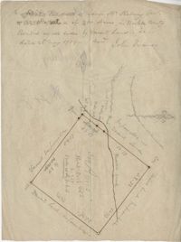
26 acres of land exchanged by John Stanyarn with Col. John Gibbes in the north side of Marshall's Creek on John's Island. Bounding on the south on lands belonging to the said Stanyarn and on all other sides on lands of John Gibbes. Laid out in 1753. Names associated with this plat are John Stanyarn, John Gibbes and Wilkins. Notable geographic locations include Johns Island and Marshall's Creek.
The Charles Pinckney Account Book, 1753, is an account book that includes rental rolls, listings of slaves, lists of titles, acreage allotments and deeds of real estate. Many of the slaves referenced in the account book are listed by first name, their slave family as well as their age.
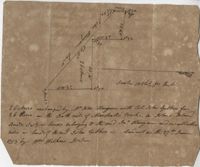
Plat of 163 acres in the St. George District. Very little detail or explanation provided on the plat. Names associated with this plat are David Run, John Woodrich, Elibu [?] Baker, John Drayton, and B. Wood [?]. Notable geographic locations include St. George Parish and St. George District.
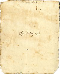
Receipt book kept by Eliza L. Pinckney includes formulas for making medicines to treat croup, fever, dropsy, and other conditions; recipes for cheese cake, puddings, currant wine, orange marmalade, jelly, oyster soup, and other foods; instructions for preparing meats and rice, and preserving and pickling foods; and a formula "To make the hair grow."
Plat of 300 acres in Berkeley County. Very little detail included in the plat. Names associated with this plat are James McKelvey, John Evans and Sarah Vance. Notable geographic locations include Berkeley County and Russells Creek.
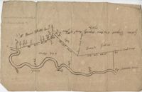
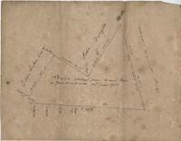
250 acre plot given to Peter Lesesne on the 20th of February 1760, butting and bounding on the south side of the Santee River. Names associated with this plat are Peter Lesesne, James Thomson, Peter Robert, Joseph Manap [?], and Phippes.