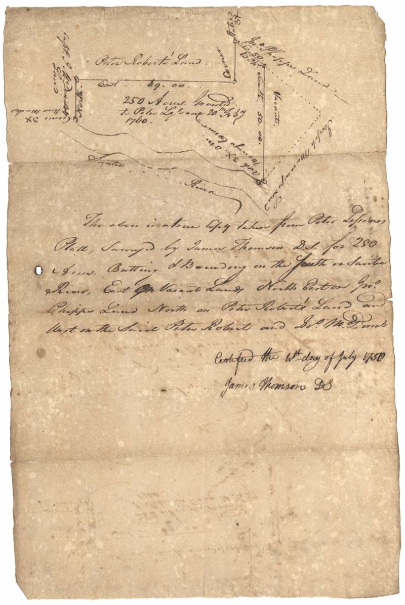
St. James Parish 1758
Title:
St. James Parish 1758
Date:
1758
Description:
250 acre plot given to Peter Lesesne on the 20th of February 1760, butting and bounding on the south side of the Santee River. Names associated with this plat are Peter Lesesne, James Thomson, Peter Robert, Joseph Manap [?], and Phippes.
Collection Title:
John McCrady Plats and Deeds Collection Contributing Institution:
South Carolina Historical Society Media Type:
Maps Topical Subject:
Conveyancing--South Carolina , Maps , and Surveying--South Carolina Geographic Subject:
Santee River (S.C.) Language:
English
Shelving Locator:
510.00, Box 3, Folder 99
Date Digital:
2018-09-27
Digitization Specifications:
400 dpi, 24-bit depth, color, Bookeye 4 Basic, Archival masters are tiffs.
Internet Media Type:
image/jpeg
Copyright Status Statement:
Public Domain.
Access Information:
For more information and re-use requirements contact the South Carolina Historical Society, Charleston, SC, 29401.
Admin ID:
223363