Page 237 of the City Engineer's Plat Book with three plats. Plat 1 shows "property situated on the west side of Rutledge Avenue," most of which is situated between Grove Street and Moultrie Street. Plat 1 also marks a "Brick Dwelling" and a stretch of marsh land. Plat 2 features land labeled "Trustees of the Endowment Fund of the Charleston Library Society," located between Rutledge Avenue and the Ashley River. Plat 3 shows land located on Huger Street, between King Street and Meeting Street.
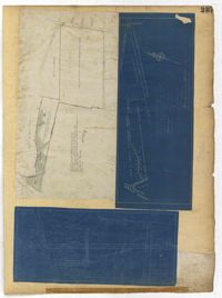
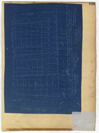
Page 229 of the City Engineer's Plat Book with two plats. Plat 1 features lots located on Queen Street, near its intersections with Mazyck Street, Friend Street, King Street, and Meeting Street. Plat 2 features lots located between Sans Souci Street and Simons Street, and between Rutledge Avenue and King Street.
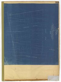
Page 247 of the City Engineer's Plat Book with one plat. The plat shows lots located from the west side of Ashley Avenue to King Street, between Mount Pleasant and Sans Souci Street. The plat also shows Darlington Street, Rutledge Avenue, Magnolia Street, Tracy Street, and Laurel Avenue.
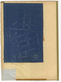
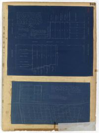
Page 240 of the City Engineer's Plat Book with one plat. The plat shows "The Property of Riverside Park Inc. and Peerless Securities Co." The streets shown include Rutledge Avenue, Sans Souci Street, Hester Street, and Ashley Avenue.
Page 245 of the City Engineer's Plat Book with two plats. Plat 1 shows lots located on and near Seyle Street, between Huger Street and Moultrie Street. Plat 2 shows lots on and near Grove Street, between Rutledge Avenue and King Street. Plat 2 also shows Tracy Street.
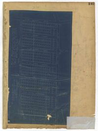
Page 242 of the City Engineer's Plat Book with one plat. The plat shows lots located on and near King Street, between Cypress Street and Romney Street. It also features a stretch of railroad track.
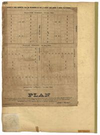
Page 241 of the City Engineer's Plat Book with one plat. The plat shows lots on and near King Street, Baxter Street, and Lenox Street. It also shows the end of Sans Souci Street.
Page 168 of the City Engineer's Plat Book with one plat. The plat shows lots located between Hanover Street and Meeting Street, including the intersection of Cedar Street and Nassau Street.
Page 81 of the City Engineer's Plat Book with five plats. Plat 1 shows lots between Cooper Street and Blake Street, near their intersections with Drake Street. Plat 2 features an extension of Columbus Street stretching from Bay Street to the Cooper River, and also shows lots belonging to a cotton factory, the Northeastern Railroad Company (N.E.R.R. Co.), and the South Carolina Railway Company (So. Ca. R. Way Co.). Plat 3 features lots on a city block between Blake Street, Cooper Street, Drake Street, and Bay Street. Plat 4 shows land near Boundary Street, Pinckney Street, Doughty Street, and "Commings Creek." It also shows an island, a mill pond, several lots in the area, Hutson Street, Thomas Street, and President Street. Plat 5 shows land located between Calhoun Street and Bull Street, and Lynch Street and Rutledge Street, including Cannon Park.