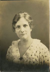
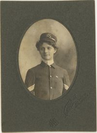
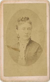
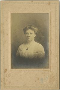
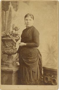
Black-and-white photograph of Minna McLeod. Writing on back of image reads, "Miss Minna McLeod. This picture was sent two years ago. Historian S.C. Division UDC."
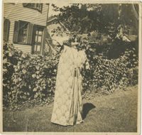
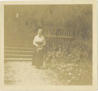
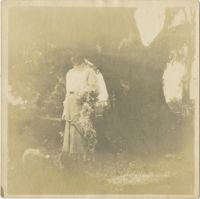
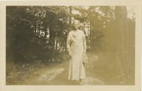
Black-and-white photograph of a woman wearing a long flowered dress standing in front of row of hedges. Writing on back of image reads, "(Susie Mcleod) in Auburn NY."
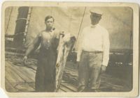
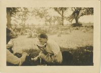
Black-and-white image of two men on deck of boat, one holding a fish. Inscription on back of image reads, "W.E. McLeod on right with member of crew holding a dolphin just caugh. On schooner Helen H. Benedict heading for New York August 1912."
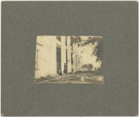
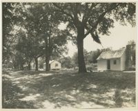
Black-and-white photograph depicting road near slave cabins on McLeod Plantation property. Writing on back of image reads, "James Isl (McLeod's Slave St.) McLeod's Plantation on Folly Road."
Black-and-white photograph of woman standing in front of steps. Writing on back of image reads, "This is much better than the other one, isn't it? Mrs. W.W. McLeod by the south steps."
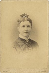
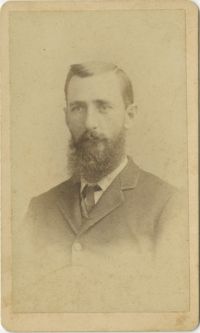
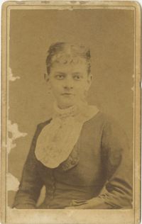
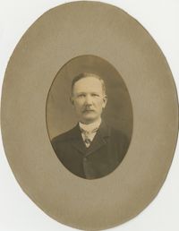
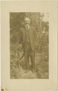
Black-and-white photograph, on card, of a portrait of a man. The area of the photograph where his eyes are has received damage. Writing on back of card reads, "W.E. McLeod."
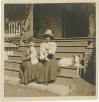
Two unidentified women sitting on the steps of the McLeod’s front porch, each holding a white cat. William McLeod’s dog is sitting on the steps with them.
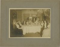
Black-and-white photograph, on card, depicting image of unidentified bride and groom with 11 unidentified men and women seated around a table. Writing on back of card reads, "Mr. McLeod Call For."
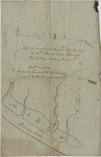
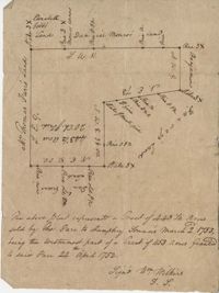
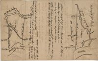
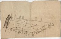
"350 acres granted to Thomas Smith on the 28th March 1694, Bounding [?] On Medway River South on land formerly laid out to Robert Skelton and went north…" Names associated with this plat are Thomas Smith and Robert Skelton.
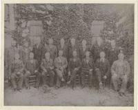
Black-and-white photograph of 17 men wearing suits standing/seated in front of wall covered in vines. Writing on image has numbers on coat jackets of each man.
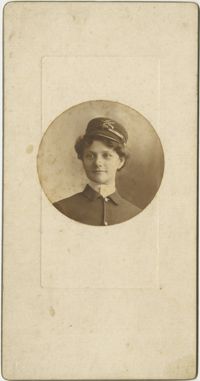
Black-and-white image depicting two women and dog on boat deck. Inscription on back of image reads, "Eulalie Lawton - left, Min McLeod - right, on the Merrimac."
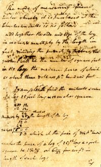
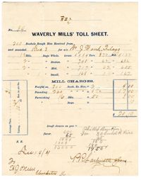
A two-page record relating to bushels of rice given to Dr. J. Ward Flagg from P.R. Lachicotte & Sons. Also includes the information related to rice farming with associated figures.
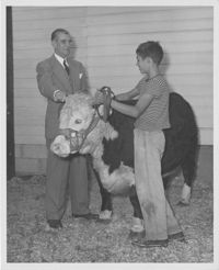
A black and white photograph of a man, young boy and a steer that was awarded a ribbon and title of Champion Steer in a 4-H Club competition at the Charleston Agricultural and Industrial [? Illegible] Fair.
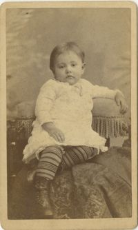
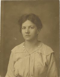
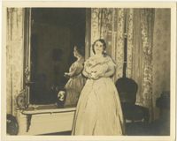
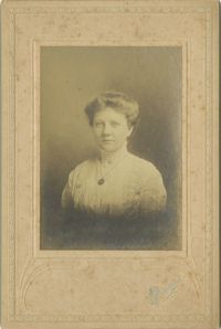
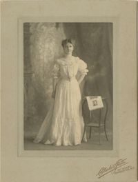
Black-and-white photograph, mounted on a card, of a portrait of a young woman standing next to a table that has a piece of paper with four other portraits on it.
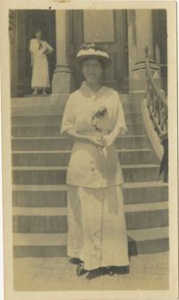
Black-and-white photograph of a woman wearing a hat and holding a flower standing in front of steps. Another woman is visible standing in doorway in the background.
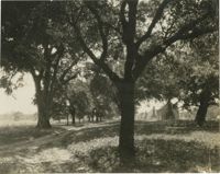
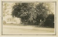
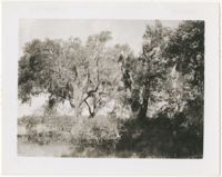
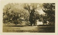
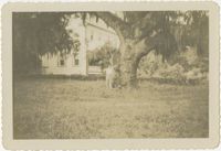
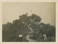
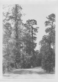
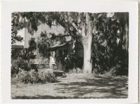
Black-and-white photograph of large oak tree with body of water visible in background of right side of image and outbuilding in background of left side of image.
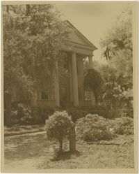
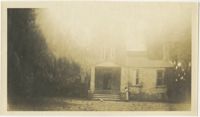
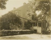
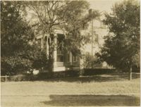
Black-and-white image depicting view of the north west side of McLeod Plantation residence. Writing on back of image reads, "McLeod House. North west view. About 1940."
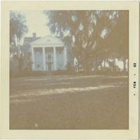
Black-and-white image depicting north view of McLeod Plantation. Writing on back of image reads, "McLeod Plantation house. James Island S.C. North View, Fall of 1954."
Plat consists of 900 acres. Names associated with this plat include Rero A. Stoble, James Bullock and H. Bryan. Notable geographic locations include Savannah and St. Peter's Parish.
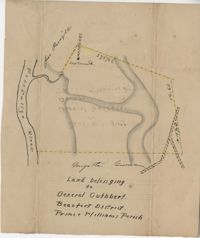
Plat of land belonging to General Cuthbert in the Beaufort District on the Pocotaligo River. Little other detail included in the plat besides the property lines and the river. Names associated with this plat include Luna Cuthbert and Cuthbert.
200 acres located in Colleton County on the north side of Colleton River. There is a note stating that Samuel Lowall was also granted 200 acres "situated on this side or here, dated 19th Feb. 1711." Names associated with this plat are Robert Gibbs, Samuel Lowall, Charles Parker and James Cockran. Notable geographic locations include St. Paul's Parish, Colleton River and Colleton County.
Plat of a tract of land with 443.5 acres sold by Thomas Farr to Humphrey Sommers. It is the westernmost part of a tract of 1153 acres granted to said Farr in 1752. Names associated with this plat include Thomas Farr, Humphrey Sommers, Wilkins, Elizabeth Gibbs, Daniel Monro, Benjamin Harvey and Daniel Green.
296 acres of land conveyed to Alexander Walker to John Sumer and M. Weston executors of the last will and testament of Richard Downs (1705). Names associated with this plat include Richard Downs, Smith, Joseph Stanyarn, Coats, Alexander Walker, John Sumer, Plowden Weston, Roper and Chrisby [?]. Notable geographic locations include Broad Road to Jacksonborough and Stono.
Black-and-white photograph of line of slave cabins on McLeod Plantation. Writing on back of image reads, "McLeod Plantation, James Island, S.C. - Part of "The Street" looking west away from the "Big House" 1954."
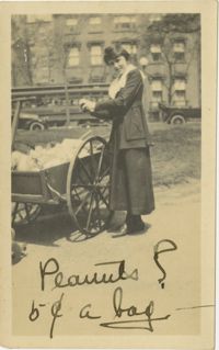
Black-and-white photograph of a young woman standing near a cart of produce. Writing on front of image reads, "Peanuts? 6- c a bag." Writing on back of image reads, "Susanne Ruby Baltimore."
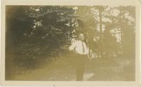
Black-and-white photograph of man standing on pathway, building visible in background. Writing on back of image reads,"U.S.S. Pensacola. c/o Postmaster, New York, N.Y. Wm. P. Hodgster."
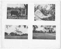
A black and white print of two black and white photographs. Beginning top left and following clockwise is: Photograph of Edward Walpole with Champion Bull; Photograph of Man Holding Grapes; Photograph of House Flying American Flag; and Photograph of Greek Revival Architecture on the Farm
Two parcels of land (A & B) on the south side of the south branch of the Santee River in St. James Parish, Charleston District. Names associated with this plat include Rebecca Motte and Jonah Collin. Notable geographic locations include Washo Plantation, St. James Parish, Santee and Charleston District.
Plan of a body of land now part belonging to Mr. George Summers and part to John Summers and part of the estate of Brigdon Smith lying at Stono adjoining lands of S. Matlock. Names associated with this plat are John Summer, George Summer, Brigdon Smith, Malleck, J. Fenwich, Edward Bellinger, Christopher Wilkenson, John Tucker, W. Owen, Henry Hyrne, Inch, Downs, Elizabeth Elliott, George Tommer, Thomas Farr, Smith Mellichamp, and Ann Downs. Notable geographic locations include New Road, St. Paul's Parish and Stono.
Copy of two plats: 1) 300 acres conveyed by Thomas Lynch to William Moultrie April 1, 1762, afterwards conveyed by Moultrie to Benjamin Singleton 2) 53 acres conveyed by Francis Kinloch to William Moultrie on the 8th February, 1765 now belonging to Benjamin Singleton. Names associated with this plat are Thomas Lynch, William Moultrie, Benjamin Singleton, Francis Kinloch, and Manigault. Notable geographic locations include Santee, White Oak, Six Mile Creek, and the Santee River.
222 acres sold by Archibald Stanyarn to Andrew Down in 1772. Reverse side includes notes on various conveyances. Names associated with this plat are Archibald Stanyarn, Andrew Down, J. Williamson, Edmond Bellizer, Thomas Cliffon, Kewn [?], David Joomer [?] and Henry. Notable geographic locations include Colleton County and Stono River.
Plat of two tracts of land (1000 acres) adjoining each other on the north side of the Santee River now belonging to the estate of Brown. Copy from the plat annexed to the orginal grants from the Lords Proprietors. Names associated with this plat are Peter Gaillard, Brown, Henry Bruneau and The Lords Proprietors. Notable geographic locations include the Santee River and Dohov Swamp and Creek.
Plat includes 110 acres sold to Hugh Rutledge and surrounded by other properties owned by him. Property sold to Rutledge in July of 1791. Names associated with this plat are Hugh Rutledge, Charles Pinckney, and James Stanyuin [?].
Plat of land belonging to General Cuthbert in the Beaufort District on the Pocotaligo River. Little other detail included in the plat besides the property lines, trees and the river. Names associated with this plat are Cuthbert Luna, Smith, Gordon [?], and Adam Jordan.
Three separate 211 acre plots (633 total) of land that are budding and bounding on the south side by the Santee River, shows some trees at the property border and surrounding neighbors. Names associated with this plat are Major Ladson and William Moultrie. Notable geographic locations include the Santee River.
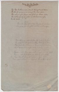
Handwritten poem by James Drayton about a conversation held in a prison between a father and his daughter during the reign of the English King Richard III