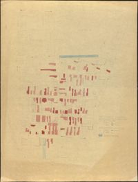
Page 111 of the City Engineer's Plat Book with one plat. This plat shows lots located near the intersection of East Bay Street and Broad Street. It also shows a building labelled "EXCHANGE," and Gillon Street.
Page 126 of the City Engineer's Plat Book with three plats. Plat 1 shows lots and structures located between George Street and Boundary Street, and between Meeting Street and Scarborough Street. Plat 2 shows lots on Anson Street, with one building labelled "Palmetto Engine House." Plat 3 shows a large swathe of land, including marshes and streams. One stream is labelled "Vardells CK," and a line towards the right of the plat is labelled "North Eastern Rail Road." The streets on this plat include King Street, Hampton Street, Moultrie Street, Meeting Street, America Street, Bay Street, Stewart Street, Cooper Street, and Line Street.
Page 254 of the City Engineer's Plat Book with one plat. A "Plat of Wagner Terrace," showing numerous lots and Hampton Park. Streets shown include Dunneman Street, Grove Street, and Rutledge Avenue.
Page 193 of the City Engineer's Plat Book with one plat. The plat shows lots located between Congress Street and Fishburne Street, and from Rutledge Street to past President Street. The plat also shows Payne Street.
Page 44 of the City Engineer's Plat Book with two plats. Plat 1 shows land between Meeting Street and a stretch of Marsh, and shows a stretch of railroad. Plat 1 also shows "Nassaw Street," Hanover Street, America Street, William Street, Isabella Street, "Rumney Street," Center Street, and "Cool-Blow Street." Plat 2 shows plats on "Rumney Street," between King Street and Meeting Street, including the intersection with Russell Street.
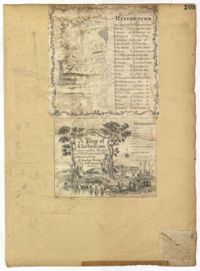
Page 203 of the City Engineer's Plat Book with one plat. An illustrated title card reads "A Plan of Charles Towne Copied with a Pen from an Old Dilapidated Plat without a Date," and depicts a harbor scene with Europeans and enslaved people. The plat labels landmarks and streets using capital and lowercase letters. These locations include Broad Street, the "State House," several churches, Boundary Street, the Exchange, an armory, and a beef market.
Page 214 of the City Engineer's Plat Book with two plats. Plat 1 shows lots located between Savage Street and Chisolm Street, and between Broad Street and Tradd Street. Plat 1 also shows Rutledge Avenue. Plat 2 shows a similar area to Plat 1, but also includes New Street, Franklin Street, Trapman Street, and Lynch Street.
Copy of a plat of 250 acres laid out to Abraham Michau on the north side of Santee River and “now belonging to John Pedro." Names associated with this plat are Abraham Michau, John Pedro, George Hunter and James Glen. Notable geographic locations include the Santee River, Prince Frederick Parish and Georgetown District.
876 acre plot for Simpson, shows roads, houses, and rivers/creeks, no names on any of the details, includes surrounding tracts of lands and trees on the property boundaries. Names associated with this plat are Simpson, Keith, James Gray Wiase, and Charles Johnston.
Plat of Hopewell Plantation with surrounding lands owned by several people, shows the Edisto River and an unnamed settlement, labels the land in the center as uncleared land while swamps, roads, rivers and trees surround it. Acreage unclear. Names associated with this plat are Baring, Branford, Mellechamp, Colonel W. Hayne and Arthur Middleton. Notable geographic locations are St. Paul's Parish, Edisto River, and Willtown Road.
Copy of a plat part now belonging to Benjamin Perry and part to John Pringle on the west side of Ashley River. Names associated with this plat include John Pringle, Benjamin Perry, John Julius Pringle, Lambert Lance, Abraham Ladson, Sarah Rose, Nathaniel Bradwell, Ephraim Mitchell, Thomas Drayton, John Frazer, Frances Baker, Thomas Osborn, Isaac Landson, Isaac Perry, John Drayton, Glen Drayton, Francis Ladson and W. John Cattle. Notable geographic locations include the Ashley River, Charleston, Berkeley County, and Ashley River Road.
Six maps conveying plans to beautify Ansonborough, showing the footprints of buildings and annotated to indicate the status of buildings, traffic flow, and scenarios that would result from the Ansonborough Rehabilitation Project.
Hand-drawn and color-coded map of Ansonborough indicating properties purchased by HCF, restored by HCF, for sale by HCF, restored privately, and other distinctive antebellum houses. Created to illustrate HCF’s Ansonborough Rehabilitation Project.
Map of Ansonborough showing Meeting Street, King Street, Hasell Street, Maiden Street, Old Church Street, Bay Street, and others. A small piece of paper taped to the back reads: "Kindness of: Mr. Gedney M. Howe."
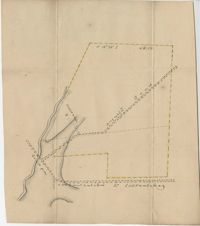
Plat of land near Pocotaligo. Very little information and explanation are included. The land looks to be near a crossroads and some form of water. Names associated with this plat are Cuthbert. Notable geographic locations include Augusta Road, Cossawhatchie [Coosawatchie], Pocotaligo, and Prince William's Parish.
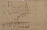
Plat is laid out for 200 acres of land but when surveyor toured the land contained 547 acres apparently the surveyor did not "run the lines" properly when the land was first laid out and not setting corners. Names associated with this plat are Thomas Tucker, Archibald Crall, John Cook, Richard Ireland, Levey, John Linder, and James Stuard. Notable geographic locations include the Edisto River.