Search Home
Search in
search for
Simple Search
Page Content Search
Title Search
Creator Search
Subject Search
Search
search icon
Search
Search Constraints
Start Over
You searched for:
Media Type
Maps
✖
Remove constraint Media Type: Maps
Date Range (beta)
1900
to
1924
✖
Remove constraint Date Range (beta): <span class="from" data-blrl-begin="1900">1900</span> to <span class="to" data-blrl-end="1924">1924</span>
1
-
27
of
27
Sort
by Relevance
Relevance
Title
Date (Newest)
Date (Oldest)
Number of results to display per page
50
per page
10
per page
20
per page
50
per page
100
per page
View results as:
list icon
List
masonry icon
Masonry
Search Results
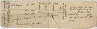
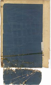
St. Paul's Parish Plat 1904
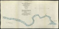
U.S. Engineer Maps of the Waccamaw River, 1903
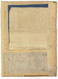
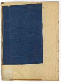
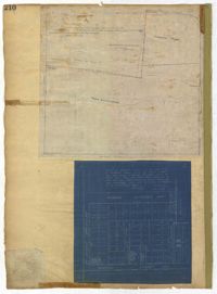
City Engineers's Plat Book, 1671-1951, Page 243
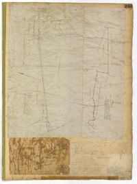
City Engineers's Plat Book, 1671-1951, Page 244
City Engineers's Plat Book, 1671-1951, Page 246
City Engineers's Plat Book, 1671-1951, Page 251
City Engineers's Plat Book, 1671-1951, Page 250
City Engineers's Plat Book, 1671-1951, Page 253
City Engineers's Plat Book, 1671-1951, Page 215
City Engineers's Plat Book, 1671-1951, Page 145
City Engineers's Plat Book, 1671-1951, Page 235
City Engineers's Plat Book, 1671-1951, Page 237
City Engineers's Plat Book, 1671-1951, Page 247
City Engineers's Plat Book, 1671-1951, Page 240
City Engineers's Plat Book, 1671-1951, Page 245
City Engineers's Plat Book, 1671-1951, Page 242
City Engineers's Plat Book, 1671-1951, Page 192
City Engineers's Plat Book, 1671-1951, Page 187
City Engineers's Plat Book, 1671-1951, Page 45
City Engineers's Plat Book, 1671-1951, Page 248
City Engineers's Plat Book, 1671-1951, Page 252
City Engineers's Plat Book, 1671-1951, Page 258
City Engineers's Plat Book, 1671-1951, Page 35
City Engineers's Plat Book, 1671-1951, Page 202
City Engineers's Plat Book, 1671-1951, Page 208
City Engineers's Plat Book, 1671-1951, Page 236
City Engineers's Plat Book, 1671-1951, Page 210
Limit your search
Collection
City Engineers's Plat Book, 1671-1951
25
John McCrady Plats and Deeds Collection
1
U.S. Engineer Maps of the Waccamaw River, 1903
1
Contributing Institution
The Charleston Archive at CCPL, City of Charleston
25
Coastal Carolina University, Horry County Archives Center
1
South Carolina Historical Society
1
Media Type
Maps
✖
[remove]
27
Subject (Topic)
Cadastral maps, Surveys
25
Conveyancing--South Carolina, Maps, Surveying--South Carolina
1
Subject (Geographic)
Charleston (S.C.)
25
Conway (S.C.)--Maps
1
Saint Paul’s Parish (Charleston County, S.C.)
1
Waccamaw River (N.C. and S.C.)
1
Date
1919
3
1920
3
1917
2
1919, 1920
2
1921, 1894
2
12/9/1904
1
1900, 1901, 1902
1
1901, 1917
1
1902, 1903, 1838
1
1903
1
more
Date
»
Date Range (beta)
1900
to
1924
✖
[remove]
27
1900
to
1901
2
1902
to
1904
3
1905
to
1906
0
1907
to
1909
1
1910
to
1911
1
1912
to
1914
0
1915
to
1916
1
1917
to
1919
11
1920
to
1921
5
1922
to
1924
3
Current results range from
1900
to
1923
Date Range (beta) range begin
Date Range (beta) range end
View larger »