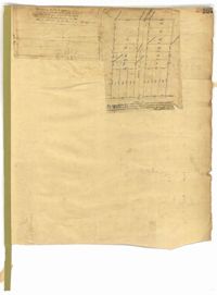
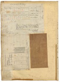
Page 157 of the City Engineer's Plat Book with two plats. Plat 1 features a lot of land located on the South Side of Line Street. Plat 2 shows lots located on and near the intersection of Spring Street and Kracke's Court.
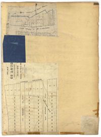
Page 164 of the City Engineer's Plat Book with three plats. Plat 1 shows lots located between Meeting Street and Aiken Street, and between Cooper Street and Line Street. Plat 2 shows lots located on Felix Street. Plat 3 shows lots located on Grove Street, and shows a stream and a label reading "Frenchman's Hill."
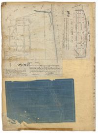
Page 165 of the City Engineer's Plat Book with three plats. Plat 1 shows lots located near a "Public Road from and to Charleston." It also shows marsh land, a fishpond, and a garden. Plat 2 shows land located near the intersection of America Street and Brigade Street. Plat 3 shows lots located near the intersection of Meeting Street and Riker Street, including a stretch of land labeled "Low Ground."
Page 166 of the City Engineer's Plat Book with five plats. Plat 1 shows lots and structures located near the intersection of Columbus Street and Meeting Street. Plat 2 features lots located along Moultrie Street, between Meeting Street and Russel Street. Plat 2 also shows King Street and Hampton Street. Plat 3 shows lots located between Meeting Street and a line labeled "South Carolina R. R. Company," near Romney Street, Addison Street, and Poinsett Street. Plat 4 shows a lot located on the north side of Amherst Street. Plat 5 shows lots located near the intersection of Bay Street and Blake Street.
Page 167 of the City Engineer's Plat Book with two plats. Plat 1 shows lots located between Meeting Street and a line labelled "So. Ca. R. R." Plat 2 shows lots located between Moultrie Street and Line Street, and between America Street and Meeting Street. Plat 2 also shows lots between Hampton Street and Moultrie Street, West of Meeting Street.
Page 176 of the City Engineer's Plat Book with three plats. Plat 1 shows lots located between Meeting Street and land owned by the South Carolina Railroad Company. Plat 2 shows lots located near the intersection of King Street and Line Street. Plat 3 features a proposed road from Clements Ferry Road to Chicora Park. It also shows a stretch of pine woods and a stretch of land labelled as "Bottom."
Page 173 of the City Engineer's Plat Book with five plats. Plat 1 shows lots and structures located near the intersection of Meeting Street and Brigade Street. Plat 2 shows lots located between Meeting Street and Lee Street, and includes a lot labeled "German Cemetery." Plat 3 shows lots located between Cunnington Avenue and Wiliman Street, and between Meeting Street and Lee Street, and shows a lot labeled "4th Brigade." Plat 4 shows lots located near Brigade Street. Plat 5 features lots located in the Village of Hampstead, between Bay Street and Town Creek.
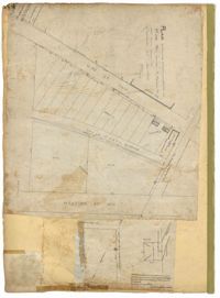
Page 170 of the City Engineer's Plat Book with four plats. Plat 1 shows lots located between King Street and Meeting Street, and between Romney Street and Grove Street. Plat 2 shows lots located between King Street and Meeting Street, and between Brigade Street and Mount Pleasant Street. Plat 4 shows lots located on Butler Street, near its intersection with Russell Street. Plat 5 features a lot labelled "Reservoir," located between Hanover Street and America Street.
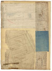
Page 172 of the City Engineer's Plat Book with three plats. Plat 1 features a stretch of land located between Nassau Street and "Town Creek," and between Mary Street and Cooper Street. Plat 2 shows lots located near Division Street, Cleland Street, Union Street, and "Town Creek." Plat 3 shows lots located between President Street and Norman Street, near where it intersects with Spring Street.
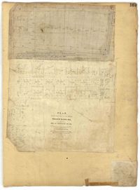
Page 174 of the City Engineer's Plat Book with two plats. Plat 1 shows lots and structures located between King Street and Meeting Street. Plat 2 features a lot located on Nassau Street, near where it intersects with Stewart Street.