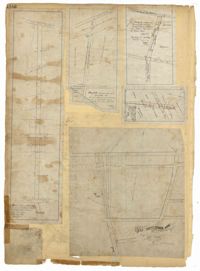
Page 102 of the City Engineer's Plat Book with five plats. Plat 1 shows lots along a stretch of Rutledge Avenue from Grove Street to Sans Souci Street. Plat 2 features a projected extension of Rutledge Avenue from Mt. Pleasant Road to Heriot Street, and also shows a lot labelled "S.C. Agricultural Society." Plat 3 shows a projected extension Rutledge Avenue, extending from Sans Souci Street to Mt. Pleasant Road. Plat 4 shows a projected expansion of Rutledge Avenue through Heriot Street, and also shows a plot labelled "Agricultural Society." Plat 5 shows a projected extension of Rutledge Avenue from Grove Street to Simons Street, and also shows King Street.
Page 99 of the City Engineer's Plat Book with four plats. Plat 1 shows land located near Meeting Street, between Williams Street and Semmes Street. Plat 1 also shows Nassau Street, Romney Street, some marshland, and New Market Creek. Plat 2 shows a lot with two structures located on Laurel Street. Plat 3 features lots located between Congress Street and Gadsden Street, near Pinckney Street. Plat 4 features lots located along Mount Street, between President Street and Payne Street.
Page 97 of the City Engineer's Plat Book with three plats. Plat 1 shows a stretch of land extending from Cunnington Street to Columbus Street, with a projected rout for America Street. Plat 1 also shows Hampstead Mall, Meeting Street, several creeks, some city lands, and a stretch of King Street. Plat 2 shows land from near Line Street to Hudson Street, between King Street and Meeting Street. Plat 2 also features structures, including several freight depots. Plat 3 shows a lot labelled "Lands of Fourth Brigade," between Brigade Street and William Street.
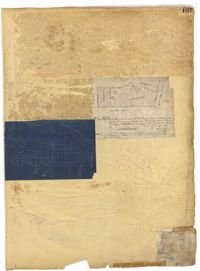
Page 107 of the City Engineer's Plat Book with two plats, labelled 3 and 4. Plat 3 features a lot and buildings located on the intersection or Tradd Street and East Bay Street. Plat 4 shows lots located near Gibbes Street, Tradd Street, New Street, and Savage Street. Plat 4 also shows three lines, labelled "Edge of high land," "Low water by Parker," and "Edge of Channel by Purcell and Parker."
Page 101 of the City Engineer's Plat Book with two plats. Plat 1 shows lots located between Washington Street and Wharf Street, and between Calhoun Street and Laurens Street. Plat 2 shows lots located near the intersection of Rutledge Avenue and Line Street, with several buildings labelled.
Page 112 of the City Engineer's Plat Book with five plats. Plat 1 shows lots and structures located on the north side of Tradd Street. Plat 2 shows lots located on the east side of Savage Street. Plat 3 shows lots located on King Street. Plat 4 shows lots located between Broad Street and Tradd Street, and between Lynch Street and the Ashley River. Plat 5 shows lots and structures located near the intersection of King Street and Broad Street.
Page 111 of the City Engineer's Plat Book with one plat. This plat shows lots located near the intersection of East Bay Street and Broad Street. It also shows a building labelled "EXCHANGE," and Gillon Street.
Page 24 of the City Engineer's Plat Book with three plats. Plat 1 shows lots located near King Street, Meeting Street, Wolf Street, March Lane, and Reid Street, including a portion of land labelled "Old fish pond low & broken land" and large label reading "Part of Hampstead." Plat 2 shows lots and features near the Charleston Harbor on the Cooper River, Boundary Street, Charlotte Street, Washington Street, and East Bay Street, and notes the "High Water Mark at Common Tides." Plat 3 shows lots located Meeting Street, Elizabeth Street, Ann Street, John Street, "Chapple Street," Alexander Street, and Washington Street, including a lot labelled "Tobacco Inspection."
Page 26 of the City Engineer's Plat Book with two plats. Plat 1 is a plan for a public square located near the intersection of Pinkney Street and Boundary Street, and shows a creek. Plat 2 features a lot located on the Ashley River channel and "Commings Creek," located near the intersections of Pinckney Street and Boundary Street, and Bull Street and Rutledge Street. Plat 2 also labels a pond, an island, and "Cannon's Point." Plat 3 shows lots located between Boundary Street and Bull Street, near the intersections with Barre Street, Gadsden Street, Lynch Street, Rutledge Street, Pitt Street, and "Comming Street."
Page 29 of the City Engineer's Plat Book with three plats. Plat 1 shows lots and structures located near Calhoun Street, Rutledge Street, Lynch Street, Gadsden Street, Lucas Street, and Bennett Street, including a lot labelled "Public Square," a creek, and a building labelled "Saw Mill." Plat 2 shows land located near the intersection of West Bay Street and a body of water labelled "Mill Pond." Plat 3 shows land located near the Ashley River channel and a road labelled "Causeway Leading to Rice Mill."