Copy of plat of 342 acres on Johns Island. Very little detail, just an outline of the property with trees on the edges. Names associated with this plat are Thomas Ladson, Hanscome, Allen, William Wallisby, Robert Murens, and Brocher. Geographic locations are the Stono River, Colleton County and Johns Island.
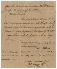
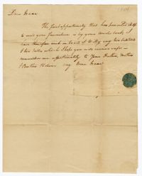
Petition of Anne Williams to the St. Andrew's Society explaining that she lives unmarried in Edinburgh and requesting that her annuity be paid. A postscript confirms that Anne Williams is alive and unmarried.
This plantation diary includes day-to-day management of Drayton plantations, (particularly Drayton Hall and Jehossee), focusing on crops, livestock, labor, and the movement of these between estates. Includes details on the unsatisfactory work of overseers, marriage of Charlotte Drayton, building of a new barn and slave houses, slave deaths from snake/spider bites and lightning strikes.
A power of attorney document stating that Matthew Bryan of Netherton in England appoints John Ball from South Carolina his attorney. Matthew Bryan outlines attorney responsibilities which includes overseeing all financial accounts in the United States.
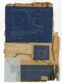
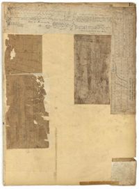
Page 256 of the City Engineer's Plat Book with four plats. Plat 1 shows land located between Elliot Street and Boundary Street, near Mill Street, Bee Street, President Street, and Doughty Street. It also shows several streams, a mill pond, and a large stretch of marsh land. Plat 2 shows a lot on Brigade Street. The third plat shows a lot and building located on the corner of Grove Street and Russell Street. The fourth plat shows lots located near the intersection of Grove Street and Tracy Street.
Page 183 of the City Engineer's Plat Book with five plats. Plat 1 shows lots located along Simons Street, between King Street and a stretch of marshland. Plat 2 shows lots on and near "Simmons" Street. It also shows lots near King Street and Romney Court. Plat 3 shows lots located near the intersection of King Street and Grove Street. Plat 4 shows lots and structures located near the intersection of Simons Street and King Street. Plat 5 shows lots along Simons Street, located between King Street and a stretch of marshland.
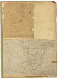
Page 151 of the City Engineer's Plat Book with two plats. Plat 1 shows lots and structures located on and near Anson Street. Plat 2 shows lots and structures located between Coming Street and the Ashley River Channel, and between Elliott Street and Mill Creek. The plat also shows 50 acres of marsh, several bodies of water, Boundary Street, Pinckney Street, Cannon Street, and President Street.