Search
« Previous |
1 - 10 of 27
|
Next »
Search Results
Date:
1945
Description:
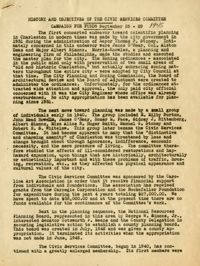
A report entitled "History and Objectives of the Civic Services Committee Campaign for Funds" (Sept. 25-29, 1945).
Date:
1945
Description:
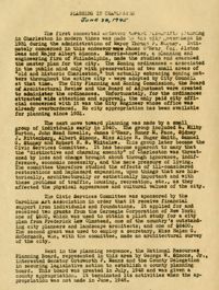
A report entitled "Planning in Charleston" (June 28, 1945).
Date:
1945
Description:
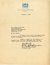
Letter to the Civic Services Committee from W. L. Hardeman regarding Charleston county figures for passenger cars, trucks, trailers, and motorcycles.
Date:
1945
Description:
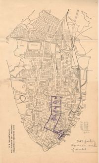
Map of Area 1 bounded by George Street, St. Philip Street, Vanderhorst Street, Hutson Street, and Meeting Street assigned to Mrs. T W. Thornhill.
Date:
1945
Description:
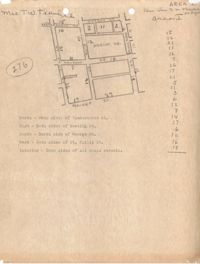
Map of Area 3 bounded by Beaufain Street, Hasell Street, Meeting Street, Broad Street, Legare Street, and Archdale Street assigned to Ferdinanda Waring.
Date:
1945
Description:
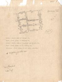
Map of Area 2 bounded by George Street, Meeting Street, Philip Street, Beaufain Street, and Hasell Street assigned to Mrs. Thornhill and Mrs. Taft.
Date:
1945
Description:
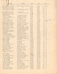
Parking survey of trucks, showing name on truck, name of store, time-in, time-out, and total time parked.
Date:
1945
Description:
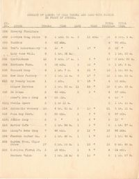
Summary of length of time trucks and cars were parked in front of stores.
Date:
1945
Description:
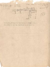
Map of Area 4 bounded by Broad Street, East Bay Street, and Tradd Street assigned to Mr. Martin Powers and Maier Triest.
Date:
1945
Description:
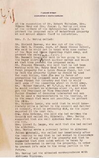
Notes regarding the efforts of Metropolitan Council members to protest the proposed sale of waterfront property at South Adgers Wharf to industries.