US Route 17 Photo 585
Close Viewer
- Title:
- US Route 17 Photo 585
- Date:
- 1968
- Creator (Corporate):
- South Carolina. Dept. of Transportation
- Description:
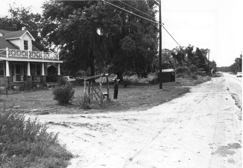
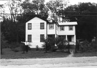
- House and lot on site affected by the widening of U.S. Route 17. Small roadside stand on property. Presumably located in Mount Pleasant or vicinity. Surveyor notations on back of photo: "Dkt.: 10.597. Property owner: Dorothy R. Ayers, et al. Tract: 12-A213. Station: 259+50Rt. looking north. Date: Sept. 17, 1968." [See collection description for explanation of surveyor notations.]
- Collection Title:
- SCDOT Photographs: Properties in the Right-of-Way
- Contributing Institution:
- Historic Charleston Foundation
- Media Type:
- Images
- Topical Subject:
- Right of way--South Carolina--Charleston County, Highway planning--South Carolina--Charleston County, Vernacular architecture--South Carolina--Charleston County, Lost architecture--South Carolina--Charleston County, and Dwellings--South Carolina--Charleston County
- Geographic Subject:
- Charleston County (S.C.)--Buildings, structures, etc.
- S.C. County:
- Charleston County (S.C.)
- Shelving Locator:
- 2009.022.1, photo ID# 1-2,DOTPhoto_0720
- Date Digital:
- 2011-07
- Digitization Specifications:
- 600 ppi, 24-bit depth color, HP Scanjet 4890. Archival Masters are tiffs.
- Copyright Status Statement:
- Digital image copyright 2010, Historic Charleston Foundation. All rights reserved. For more information contact Margaretta Childs Archives at HCF, P.O. Box 1120, Charleston, SC 29402.
- Admin ID:
- 35507
Permalink