I-26 Photo 0006
Close Viewer
- Title:
- I-26 Photo 0006
- Date:
- 1961
- Creator (Corporate):
- South Carolina. Dept. of Transportation
- Description:
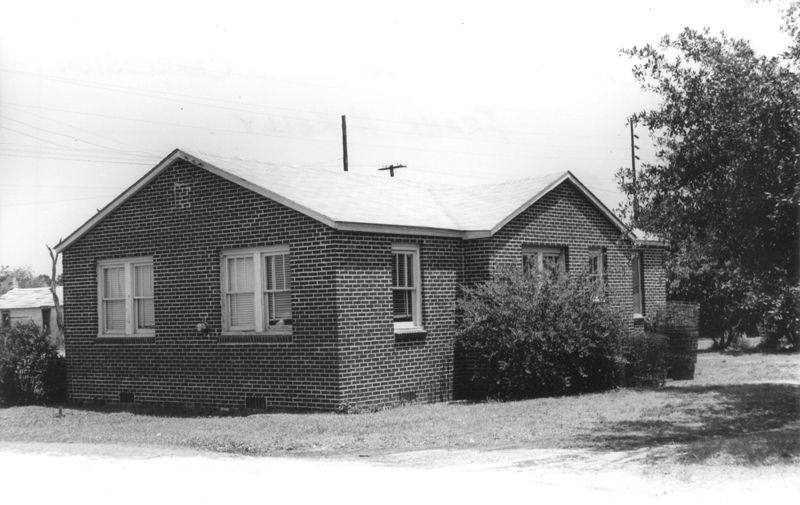
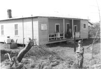
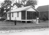
- House (corner view, rear) on site affected by the construction of Interstate 26 (I-26). Building address number 1724. Possibly on Rivers Avenue. Surveyor notations on back of photo: "Dkt.: 10.486. Property owner: Frank H. Kelly. Tract: 5. Station: 8+35 Lt. Date: May 30, 1961. Proximity." [See collection description for explanation of surveyor notations.]
- Collection Title:
- SCDOT Photographs: Properties in the Right-of-Way
- Contributing Institution:
- Historic Charleston Foundation
- Media Type:
- Images
- Topical Subject:
- Right of way--South Carolina--Charleston County, Highway planning--South Carolina--Charleston County, Vernacular architecture--South Carolina--Charleston County, Lost architecture--South Carolina--Charleston County, and Dwellings--South Carolina--Charleston County
- Geographic Subject:
- Charleston County (S.C.)--Buildings, structures, etc.
- S.C. County:
- Charleston County (S.C.)
- Shelving Locator:
- 2009.022.1, photo ID# 1-33,DOTPhoto_0805
- Date Digital:
- 2011-07
- Digitization Specifications:
- 600 ppi, 24-bit depth color, HP Scanjet 4890. Archival Masters are tiffs.
- Copyright Status Statement:
- Digital image copyright 2010, Historic Charleston Foundation. All rights reserved. For more information contact Margaretta Childs Archives at HCF, P.O. Box 1120, Charleston, SC 29402.
- Admin ID:
- 46272
Permalink