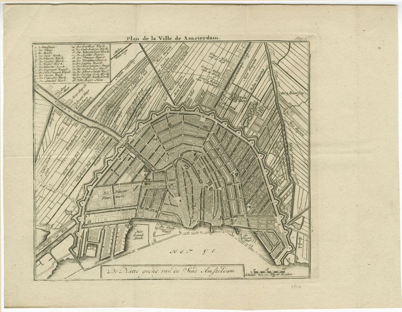
Plan de la Ville de Amsterdam / De Platte grond van de Stad Amsteldam
Close Viewer
Title:
Plan de la Ville de Amsterdam / De Platte grond van de Stad Amsteldam
Date:
1802
Description:
Black-and-white engraved map of Amsterdam, with a key including the Portuguese Synagogue and Great Synagogue. From Le guide d'Amsterdam, ou Description de ce qu'il y a de plus intéressant, published Amsterdam: C. Covens.