Ashley River Plat 1772
Close Viewer
- Title:
- Ashley River Plat 1772
- Date:
- 1772
- Description:
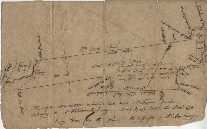
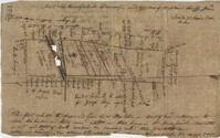
- "Plan of a Plantation containing 240 acres in St. Andrew’s parish belonging to William Newbenny. Surveyed by N. Brandwill March 1772. Copy taken from the plan in the property of William Newbenny." The plat also contains the location of a structure and a road leading to it. Plantation located on East side of Ashley River. Names associated with this plat are William Mewhening, N. Brandwill, Whitenarth Tuller, William Scotts, Ralph Izard, the Lords Proprietors, William Williams and William Scott.
- Collection Title:
- John McCrady Plats and Deeds Collection
- Contributing Institution:
- South Carolina Historical Society
- Media Type:
- Maps
- Personal or Corporate Subject:
- Izard family
- Topical Subject:
- Conveyancing--South Carolina, Maps, and Surveying--South Carolina
- Geographic Subject:
- Ashley River (S.C.)
- Language:
- English
- Shelving Locator:
- 510.00, Box 3, Folder 15
- Date Digital:
- 2017-02-14
- Digitization Specifications:
- 400 dpi, 24-bit depth, color, Bookeye 4 Basic, Archival masters are tiffs.
- Internet Media Type:
- image/jpeg
- Copyright Status Statement:
- Public Domain.
- Access Information:
- For more information and re-use requirements contact the South Carolina Historical Society, Charleston, SC, 29401.
- Admin ID:
- 223303
Permalink